Area Overview for NR28 9JS
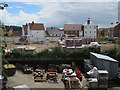
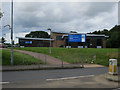
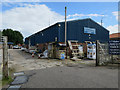
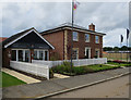
Photos of NR28 9JS
Area Information
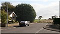
The postcode area of NR28 9JS represents a compact residential cluster covering just 1.1 hectares within Norfolk. It serves a population of 1,922 people, creating a small community where neighbours likely know one another. Living in NR28 9JS means occupying a space with a population density of 1,133 people per square kilometre, a figure that reflects a tight-knit environment rather than a sprawling suburb. This specific area sits within the broader context of the North Norfolk region, offering a distinct pocket of domestic life that balances proximity to larger towns with a sense of local independence. The character of NR28 9JS is defined by its residential focus, making it an established part of the local landscape. Potential buyers should view this postcode as a precise location within a larger village or hamlet structure. The area provides a grounded setting for those seeking a home in a defined, manageable neighbourhood without the noise or congestion of a growing urban centre.
- Area Type
- Postcode
- Area Size
- 1.1 hectares
- Population
- 1922
- Population Density
- 1133 people/km²
Homes in NR28 9JS are characterised by a strong owner-occupier market. With 73% of the population owning their homes, the area functions as a traditional residential settlement rather than a transient rental hub. The accommodation type is exclusively houses, which dictates the nature of the stock available for purchase or consideration within this specific 1.1-hectare cluster. This homogeneity means buyers will not find flats or apartments here; instead, they are looking at the variety of house types that serve families and retirees alike. The high ownership rate often correlates with lower tenant turnover and a stable estate. For someone considering living in NR28 9JS, the market presents a landscape of existing, long-held properties. The density of 1,133 people per square kilometre suggests that while the area is small, it is fully occupied. This concentration of houses supports a local economy based on maintenance and home improvement rather than investment or short-term lets. The property stock is uniform in its classification, catering to those who value private ownership in a house structure.
House Prices in NR28 9JS
Showing 13 properties
| Address | Type | Beds | Baths | Last Sale Price | Last Sale Date | |
|---|---|---|---|---|---|---|
| 11 Avenue Road, North Walsham, NR28 9JS | Bungalow | - | - | £340,000 | Jul 2022 | |
| Trafalgar Terrace, 7 Avenue Road, North Walsham, NR28 9JS | Terraced | 3 | 1 | £149,950 | Apr 2016 | |
| Cobwebs, 12 Avenue Road, North Walsham, NR28 9JS | Bungalow | 3 | 1 | £225,000 | Jul 2014 | |
| Trafalgar Terrace, 9 Avenue Road, North Walsham, NR28 9JS | Terraced | - | - | £98,000 | Apr 2003 | |
| 10 Avenue Road, North Walsham, NR28 9JS | Detached | - | - | £120,000 | Jul 1996 | |
| Trafalgar Terrace, 5 Avenue Road, North Walsham, NR28 9JS | Terraced | 2 | - | - | - | |
| Trafalgar Terrace, 2 Avenue Road, North Walsham, NR28 9JS | Terraced | 2 | 1 | - | - | |
| St Crispin, 14 Avenue Road, North Walsham, NR28 9JS | Detached | - | - | - | - | |
| Trafalgar Terrace, 6 Avenue Road, North Walsham, NR28 9JS | house | - | - | - | - | |
| Trafalgar Terrace, 8 Avenue Road, North Walsham, NR28 9JS | Terraced | - | - | - | - |
Energy Efficiency in NR28 9JS
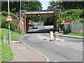
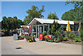
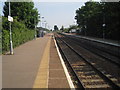
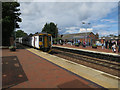
Daily life in NR28 9JS benefits from practical access to essential amenities within a reasonable reach. Residents can rely on three railway stations for rail connectivity: North Walsham Railway Station, Worstead Railway Station, and Gunton Railway Station. These stops facilitate travel to Aylsham, the nearest metro area hub, which is located nearby. For daily shopping needs, there are five notable retail options in close proximity. Lidl North, Morrisons Daily North, and Sainsburys North provide the necessary groceries and daily essentials without requiring a long commute to a city centre. This concentration of supermarkets and transport links means that living in NR28 9JS involves little logistical friction. You can handle your weekly shop and catch a train ride to the wider county with ease. The area supports a self-contained lifestyle where large towns are accessible but not immediately overwhelming. The presence of these specific retailers and stations highlights a functional layout designed for convenience. Residents do not need to venture far to access high street goods or mainline rail services. This balance of local convenience and regional access defines the practical reality of the neighbourhood.
Amenities
Schools
Families living in NR28 9JS have access to a specific mix of educational institutions nearby. The nearest independent school is St Nicholas House School, which offers a private education option for local children. For older students requiring further education, Paston College serves as the relevant sixth-form institution in the vicinity. There is also a Visiting Teacher Service North operating in the area, which provides additional educational support services. This combination of independent and sixth-form options indicates that the area caters to families who may have specific educational preferences or requirements. While secondary schools are not listed in the immediate data, the presence of a sixth-form college suggests pathways are available for local youth. The proximity of these institutions means that students do not need to travel excessively far for their education. The presence of St Nicholas House School offers a selective route, while Paston College provides continuity for older pupils. These schools form the educational backbone for the 1,922 residents of the postcode area.
| Rank | School | Type | Entry gender | Ages |
|---|
Explore more schools in this area
Go to Schools tabDemographics
The community within NR28 9JS is defined by a mature population profile. The median age stands at 47 years, indicating that adults between the ages of 30 and 64 years form the most common age range. This demographic skew suggests an area populated by established residents rather than transient young professionals or families with very young children. Home ownership is a dominant feature of the neighbourhood, with 73% of residents owning their accommodation outright. This high level of ownership usually points to long-term stability within the household composition. The area consists primarily of houses, which aligns with the demographic tendency for homeownership. The predominant ethnic group is White, reflecting the traditional settlement patterns of the region. These statistics paint a picture of a settled community where adults have put down roots. The age distribution implies a quieter atmosphere during the day, as the bulk of the workforce may be retired or self-employed rather than present in large numbers during standard business hours.
Household Size
Accommodation Type
Tenure
Ethnic Group
Religion
Household Composition
Age
Household Deprivation
NS-SEC
Explore more demographic insights in this area
Go to Demographics tabPlanning
Planning Constraints
- Flood RiskPremium
- Ramsar Wetland SitesPremium
- Area of Outstanding Natural BeautyPremium
- Protected Nature ReservePremium
- Protected WoodlandPremium