Area Overview for NR28 9JE
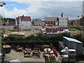
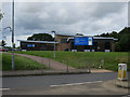
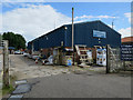
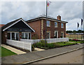
Photos of NR28 9JE
Area Information
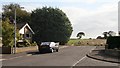
Living in NR28 9JE offers a quiet residential existence within a very small cluster. This specific postcode covers just 7226 square metres, accommodating a population of 1180 people. The area represents a tight-knit community where residents share close proximity. The location sits in England, featuring a mix of houses that define the housing stock locally. You will find yourself in a setting where daily life revolves around a compact neighbourhood rather than a sprawling city layout. The population density stands at 351 people per square kilometre, indicating a moderately populated but still intimate environment. This area serves as a distinct residential haven, separate from larger urban centres. You move here for space and a lower-key lifestyle, knowing the boundaries of your immediate surroundings are clear. The character of NR28 9JE is defined by its limited footprint and the fact that it contains hundreds of households within a few hectares. Your day-to-day experience involves navigating a space where everyone is potentially a neighbour. The small size means local events and community interactions can form quickly since physical distances are short. You do not need to travel far to know the people living in NR28 9JE. The area functions as a dedicated residential zone, focusing on home life without the complexity of larger urban districts.
- Area Type
- Postcode
- Area Size
- 7226 m²
- Population
- 1180
- Population Density
- 351 people/km²
The property market in NR28 9JE reflects a strong preference for owner-occupied homes. With 86% of the housing stock owned by residents, this area functions primarily as a buyer's market rather than a rental hub. The accommodation type is exclusively houses, meaning you will not find apartments or flat developments within this cluster. This homogeneity suggests that the houses here are likely single-family homes, often detached or semi-detached, suited for the local population profile. Prospective buyers looking at NR28 9JE can expect a stable environment where sellers often stay in their properties after purchase, though this is not a stated trend. The high ownership rate reduces competition from transient tenants or seasonal buyers. Investment opportunities focused on quick flips may be less common given the stability of the owners. If you are considering purchasing homes in NR28 9JE, you enter a market with established residents who have deep roots in the neighbourhood. The small area size of 7226 square metres treats every property as a valuable asset within a limited space. You should approach viewings with an understanding that the supply of homes is constrained by the physical boundaries of the postcode.
House Prices in NR28 9JE
Showing 10 properties
| Address | Type | Beds | Baths | Last Sale Price | Last Sale Date | |
|---|---|---|---|---|---|---|
| 6 Baker Close, North Walsham, NR28 9JE | Bungalow | 3 | 1 | £345,000 | Dec 2023 | |
| 1 Baker Close, North Walsham, NR28 9JE | Bungalow | 3 | 1 | £365,000 | Sep 2023 | |
| 11 Baker Close, North Walsham, NR28 9JE | Bungalow | - | - | £267,500 | Feb 2019 | |
| 4 Baker Close, North Walsham, NR28 9JE | Bungalow | 3 | - | £325,000 | Jul 2018 | |
| 5 Baker Close, North Walsham, NR28 9JE | Bungalow | 3 | 1 | £269,950 | May 2016 | |
| 7 Baker Close, North Walsham, NR28 9JE | Bungalow | - | - | £280,000 | Jan 2016 | |
| 9 Baker Close, North Walsham, NR28 9JE | Bungalow | 3 | 1 | £190,000 | Aug 2009 | |
| 3 Baker Close, North Walsham, NR28 9JE | Detached | - | - | £150,000 | Jul 2002 | |
| 8 Baker Close, North Walsham, NR28 9JE | Detached | 3 | 1 | - | - | |
| 2 Baker Close, North Walsham, NR28 9JE | Detached | - | - | - | - |
Energy Efficiency in NR28 9JE
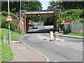
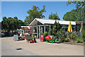
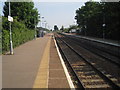
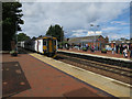
Daily life in NR28 9JE is facilitated by a selection of nearby amenities within practical reach. Residents have access to three railway stations, including North Walsham Railway Station, Worstead Railway Station, and Gunton Railway Station. These provide rail links for travel to larger towns and cities. For shopping needs, you can visit five local retail outlets near the area. Notable options include Lidl North, Morrisons Daily North, and Sainsburys North, which offer groceries and essentials. These supermarkets are convenient stops for weekly shopping without needing to travel far. Additionally, there is one metro stop in Aylsham, which may provide further public transport connections depending on your route. The availability of these three major supermarket chains ensures that household shopping requirements are met easily. Residents enjoy a lifestyle where basic necessities are within a short drive or walk. The presence of multiple railway stations adds flexibility for commuters or those willing to take short train rides. Your lifestyle in NR28 9JE balances a quiet residential setting with access to national retailer chains and public transport hubs.
Amenities
Schools
Families in NR28 9JE have access to specific educational institutions within the local catchment. The primary educational option listed for the area is North Walsham High School, which also operates as an academy. This institution holds an Ofsted rating of good, indicating a level of educational quality recognised by the government. The school serves as the nearest educational facility for children in NR28 9JE. While the school shares a name as both a primary and an academy entity, it provides a single point of reference for local schooling. You can expect that children living in this postcode are likely to attend this establishment for their education. The presence of a good-rated academy suggests a commitment to academic standards in the surrounding region. This mix of school types simplifies the choice for parents, as there is a clear, rated option nearby. North Walsham High School acts as the central pillar for the children's education in this community. Residents do not have multiple competing primary choices listed in current data. The proximity to this rated school is a practical benefit for families prioritising education quality in NR28 9JE.
| Rank | School | Type | Entry gender | Ages |
|---|
Explore more schools in this area
Go to Schools tabDemographics
The community in NR28 9JE has a distinct age profile that influences the local atmosphere. The median age for residents is 47 years, suggesting a mature population. The most common age range is the elderly group, comprising those over 65 years old. This demographic shift means you will likely encounter older neighbours who have lived in the area for a significant time. Home ownership is extremely common here, with an 86% ownership rate. Nearly nine out of ten residents own their properties outright or have a mortgage. This high figure indicates a stable community where large families or young professionals seeking rentals are less visible. The accommodation type is predominantly houses, fitting the older demographic and the smaller plots available in this postcode. Diversity is governed by the predominant ethnic group being White, which reflects a typical rural or semi-rural settlement pattern in England. This homogeneity creates a consistent cultural environment. The data shows no significant variation in household types, reinforcing the image of a traditional family or retirement setting. For residents, this translates to a predictable social landscape where community norms are established and widely followed by peers. You join an area with defined expectations regarding home maintenance and neighbourly conduct.
Household Size
Accommodation Type
Tenure
Ethnic Group
Religion
Household Composition
Age
Household Deprivation
NS-SEC
Explore more demographic insights in this area
Go to Demographics tabPlanning
Planning Constraints
- Flood RiskPremium
- Ramsar Wetland SitesPremium
- Area of Outstanding Natural BeautyPremium
- Protected Nature ReservePremium
- Protected WoodlandPremium