Area Overview for NR28 9BT
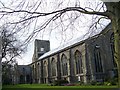
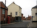
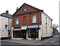
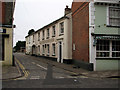
Photos of NR28 9BT
Area Information
Living in the NR28 9BT postcode covers a small residential cluster containing 1922 people across 5304 square metres. This compact footprint creates a high-density environment with 1133 people per square kilometre. You are moving into a location defined by its precise boundaries rather than sprawling suburbs. The area functions as a specific segment of North Norfolk, offering a contained living experience where every neighbour is a neighbour. Daily life here revolves around proximity, as the neighbourhood packs significant population into a surprisingly small land area. This concentration means you will find yourself in a community where residents know one another, largely because the physical space limits anonymity. The area contains almost exclusively houses, shaping a residential character distinct from mixed-use high streets or apartment blocks. As you walk through the streets, you will notice a population density typical of established residential zones rather than new build estates. This density offers convenience but also means you live in close quarters. The postcode serves as a gateway for those seeking a specific slice of rural Norfolk without the isolation of the most remote villages. You trade open sky for a tightly knit community where the local environment is shared intensively. Understanding the scale of NR28 9BT helps you appreciate the intensity of community life you will share with 1922 fellow residents in a very limited space.
- Area Type
- Postcode
- Area Size
- 5304 m²
- Population
- 1922
- Population Density
- 1133 people/km²
The property market in NR28 9BT is characterised by a heavy tilt towards ownership, with 73% of homes occupied by their owners. This statistic defines the area as a quintessential owner-occupier zone rather than a letting market. Accommodation types are almost exclusively houses, meaning you will not find apartments or flats within this specific postcode cluster. This housing stock suggests a market driven by established families or couples seeking traditional detached or semi-detached dwellings. The dominance of houses contrasts with urban centres where flats might share the market share. You are stepping into a market where resale rates may be slower due to the large percentage of long-term owners. This ownership culture creates a demand for maintenance and improvement rather than quick turnover rentals. Buyers looking at NR28 9BT are entering an environment where properties have matured over decades. The absence of rental stock within the data implies that landlords looking at this specific postcode may be working with limited listings. This scarcity affects pricing dynamics and means competitive bidding is common for quality properties. The area lacks the transient nature of a student zone or a commuter rental hub. Instead, it offers a quiet, predictable market where buyers often stay for life.
House Prices in NR28 9BT
Showing 12 properties
| Address | Type | Beds | Baths | Last Sale Price | Last Sale Date | |
|---|---|---|---|---|---|---|
| 35A Market Place, North Walsham, NR28 9BT | Flat | 2 | 1 | £360,000 | May 2024 | |
| First Floor Flat, 36 Market Place, North Walsham, NR28 9BT | Flat | - | - | - | - | |
| Flat 1, 44 Market Place, North Walsham, NR28 9BT | Flat | - | - | - | - | |
| The Flat, 45 Market Place, North Walsham, NR28 9BT | Flat | 2 | 1 | - | - | |
| 46-47 Market Place, North Walsham, NR28 9BT | office_workshop | - | - | - | - | |
| 38A Market Place, North Walsham, NR28 9BT | Flat | - | - | - | - | |
| Keys, 43 Market Place, North Walsham, NR28 9BT | retail_financial | - | - | - | - | |
| Flat 2, 40 Market Place, North Walsham, NR28 9BT | Flat | 1 | 1 | - | - | |
| Flat 1, 40 Market Place, North Walsham, NR28 9BT | Flat | - | - | - | - | |
| Flat 1, 39 Market Place, North Walsham, NR28 9BT | Flat | - | - | - | - |
Energy Efficiency in NR28 9BT
Residents of NR28 9BT enjoy immediate access to essential retail and leisure options. Five major retailers operate near the area, including Morrisons Daily North, Lidl North, and Sainsburys North. These supermarkets provide all you need for weekly grocery shopping, ensuring you rarely have to travel far for food staples. The variety of these chains indicates a reliable high-street style retail environment within reach of the neighbourhood. Transport links are equally convenient, with three railway stations located nearby: North Walsham Railway Station, Worstead Railway Station, and Gunton Railway Station. You rely on rail to connect with wider Norfolk and major cities. The area also has one metro link at Aylsham, offering regional connectivity. This transport network allows you to commute or travel quickly without depending solely on roads. The combination of local supermarkets and rail access creates a balanced lifestyle where you can shop locally and travel regionally. Dining and entertainment choices are likely anchored by the retail presence, though specific restaurants are not listed in the current data. The practicality of living here lies in the proximity of these essential services. You can manage your daily household tasks and social outings without significant travel time. The layout of NR28 9BT supports a lifestyle that prioritises convenience and accessible public transport.
Amenities
Schools
Families considering NR28 9BT have access to three key educational institutions nearby. St Nicholas House School operates as an independent school, offering a private education option for those seeking that specific curriculum. For secondary education, Paston College serves as a sixth-form provider, catering to older students ready for higher education or apprenticeships. The Visiting Teacher Service North rounds out the local educational landscape, providing support services that complement formal schooling. This mix of independent and sixth-form provision indicates a diverse approach to schooling available close to the area. You do not have data on primary schools or Ofsted ratings for these specific institutions in the provided record, so you must rely on the stated types to gauge the level of education. The presence of an independent school suggests a landscape where private education is viable. Paston College confirms that mature students can find local routes to university entry. The Visiting Teacher Service adds a layer of professional support, potentially benefiting children with specific learning needs or those requiring extra pastoral care.
| Rank | School | Type | Entry gender | Ages |
|---|
Explore more schools in this area
Go to Schools tabDemographics
The community in NR28 9BT is ageing, with a median age of 47 years. Most residents fall into the 30-64 year age range, indicating a neighbourhood dominated by established adults rather than young families or empty nesters. This demographic profile suggests a stable population that has moved beyond their initial property purchase. Home ownership stands at 73%, confirming this is an area where people build roots rather than rent temporary homes. This high rate of ownership aligns with the accommodation type, which consists entirely of houses. Ethnic diversity is low within this specific cluster, as White residents form the predominant group. This homogeneity often fosters a strong sense of shared local identity. You are joining an area where cultural practices and lifestyle choices likely mirror one another closely. The age and ownership data indicate a settled population with significant equity in their homes. This stability is evident in the lack of rental housing within the specific postcode. Residents here have likely completed mortgages and settled into long-term living arrangements. The demographic weight sits comfortably in mid-adulthood, suggesting a lifestyle focused on stability, local engagement, and managing household finances without the pressure of a recent move.
Household Size
Accommodation Type
Tenure
Ethnic Group
Religion
Household Composition
Age
Household Deprivation
NS-SEC
Explore more demographic insights in this area
Go to Demographics tabPlanning
Planning Constraints
- Flood RiskPremium
- Ramsar Wetland SitesPremium
- Area of Outstanding Natural BeautyPremium
- Protected Nature ReservePremium
- Protected WoodlandPremium