Area Overview for NR28 9AN
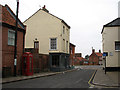
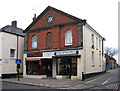
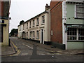
Photos of NR28 9AN

Area Information
NR28 9AN represents a specific postcode area covering a small residential cluster of just 3008 m². This compact footprint supports a population of 1552 residents, creating a tightly knit community environment. Living in NR28 9AN offers a sense of place defined by its density, with 515,910 people per km² according to the available metrics. This high population density relative to the land size suggests an area where neighbours and local services are immediately accessible. The community is predominantly composed of adults between 30 and 64 years of age, carrying a median age of 47 years. This demographic profile indicates an area with established families and mature households rather than a student population or transient workforce. Homes in NR28 9AN are primarily houses, reflecting a domestic setting focused on private residence rather than flat blocks. With 48% home ownership, the area possesses a stable residential base where many locals have taken root. You can expect daily life here to revolve around immediate local amenities and a strong sense of neighbourhood familiarity. The area avoids planning constraints such as Areas of Outstanding Natural Beauty or protected woodlands, meaning development could theoretically adapt to future needs. Safety is a key consideration, with a crime risk score of 53 indicating medium levels requiring standard precautions. The location benefits from excellent digital connectivity scores of 90 for broadband and 77 for mobile coverage, supporting modern working lifestyles even within this small geographic zone.
- Area Type
- Postcode
- Area Size
- 3008 m²
- Population
- 1552
- Population Density
- 3469 people/km²
The property market in NR28 9AN is characterised by a specific residential stock suited to local needs. The accommodation type is strictly houses, meaning you will not find high-rise flats or purpose-built rental towers within this postcode. This focus on detached or semi-detached dwellings supports families and individuals seeking garden space and private living areas. Home ownership stands at 48%, a figure that indicates a steady transition toward owning rather than renting, typical of a town centre or mature suburban cluster. For buyers looking at homes in NR28 9AN, the primary choice is a substantial house rather than an apartment conversion. The small total area of 3008 m² suggests a concentrated housing stock where properties are likely close to one another. You are entering a market where competition involves traditional house buying rather than bidding on new-build complexes. The population of 1552 residents supports a local economy based on local services rather than large commercial employers driving high rental demand. If you are considering living in NR28 9AN, you are looking at a market defined by stability and existing housing assets. The 48% ownership rate implies that just under half of the local population have secured ownership, leaving room for growth in the owner-occupier sector. This balance often results in lower turnover compared to genuine rental estates, providing a quiet and predictable environment for new residents.
House Prices in NR28 9AN
Showing 25 properties
| Address | Type | Beds | Baths | Last Sale Price | Last Sale Date | |
|---|---|---|---|---|---|---|
| 14, Park Court, New Road, North Walsham, NR28 9AN | Flat | - | - | £100,000 | May 2023 | |
| 20, Park Court, New Road, North Walsham, NR28 9AN | Flat | 1 | 1 | £79,000 | May 2015 | |
| 6, Park Court, New Road, North Walsham, NR28 9AN | Flat | - | - | - | - | |
| 9, Park Court, New Road, North Walsham, NR28 9AN | Flat | - | - | - | - | |
| 8, Park Court, New Road, North Walsham, NR28 9AN | Flat | - | - | - | - | |
| 10, Park Court, New Road, North Walsham, NR28 9AN | Flat | - | - | - | - | |
| 25, Park Court, New Road, North Walsham, NR28 9AN | Flat | - | - | - | - | |
| 19, Park Court, New Road, North Walsham, NR28 9AN | house | - | - | - | - | |
| 22, Park Court, New Road, North Walsham, NR28 9AN | Flat | - | - | - | - | |
| 5, Park Court, New Road, North Walsham, NR28 9AN | Flat | - | - | - | - |
Energy Efficiency in NR28 9AN
Your daily life in NR28 9AN is supported by a cluster of amenities within easy reach. Retail options include five notable venues, specifically Lidl North, Morrisons Daily North, and Sainsburys North. These supermarkets form the backbone of your weekly shopping routine, providing fresh food and household goods without the need for long drives. For travel, three railway stations—North Walsham Railway Station, Worstead Railway Station, and Gunton Railway Station—are close enough for regular commutes. A single metro option connects you to Aylsham, expanding your public transport choices. This mix of retail and rail ensures you can run errands locally or travel further afield with minimal effort. The area covers 3008 m², which confines your lifestyle to a very localised footprint where walking to the shops is often feasible. There are no identified protected nature reserves or Areas of Outstanding Natural Beauty directly impacting your immediate planning or views. The presence of Lidl North and Morrisons Daily North means you have major national chains nearby for consistent quality. If you are living in NR28 9AN, you benefit from the convenience of having essential retail and transport nodes in close proximity. The three railway stations offer a layer of connectivity that is often missing in isolated hamlets. This blend of self-sufficiency and external access defines the practical rhythm of life here.
Amenities
Schools
Families residing in or near NR28 9AN have several educational options within their immediate reach. North Walsham Infant School and Nursery operates as a primary institution, catering to the younger end of the school age group. Further education is provided by North Walsham Junior School, which functions as both a primary setting and a college academy. The North Walsham Junior School also holds a 'good' Ofsted rating in its capacity as an academy, a specific performance metric indicating a standard of education above the minimum required. You have access to multiple primary schools close by, ensuring flexibility for younger children. These schools are in the North Walsham area, serving the broader community that includes NR28 9AN. The presence of academies alongside traditional primary schools offers a mix of management structures for parents to consider. While the data does not list secondary schools, the primary focus in this immediate vicinity is on infant and junior education. If you are living in NR28 9AN, the schools near your home provide a solid foundation for early learning. The specific naming of North Walsham Infant School and Nursery confirms local provision for very young children. Parents can expect a network of schools including the academy variant of North Walsham Junior School, ensuring educational continuity.
| Rank | School | Type | Entry gender | Ages |
|---|
Explore more schools in this area
Go to Schools tabDemographics
The community in NR28 9AN is defined by a mature demographic profile where the most common age range is adults aged 30 to 64 years. You will find a median age of 47 years across the population of 1552 residents. This age distribution highlights an area suited to families that have moved past early parenting years and residents seeking a stable, mature environment. Accommodation in the area consists almost entirely of houses, which aligns with the lifestyle preferences of this older age group. Nearly half of all residents own their homes, with a home ownership rate standing at 48%. This figure places the area in a half-and-half split between owner-occupiers and renters, suggesting a balanced market rather than a student-produce or purely speculative investment zone. The predominant ethnic group is White, mirroring the wider patterns found in many towns within Norfolk. The area features a mix of primary and academy schools nearby, attended by children of the younger members of this core demographic. You do not find young people in their twenties or retired seniors forming the bulk of the population statistic. The medium crime risk score of 53 out of 100 requires all residents to adopt standard security practices, but it does not indicate a location plagued by high crime. The density of 515,910 people per km², while derived from the small total area size, points to a compact living arrangement where community interaction is likely frequent and direct.
Household Size
Accommodation Type
Tenure
Ethnic Group
Religion
Household Composition
Age
Household Deprivation
NS-SEC
Explore more demographic insights in this area
Go to Demographics tabPlanning
Planning Constraints
- Flood RiskPremium
- Ramsar Wetland SitesPremium
- Area of Outstanding Natural BeautyPremium
- Protected Nature ReservePremium
- Protected WoodlandPremium