Area Overview for NR28 9AD
Photos of NR28 9AD
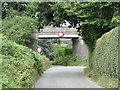
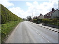
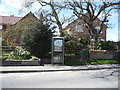
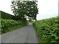
44 photos from this area
Area Information
Key information about the NR28 9AD including its size, population, and administrative classification.
- Area Type
- Postcode
- Area Size
- 9162 m²
- Population
- 1504
- Population Density
- 103 people/km²
House Prices in NR28 9AD
13
Properties
£195,583
Average Sold Price
£128,000
Lowest Price
£300,000
Highest Price
Showing 13 properties
| Address | Type | Beds | Baths | Last Sale Price | Last Sale Date | |
|---|---|---|---|---|---|---|
| 3 Mundesley Road, Paston, NR28 9AD | Semi-detached | 3 | 3 | £300,000 | Jan 2025 | |
| 2 Mundesley Road, Paston, NR28 9AD | house | - | - | £153,000 | Jan 2018 | |
| The Oaks, Mundesley Road, Paston, NR28 9AD | Detached | 3 | 3 | £280,000 | Jun 2017 | |
| Poppy House, Mundesley Road, Paston, NR28 9AD | Detached | 3 | 1 | £180,000 | Jul 2004 | |
| 5 Mundesley Road, Paston, NR28 9AD | Semi-detached | - | - | £128,000 | Dec 2003 | |
| Cornfield Cottage, Mundesley Road, Paston, NR28 9AD | Detached | - | - | £132,500 | Oct 2001 | |
| 4 Mundesley Road, Paston, NR28 9AD | Detached | 4 | 3 | - | - | |
| 1, Dutch Cottages, Mundesley Road, Paston, NR28 9AD | Cottage | 3 | 1 | - | - | |
| Acorn Lodge, Mundesley Road, Paston, NR28 9AD | Detached | - | - | - | - | |
| 6 Mundesley Road, Paston, NR28 9AD | Semi-detached | - | - | - | - |
Page 1 of 2
Energy Efficiency in NR28 9AD
Amenities
Schools
| Rank | School | Type | Entry gender | Ages |
|---|
Explore more schools in this area
Go to Schools tabDemographics
Household Size
Two person
most common
Accommodation Type
Houses
most common
Tenure
76
majority
Ethnic Group
White
most common
Religion
N/A
most common
Household Composition
N/A
most common
Age
47
median
Adults (30-64 years)
most common
Household Deprivation
N/A
with no deprivation
NS-SEC
28
in Lower managerial occupations
Explore more demographic insights in this area
Go to Demographics tabPlanning
Planning Constraints
- Flood RiskPremium
- Ramsar Wetland SitesPremium
- Area of Outstanding Natural BeautyPremium
- Protected Nature ReservePremium
- Protected WoodlandPremium