Area Overview for NR28 0XB
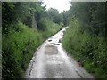
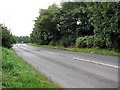
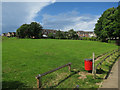
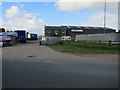
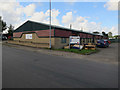
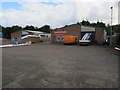
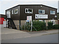
Photos of NR28 0XB


Area Information
Living in NR28 0XB means residing in a small residential cluster defined by postcode NR28 0XB in England. The area has a population of 1529 people situated across land with a density of 575 people per square kilometre. This compact size creates a close-knit environment where residents know their neighbours. You will find a community with a mature character given the median age of 47 years. Most residents fall within the 30 to 64 age range, suggesting a stable population of working adults and established families. The homes are predominantly houses rather than flats or apartments. You can expect a quiet, suburban lifestyle where daily needs are met within a short travelling distance. Safety is a defining feature with a risk score of 80 out of 100, indicating crime levels below the national average. Environmental assessments confirm no flood risk and no protected nature reserves or woodlands in the immediate vicinity. Planning constraints related to Ramsar sites or Areas of Outstanding Natural Beauty are absent. This makes development straightforward for local initiatives. The postcode area represents a practical choice for those seeking a low-maintenance living situation without the pressures of larger towns.
- Area Type
- Postcode
- Area Size
- Not available
- Population
- 1529
- Population Density
- 575 people/km²
Homes in NR28 0XB are overwhelmingly houses, creating a consistent market for buyers seeking single-family residences. Sixty-eight per cent of properties are owner-occupied, indicating a market driven by owner-movers and displacements rather than high levels of renting. This statistic suggests that if you wish to buy in NR28 0XB, you will join a majority of residents who have purchased outright or with a mortgage and stayed long-term. The accommodation type data confirms a dominance of houses over flats or other structures. This layout is typical for the postcode area which serves as a small residential cluster. The population of 1529 spreads across this housing stock at a density of 575 people per square kilometre. You should anticipate a market that may be slower moving than in major cities but with little transient turnover. The lack of rental data suggests a low volume of let-to-let investments. This environment is suitable for those who value stability in their property investment or wish to settle down without the uncertainty of a volatile rental market.
House Prices in NR28 0XB
No properties found in this postcode.
Energy Efficiency in NR28 0XB
Your daily life in NR28 0XB benefits from a selection of nearby amenities within a practical reach. For shopping, you have access to Sainsburys North, Morrisons Daily North, and Lidl North, covering 5 key retail outlets. These supermarkets provide all the daily food and household essentials you need without extensive driving. For transport links, North Walsham Railway Station, Gunton Railway Station, and Worstead Railway Station serve rail needs within the broader region. Aylsham acts as a nearby metro hub for longer journeys. This connectivity keeps you connected to the wider network without leaving the local comfort zone. The availability of three railway stations indicates a region well-served by public transport despite the small size of the postcode. You can reach essential services quickly while maintaining a low-stress routine. The area balances the convenience of local shops with the options provided by the nearby rail network.
Amenities
Schools
| Rank | School | Type | Entry gender | Ages |
|---|
Explore more schools in this area
Go to Schools tabDemographics
The community profile of NR28 0XB reflects a settled population. The median age of 47 years places this location firmly in the mature demographic sector. Sixty-eight per cent of households in NR28 0XB are owner-occupied. This high rate of home ownership stabilises the area and reduces reliance on the private rented sector. The predominant ethnic group is White, which aligns with the broad pattern for rural areas of this scale. Most common accommodation types are detached or semi-detached houses. You will not find high-rise blocks or large apartment complexes in this postcode. The population density of 575 people per square kilometre supports a suburban feel rather than a dense urban environment. This demographic structure suggests a neighbourhood where residents have long-term roots. Families with older children or empty nesters typically fit this profile. The stability of ownership often leads to better maintenance of the housing stock compared to areas dominated by short-term tenancies.
Household Size
Accommodation Type
Tenure
Ethnic Group
Religion
Household Composition
Age
Household Deprivation
NS-SEC
Explore more demographic insights in this area
Go to Demographics tabPlanning
Planning Constraints
- Flood RiskPremium
- Ramsar Wetland SitesPremium
- Area of Outstanding Natural BeautyPremium
- Protected Nature ReservePremium
- Protected WoodlandPremium