Area Overview for NR28 0SE
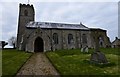
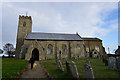
Photos of NR28 0SE
Area Information
Living in NR28 0SE means settling into a residential cluster defined by its quiet character and low population density. This specific postcode spans just 23.5 hectares, reflecting a compact living environment where the 2,379 residents share significantly less space than in urban centres. With a population density of merely 80 people per square kilometre, the area avoids the congestion of the coast and rail stations while remaining part of the broader Norwich North Norfolk region. The demographic profile suggests a family-oriented community rather than a retirement haven, as the 47-year median age falls squarely within a working-age majority. You will find that daily life here is paced by the rhythm of the Norfolk countryside rather than commercial noise. The area does not encompass major transport hubs or shopping centres within its 23.5-hectare boundary, which means your daily routine likely involves commuting to nearby towns like Mundesley or North Walsham. This location suits those who prioritise open space over immediate urban convenience. You are choosing a home where the 2,379 neighbours provide a sense of familiarity without the intrusion of crowds. The area is distinct for its exclusivity and scale, offering a rare opportunity to inhabit a space that has remained largely untouched by high-density development.
- Area Type
- Postcode
- Area Size
- 23.5 hectares
- Population
- 2379
- Population Density
- 80 people/km²
Homes in NR28 0SE are overwhelmingly detached or semi-detached family houses, with houses constituting the primary form of accommodation. The 75 per cent home ownership rate reinforces the picture of an established residential zone where property moves slowly through the market due to low vacancy. This statistic means that if you are looking to purchase, you are competing with other buyers who already have a foothold in the area rather than chasing inventory from landlords. The scarcity of rental stock aligns with the dominance of owner-occupied properties and the 80 people per square kilometre living density. You should view the property market here as one driven by local need and long-term investment rather than transient corporate housing. Because the accommodation type is exclusively houses, there are no flats or towers blocks to consider within the NR28 0SE postcode. The market responds to the needs of adults aged 30 to 64, who constitute the bulk of the population. If you seek a buy-to-let opportunity, the options are limited, but the stability of the 75 per cent ownership figure suggests your investment in a freehold property will hold value. The lack of diverse housing stock means you are looking for traditional village homes rather than modern urban units.
House Prices in NR28 0SE
Showing 5 properties
| Address | Type | Beds | Baths | Last Sale Price | Last Sale Date | |
|---|---|---|---|---|---|---|
| The Old Chapel House, Pond Lane, Knapton, NR28 0SE | Detached | - | - | £79,721 | Mar 2017 | |
| 3, Pond Cottages, Pond Lane, Knapton, NR28 0SE | house | - | - | - | - | |
| 1, Pond Cottages, Pond Lane, Knapton, NR28 0SE | Semi-detached | - | - | - | - | |
| North Acre, Pond Lane, Knapton, NR28 0SE | Detached | - | - | - | - | |
| 2, Pond Cottages, Pond Lane, Knapton, NR28 0SE | Semi-detached | - | - | - | - |
Energy Efficiency in NR28 0SE
Amenities within practical reach of NR28 0SE are primarily located a short journey away in larger towns. Residents rely on Tesco Mundesley, Sainsburys North, and Morrisons Daily North for their grocery and retail needs, all situated within a brief drive. These three major supermarkets provide the essential shopping capability required for weekly household provisions without the need for constant travelling. The area is also well-connected by rail, with Gunton, North Walsham, and Worstead railway stations forming a convenient network of three nearby options. These stations allow you to commute into Norwich or other commercial centres when your schedule requires, despite the distance from the immediate residential cluster. Your lifestyle will revolve around these key hubs rather than finding a shopping centre within walking distance of your doorstep. The 2,379 residents share a dependence on these external amenities, which supports the rural nature of the postcode. There are no dedicated leisure parks or cinema complexes listed in the immediate vicinity, so entertainment involves planning trips to Mundesley or North Walsham. This arrangement suits those who value quiet living over daily access to nightlife.
Amenities
Schools
Families residing in NR28 0SE have access to two key educational institutions that serve their primary needs. Antingham and Southrepps Community Primary School is located nearby, acting as the foundational educational setting for young children in the region. You can also find Antingham and Southrepps Primary School, which holds a 'good' Ofsted rating, providing assurance of quality education for primary-aged families. Both schools share a similar naming convention and location, suggesting they serve overlapping catchment areas or phases of education within the immediate vicinity. The presence of these two primary schools indicates that the area caters to young families without immediate access to secondary institutions on-site. You will need to arrange transportation to secondary schools located further afield, as the data lists only primary provision for NR28 0SE. This mix of school types, with two primary options, supports the demographic evidence that residents are mostly adults between 30 and 64 years old. The local schools do not designate themselves as academies or free schools in the provided records, which implies a traditional community-led model of governance.
| Rank | School | Type | Entry gender | Ages |
|---|
Explore more schools in this area
Go to Schools tabDemographics
The community in NR28 0SE is characterised by significant stability, reflected in a home ownership rate of 75 among residents. This high level of tenure indicates that housing serves as a long-term asset for most households rather than a temporary rental solution. The predominant ethnic group within these boundaries is White, which aligns with the generally homogenous nature of rural Norfolk settlements. A defining feature of this neighbourhood is the age structure, with the most common age range being adults between 30 and 64 years. This demographic shift away from schoolchildren and young retirees suggests an area populated by established professionals and lifelong residents. With 75 per cent of households owning their homes, there is likely a strong sense of community investment and local continuity. The median age of 47 further confirms that this is not a student quarter or a retirement enclave, but a vibrant settlement for working families. You will find a neighbourly environment where residents have likely lived for decades, fostering stable relationships between neighbours. The 2,379 people living here form a tight-knit group where knowing your neighbours is almost the norm due to the low population density.
Household Size
Accommodation Type
Tenure
Ethnic Group
Religion
Household Composition
Age
Household Deprivation
NS-SEC
Explore more demographic insights in this area
Go to Demographics tabPlanning
Planning Constraints
- Flood RiskPremium
- Ramsar Wetland SitesPremium
- Area of Outstanding Natural BeautyPremium
- Protected Nature ReservePremium
- Protected WoodlandPremium