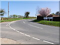
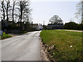
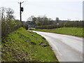
Area Overview for NR28 0RJ
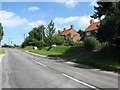
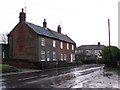
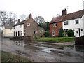
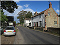
Photos of NR28 0RJ

Area Information
Living in NR28 0RJ means settling into a small residential cluster defined by a specific postcode in Norfolk. This area covers 2,419 square metres and houses a population of 2,379 people. The layout concentrates residents within a compact footprint, creating an environment where neighbours are likely within close proximity. Daily life here revolves around a defined local perimeter rather than sprawling suburbs. The area sits within characterful surroundings typical of the region, blending residential peace with practical access to wider facilities. You will find a setting that prioritises quiet domesticity over urban bustle. The population density of 80 people per square kilometre ensures that while the homes are close together, the space allows for a measured pace of life. This postcode serves as a stable base for those seeking a home in a recognised but tight-knit community. The distinct identity of NR28 0RJ comes from its clear boundaries and focused residential use, making it easy to navigate. It offers a straightforward living experience without the complexity of larger urban districts.
- Area Type
- Postcode
- Area Size
- 2419 m²
- Population
- 2379
- Population Density
- 80 people/km²
The property market in NR28 0RJ is characterised by a strong attachment to home ownership. With 75% of residents owning their homes, the area functions primarily as an owner-occupied market rather than a rental hub. This high ownership percentage indicates that houses are the standard accommodation type throughout the postcode. Buyers searching for homes in NR28 0RJ will find a stock suited to families and retirees who prioritise stability. The concentration of houses means you are unlikely to encounter high-rise flats or purpose-built student accommodation. This housing profile supports a predictable market where traditional family properties dominate the landscape. For anyone looking to purchase, the area offers established plots within a defined residential cluster. The low density of 80 people per square kilometre suggests ample space around each property. You can expect a slower-paced market with fewer price fluctuations compared to urban hotspots. The preference for owning your home implies a community invested in long-term improvements to the neighbourhood.
House Prices in NR28 0RJ
Showing 5 properties
| Address | Type | Beds | Baths | Last Sale Price | Last Sale Date | |
|---|---|---|---|---|---|---|
| Barbers Cottage, The Street, Swafield, NR28 0RJ | house | 3 | - | £252,500 | Sep 2019 | |
| Fern Cottage, The Street, Swafield, NR28 0RJ | Semi-detached | 5 | 2 | £260,000 | Feb 2014 | |
| Corner Cottage, The Street, Swafield, NR28 0RJ | house | 2 | 1 | £125,000 | Nov 2012 | |
| The Cottage, The Street, Swafield, NR28 0RJ | Cottage | 3 | 1 | - | - | |
| 5 The Street, Swafield, NR28 0RJ | house | - | - | - | - |
Energy Efficiency in NR28 0RJ
Residents of NR28 0RJ enjoy practical access to retail outlets and rail transport within a reasonable distance. Three railway stations are readily accessible, including North Walsham Railway Station, Gunton Railway Station, and Worstead Railway Station. These stations offer a direct link to wider regional networks for commuting or travel. For daily necessities, five key retail venues are nearby. Notable options include Sainsburys North, Morrisons Daily North, and Lidl North, providing a solid range of grocery shopping choices without the need for long journeys. This combination of supermarkets and rail access defines the lifestyle convenience of the area. You can manage your weekly shop and travel plans efficiently from your home. The presence of major supermarket chains indicates a well-serviced locality with established infrastructure. Life here balances local convenience with the flexibility of national transport links.
Amenities
Schools
Families seeking schools near NR28 0RJ have access to two primary options directly listed for the area. Antingham and Southrepps Community Primary School serves as a local educational provider for young children. Additionally, Antingham and Southrepps Primary School is situated nearby and holds a good Ofsted rating. Having a primary school with a good rating within reach provides reassurance for parents regarding educational standards. The presence of primary-focused institutions suggests the area caters well to younger residents. You do not have any secondary schools explicitly named in the immediate data for this specific postcode, which may mean families often look slightly further out for older children. The mix of school types here is currently focused on early education. Residents benefit from having established primary institutions within practical commuting distance. This educational provision supports the demographic trend of adult households and families with young children living in the neighbourhood.
| Rank | School | Type | Entry gender | Ages |
|---|
Explore more schools in this area
Go to Schools tabDemographics
The community in NR28 0RJ reflects a settled population with a median age of 47 years. Most residents fall into the adult age range between 30 and 64 years, indicating a neighbourhood dominated by working-age families and established individuals. Home ownership stands at 75%, which signals that the area consists mainly of long-term residents rather than short-term renters or students. Most households own their properties outright or through a mortgage, suggesting stability and invested local ties. The predominant ethnic group is White, aligning with the broader demographic trends of the surrounding region. Houses form the primary accommodation type, meaning you will predominantly see detached or semi-detached family dwellings rather than flats or apartments. This demographic mix creates a quiet environment suited to families and couples. The high ownership rate suggests that life here is anchored by people who have chosen the area for its specific character. Residents are likely focused on raising families or enjoying retirement in a stable, non-transient community.
Household Size
Accommodation Type
Tenure
Ethnic Group
Religion
Household Composition
Age
Household Deprivation
NS-SEC
Explore more demographic insights in this area
Go to Demographics tabPlanning
Planning Constraints
- Flood RiskPremium
- Ramsar Wetland SitesPremium
- Area of Outstanding Natural BeautyPremium
- Protected Nature ReservePremium
- Protected WoodlandPremium