Area Overview for NR28 0NP
Photos of NR28 0NP


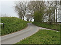
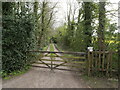
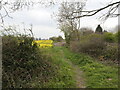
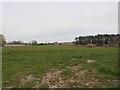
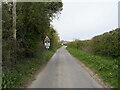
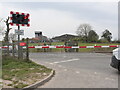
40 photos from this area
Area Information
Key information about the NR28 0NP including its size, population, and administrative classification.
- Area Type
- Postcode
- Area Size
- 13.8 hectares
- Population
- 2379
- Population Density
- 80 people/km²
House Prices in NR28 0NP
34
Properties
£182,118
Average Sold Price
£44,000
Lowest Price
£360,000
Highest Price
Showing 34 properties
| Address | Type | Beds | Baths | Last Sale Price | Last Sale Date | |
|---|---|---|---|---|---|---|
| Alpha, Southrepps Road, Antingham, NR28 0NP | Bungalow | 3 | 1 | £360,000 | Jul 2024 | |
| Wilmagh, Southrepps Road, Antingham, NR28 0NP | Bungalow | - | - | £237,000 | Jun 2021 | |
| Ashleigh, Southrepps Road, Antingham, NR28 0NP | Semi-detached | 2 | 1 | £180,000 | Nov 2020 | |
| Oaklands, Southrepps Road, Antingham, NR28 0NP | Bungalow | 4 | 1 | £330,000 | Jan 2020 | |
| Poplars Farm, Southrepps Road, Antingham, NR28 0NP | Detached | - | - | £302,500 | Sep 2019 | |
| 3, Letterbox Cottages, Southrepps Road, Antingham, NR28 0NP | house | - | - | £250,000 | Mar 2019 | |
| Horseshoe Cottage, Southrepps Road, Antingham, NR28 0NP | house | - | - | £241,500 | Aug 2016 | |
| Forge Cottage, Southrepps Road, Antingham, NR28 0NP | house | - | - | £196,500 | May 2015 | |
| Swans Nest, Southrepps Road, Antingham, NR28 0NP | Bungalow | 3 | 1 | £192,000 | Jul 2014 | |
| Sweet Briar, Southrepps Road, Antingham, NR28 0NP | Bungalow | - | - | £145,000 | Nov 2012 |
Page 1 of 4
Energy Efficiency in NR28 0NP
Amenities
Schools
| Rank | School | Type | Entry gender | Ages |
|---|
Explore more schools in this area
Go to Schools tabDemographics
Household Size
Two person
most common
Accommodation Type
Houses
most common
Tenure
75
majority
Ethnic Group
White
most common
Religion
N/A
most common
Household Composition
N/A
most common
Age
47
median
Adults (30-64 years)
most common
Household Deprivation
N/A
with no deprivation
NS-SEC
29
in Lower managerial occupations
Explore more demographic insights in this area
Go to Demographics tabPlanning
Planning Constraints
- Flood RiskPremium
- Ramsar Wetland SitesPremium
- Area of Outstanding Natural BeautyPremium
- Protected Nature ReservePremium
- Protected WoodlandPremium