Area Overview for NR28 0JD
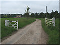
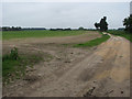
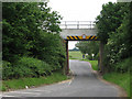
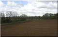
Photos of NR28 0JD

Area Information
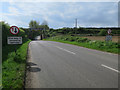
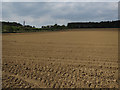
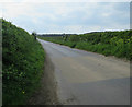
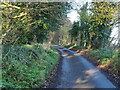
Living in NR28 0JD offers a quiet, suburban experience centred around a cluster of 1,192 residents spread across 13.1 hectares. This specific postcode area defines a small residential community where daily life moves at a deliberate pace. The population density stands at just 74 people per square kilometre, creating an open feel that contrasts sharply with more densely populated urban centres. Most residents live in houses rather than flats or apartments, reinforcing the character of a traditional, family-oriented neighbourhood. The area is primarily occupied by adults aged between 30 and 64 years, suggesting a stable community focused on established living rather than rapid turnover. Safety is a defining feature of life here, with crime risk scores indicating significantly lower offences compared to the national average. Environmental factors further support a secure lifestyle, as the area passes assessments for flood risk and lacks restrictions associated with protected nature reserves or woodlands. There are no AONB designations or Ramsar wetland sites within the immediate vicinity, meaning planning constraints are minimal and development potential remains straightforward. For those seeking homes in NR28 0JD, this mix of low density and high safety creates a predictable environment. The absence of major environmental protections allows for clarity regarding future local development projects. You can expect a setting defined by practicality and peace rather than grand architectural statements or tourism-driven activity.
- Area Type
- Postcode
- Area Size
- 13.1 hectares
- Population
- 1192
- Population Density
- 74 people/km²
The housing market in NR28 0JD is distinctly characterised by freehold properties rather than rental units or dense urban living. Sixty-seven per cent of households are owner-occupied, which signals a market driven by purchase decisions rather than the rental sector. This high ownership rate implies that landlords see that the area NR28 0JD is low turnover and stable. The accommodation type data confirms that houses form the primary stock, with no significant presence of flats or apartments within the postcode. Buyers looking for homes in NR28 0JD should expect a traditional suburban architecture designed for families rather than city dwellers. The small geographic footprint of 13.1 hectares limits the total number of available properties, making specific listings potentially rare. This scarcity often translates into competitive pricing for the limited housing that exists. Since the area lacks high density, there are no large blocks of social housing or student accommodation to compete with private sales. The property landscape is homogeneous, focusing on residential housing suitable for the local age profile. Potential buyers must be prepared to act quickly if a suitable house becomes available, as the market depth is shallow. The dominance of house ownership also means that local estate agents may handle mostly sales transactions rather than tenancy agreements.
House Prices in NR28 0JD
Showing 1 properties
| Address | Type | Beds | Baths | Last Sale Price | Last Sale Date | |
|---|---|---|---|---|---|---|
| Threeways, Obelisk Lane, Worstead, NR28 0JD | Bungalow | - | - | - | - |
Energy Efficiency in NR28 0JD
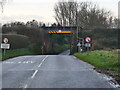
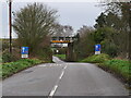
Daily life in NR28 0JD revolves around essential amenities located within easy driving distance. Four railway stations provide transport links, with Worstead, North Walsham, and Hoveton & Wroxham serving key commuting routes. Retail needs are met by five notable outlets, including Lidl North, Morrisons Daily North, and Sainsburys North. These supermarkets ensure that groceries and household essentials are readily accessible without travelling far. Two metro bus services operate from the area, connecting residents to destinations in Wroxham and Aylsham. This combination of rail, bus, and retail facilities supports a self-sufficient lifestyle. You do not need to reside in a busy city centre to access most daily provisions. The presence of major supermarket chains indicates a well-serviced suburb where basic requirements are fulfilled locally. For those who prefer car ownership, the infrastructure supports regional travel effectively. There are no listed leisure centres, theatres, or specialized sports facilities in the immediate neighbourhood data. Dining and entertainment options are primarily found in the larger towns linked by the rail and bus networks. The convenience of the area lies in its balance between isolation for peace and proximity to essential services. Residents can walk or drive easily to shops without significant time investment.
Amenities
Schools
Families living in NR28 0JD have access to one primary education option within the immediate vicinity. Worstead Church of England Primary School serves as the designated local primary institution. The school holds a 'good' Ofsted rating, indicating a standard level of educational quality recognised by regulators. Because the premises only lists a primary school, families with older children must look beyond the immediate neighbourhood for secondary education options. The absence of a listed secondary school in the data suggests that children typically transfer to feeder schools outside the NR28 0JD postcode boundaries once they reach secondary age. For parents considering this area, the presence of a single primary school with a positive rating is a strong foundation. However, the lack of secondary data means you will need to investigate school catchment zones carefully. The composition of the local education network is simple, relying on one main local provider for the early years of schooling. You can expect a straightforward process for registering children in this specific primary institution. The 'good' rating suggests a curriculum that meets national standards effectively.
| Rank | School | Type | Entry gender | Ages |
|---|
Explore more schools in this area
Go to Schools tabDemographics
The community profile in NR28 0JD reflects a mature population rather than a youthful demographic. The median age sits at 47 years, indicating that the area attracts adults well beyond their middle years. Data shows that the most common age range spans from 30 to 64 years, with very few residents falling into the under-30 category. This age distribution typically correlates with families who have settled down and moved into properties that require less urban maintenance. Home ownership is the dominant form of tenure, with 67% of residents owning their homes outright or with a mortgage. Consequently, the rental market represents a minority share of the household population. This high level of ownership stability usually results in less transient neighbours and longer-term commitments to the local street and community facilities. The predominant ethnic group is White, mirroring the broader national trend but remaining consistent within the local context. Household types predominantly feature houses, aligning with the age profile and home ownership statistics. You will find that the people living in NR28 0JD are likely to be established professionals or empty nesters who value stability. The demographic makeup does not suggest a high demand for entry-level starter homes or temporary accommodation. Instead, the population structure points towards established households seeking a long-term base in a low-density setting.
Household Size
Accommodation Type
Tenure
Ethnic Group
Religion
Household Composition
Age
Household Deprivation
NS-SEC
Explore more demographic insights in this area
Go to Demographics tabPlanning
Planning Constraints
- Flood RiskPremium
- Ramsar Wetland SitesPremium
- Area of Outstanding Natural BeautyPremium
- Protected Nature ReservePremium
- Protected WoodlandPremium