Area Overview for NR28 0HF
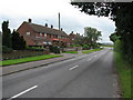
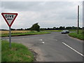
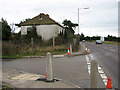
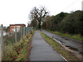
Photos of NR28 0HF

Area Information
NR28 0HF is a specific postcode area covering a small residential cluster spanning just 2.0 hectares. This compact footprint supports a population of 1,529 people, creating a tight-knit environment where neighbours are likely to know one another. Living in this area means accepting a higher density of 575 people per square kilometre, which fosters convenience but limits overt suburban sprawl. Most residents are adults aged between 30 and 64 years, indicating a community of established families and active individuals rather than university students or retirees. The prevailing architecture consists of houses, distinguishing this location from the flat-heavy landscapes found in many coastal towns near Aylsham. This low-density cluster avoids planning constraints such as Ramsar wetland sites or Areas of Outstanding Natural Beauty, allowing for standard development patterns despite the small land area. Daily life for homeowners here revolves around a mix of quiet rural living and practical access to local services. The area offers a stable setting for those seeking a home away from the hustle of major cities while maintaining a reasonable distance from North Walsham and other local transport hubs. It is a place defined by its specificity, catering to buyers looking for a defined residential zone rather than a broad neighbourhood boundary.
- Area Type
- Postcode
- Area Size
- 2.0 hectares
- Population
- 1529
- Population Density
- 575 people/km²
The property market in NR28 0HF is characterised by a predominance of owner-occupied homes. With a home ownership rate of 68%, the area functions primarily as an estate for settled residents rather than a hub for short-term rentals or buy-to-let investors. This high ownership figure implies that the housing stock consists of substantive family properties designed for long-term living. The accommodation type is strictly houses, meaning buyers looking for flats or terraced apartments will need to search in adjacent areas outside this specific postcode. You are purchasing into a market driven by retirees, families, and empty nesters who value space and privacy over urban convenience. This dynamic stabilises prices against the volatility often seen in student-led or investor-heavy districts. The small land area of 2.0 hectares constrains new supply, which may influence the availability of certain property sizes or styles. Potential buyers should anticipate a market where competition centres on location and character rather than speculative value. The lack of protected status, such as wooded reserves or nature sites, allows for standard house transactions without complex heritage restrictions. This makes the area attractive to those wishing to renovate or replace without navigating strict planning constraints common in more environmentally sensitive zones.
House Prices in NR28 0HF
Showing 29 properties
| Address | Type | Beds | Baths | Last Sale Price | Last Sale Date | |
|---|---|---|---|---|---|---|
| 53 Bradfield Road, North Walsham, NR28 0HF | Bungalow | 2 | 1 | £240,000 | Dec 2025 | |
| 29 Bradfield Road, North Walsham, NR28 0HF | Semi-detached | 3 | 1 | £355,000 | Feb 2023 | |
| 5 Bradfield Road, North Walsham, NR28 0HF | Retail | 2 | 2 | £215,500 | Oct 2022 | |
| 11 Bradfield Road, North Walsham, NR28 0HF | Semi-detached | 2 | 1 | £185,000 | Jul 2021 | |
| 49 Bradfield Road, North Walsham, NR28 0HF | Bungalow | - | - | £210,000 | May 2021 | |
| 17 Bradfield Road, North Walsham, NR28 0HF | Semi-detached | 2 | 1 | £190,000 | Sep 2019 | |
| 23 Bradfield Road, North Walsham, NR28 0HF | Semi-detached | 3 | 1 | £207,000 | Sep 2018 | |
| 55 Bradfield Road, North Walsham, NR28 0HF | Bungalow | 2 | - | £116,000 | Dec 2012 | |
| 39 Bradfield Road, North Walsham, NR28 0HF | Detached | 3 | 1 | £185,000 | Nov 2011 | |
| 47 Bradfield Road, North Walsham, NR28 0HF | Detached | - | - | £188,000 | Jul 2006 |
Energy Efficiency in NR28 0HF
Residents of NR28 0HF enjoy practical access to a variety of amenities within a short travelling distance. Locally, there are three railway stations nearby, including North Walsham Railway Station, Gunton Railway Station, and Worstead Railway Station. These options provide regular train services for commuters needing to travel further afield. For railway-free days, the nearest major cycling hub is Aylsham, offering a practical next stop for leisure or shopping trips. Retail needs are met by five nearby supermarkets, notably Waitrose North, Sainsburys North, and Morrisons Daily North. This variety ensures you can find groceries, fresh produce, and household essentials without needing a round trip to a town centre far away. The proximity of these three major chains means daily shopping is a routine errand rather than a logistical challenge. While there may be fewer independent boutiques, the core necessities for family life are within easy reach. For young families, the presence of multiple railway stations facilitates trips to schools in broader catchment areas. The lifestyle here blends self-sufficiency with the ability to access wider networks quickly. You balance a quiet home base with the convenience of essential services just outside your door.
Amenities
Schools
| Rank | School | Type | Entry gender | Ages |
|---|
Explore more schools in this area
Go to Schools tabDemographics
The community within NR28 0HF is defined by a mature age profile, with a median age of 47 years. Over two-thirds of the population falls into the adult category, specifically those aged 30 to 64 years. This demographic skew suggests a neighbourhood prioritising stability over rapid change, with fewer young professionals or elderly residents reshaping the local culture. Home ownership stands at a high 68%, reflecting an established environment where people have built lasting roots. The accommodation type is exclusively houses, meaning you will not find purpose-built apartments or high-density flats within this postcode. The predominant ethnic group is White, contributing to a culturally homogenous society where local traditions and social norms are likely well entrenched. You will find few transient populations, as the high ownership rate and age profile indicate long-term residency rather than student halls or investor portfolios. This demographic stability creates a predictable living environment where community decisions carry significant weight. Expect a neighbourhood where neighbours have known each other for decades, fostering a sense of mutual responsibility. The data does not suggest significant deprivation, allowing families to engage comfortably with local services without financial stressors dominating community life.
Household Size
Accommodation Type
Tenure
Ethnic Group
Religion
Household Composition
Age
Household Deprivation
NS-SEC
Explore more demographic insights in this area
Go to Demographics tabPlanning
Planning Constraints
- Flood RiskPremium
- Ramsar Wetland SitesPremium
- Area of Outstanding Natural BeautyPremium
- Protected Nature ReservePremium
- Protected WoodlandPremium