Area Overview for NR28 0DQ
Photos of NR28 0DQ

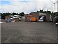
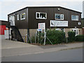
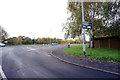
100 photos from this area
Area Information
Key information about the NR28 0DQ including its size, population, and administrative classification.
- Area Type
- Postcode
- Area Size
- 3.1 hectares
- Population
- 1463
- Population Density
- 935 people/km²
House Prices in NR28 0DQ
47
Properties
£204,856
Average Sold Price
£43,000
Lowest Price
£395,000
Highest Price
Showing 47 properties
| Address | Type | Beds | Baths | Last Sale Price | Last Sale Date | |
|---|---|---|---|---|---|---|
| 27 Mayfield Way, North Walsham, NR28 0DQ | Detached | 3 | 2 | £295,000 | Jul 2025 | |
| 50 Mayfield Way, North Walsham, NR28 0DQ | Detached | 3 | 2 | £250,000 | Nov 2024 | |
| 24 Mayfield Way, North Walsham, NR28 0DQ | Bungalow | 3 | 1 | £395,000 | Jun 2024 | |
| 10 Mayfield Way, North Walsham, NR28 0DQ | Bungalow | 4 | 2 | £350,000 | Nov 2023 | |
| 2 Mayfield Way, North Walsham, NR28 0DQ | Detached | 3 | 2 | £280,000 | Oct 2023 | |
| 37 Mayfield Way, North Walsham, NR28 0DQ | Detached | 3 | 1 | £300,000 | Sep 2023 | |
| 46 Mayfield Way, North Walsham, NR28 0DQ | Detached | 3 | 2 | £300,000 | Aug 2023 | |
| 8 Mayfield Way, North Walsham, NR28 0DQ | Bungalow | - | - | £345,000 | Mar 2023 | |
| 41 Mayfield Way, North Walsham, NR28 0DQ | Detached | 4 | 1 | £289,950 | Jul 2021 | |
| 14 Mayfield Way, North Walsham, NR28 0DQ | Bungalow | - | - | £317,000 | Mar 2021 |
Page 1 of 5
Energy Efficiency in NR28 0DQ
Amenities
Schools
| Rank | School | Type | Entry gender | Ages |
|---|
Explore more schools in this area
Go to Schools tabDemographics
Household Size
Two person
most common
Accommodation Type
Houses
most common
Tenure
79
majority
Ethnic Group
White
most common
Religion
N/A
most common
Household Composition
N/A
most common
Age
47
median
Adults (30-64 years)
most common
Household Deprivation
N/A
with no deprivation
NS-SEC
30
in Lower managerial occupations
Explore more demographic insights in this area
Go to Demographics tabPlanning
Planning Constraints
- Flood RiskPremium
- Ramsar Wetland SitesPremium
- Area of Outstanding Natural BeautyPremium
- Protected Nature ReservePremium
- Protected WoodlandPremium