Area Overview for NR28 0AU
Photos of NR28 0AU

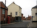
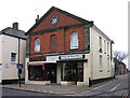
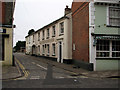
100 photos from this area
Area Information
Key information about the NR28 0AU including its size, population, and administrative classification.
- Area Type
- Postcode
- Area Size
- 1.7 hectares
- Population
- 1316
- Population Density
- 4296 people/km²
House Prices in NR28 0AU
26
Properties
£207,338
Average Sold Price
£107,000
Lowest Price
£356,500
Highest Price
Showing 26 properties
| Address | Type | Beds | Baths | Last Sale Price | Last Sale Date | |
|---|---|---|---|---|---|---|
| 21 Northmead Drive, North Walsham, NR28 0AU | Bungalow | 2 | - | £192,500 | Jul 2024 | |
| 25 Northmead Drive, North Walsham, NR28 0AU | Bungalow | 2 | 1 | £290,000 | Jan 2023 | |
| 29 Northmead Drive, North Walsham, NR28 0AU | Bungalow | 3 | 2 | £356,500 | Jun 2022 | |
| 7 Northmead Drive, North Walsham, NR28 0AU | Bungalow | - | - | £245,000 | Mar 2022 | |
| 6 Northmead Drive, North Walsham, NR28 0AU | Bungalow | - | - | £238,500 | Oct 2020 | |
| 5 Northmead Drive, North Walsham, NR28 0AU | Detached | 2 | 1 | £307,500 | Jan 2019 | |
| 8A Northmead Drive, North Walsham, NR28 0AU | Bungalow | - | - | £230,000 | Apr 2018 | |
| 17 Northmead Drive, North Walsham, NR28 0AU | Bungalow | 2 | 1 | £225,000 | Dec 2017 | |
| 10 Northmead Drive, North Walsham, NR28 0AU | Bungalow | 2 | - | £196,000 | Mar 2017 | |
| 2 Northmead Drive, North Walsham, NR28 0AU | Bungalow | 3 | - | £219,950 | Sep 2014 |
Page 1 of 3
Energy Efficiency in NR28 0AU
Amenities
Schools
| Rank | School | Type | Entry gender | Ages |
|---|
Explore more schools in this area
Go to Schools tabDemographics
Household Size
One person
most common
Accommodation Type
Houses
most common
Tenure
65
majority
Ethnic Group
White
most common
Religion
N/A
most common
Household Composition
N/A
most common
Age
47
median
Adults (30-64 years)
most common
Household Deprivation
N/A
with no deprivation
NS-SEC
22
in Lower managerial occupations
Explore more demographic insights in this area
Go to Demographics tabPlanning
Planning Constraints
- Flood RiskPremium
- Ramsar Wetland SitesPremium
- Area of Outstanding Natural BeautyPremium
- Protected Nature ReservePremium
- Protected WoodlandPremium