Area Overview for NR27 9QP
Photos of NR27 9QP
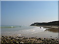
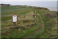
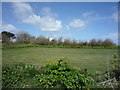
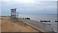
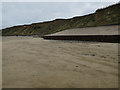
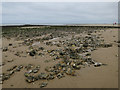

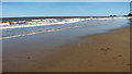
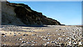
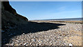
105 photos from this area
Area Information
Key information about the NR27 9QP including its size, population, and administrative classification.
- Area Type
- Postcode
- Area Size
- 39.4 hectares
- Population
- 2015
- Population Density
- 170 people/km²
House Prices in NR27 9QP
20
Properties
£289,850
Average Sold Price
£54,500
Lowest Price
£577,000
Highest Price
Showing 20 properties
| Address | Type | Beds | Baths | Last Sale Price | Last Sale Date | |
|---|---|---|---|---|---|---|
| Corner Cottage, Water Lane, West Runton, NR27 9QP | Detached | 4 | 1 | £355,000 | Jul 2023 | |
| Glenelg, Water Lane, West Runton, NR27 9QP | house | - | - | £577,000 | Feb 2021 | |
| St. Anthonys, Water Lane, West Runton, NR27 9QP | Detached | 5 | 2 | £386,000 | Jul 2019 | |
| Bryntirion, Water Lane, West Runton, NR27 9QP | house | - | - | £430,000 | Oct 2016 | |
| The Croft, Water Lane, West Runton, NR27 9QP | Detached | 4 | 3 | £280,000 | Jul 2014 | |
| Sea Nook, Water Lane, West Runton, NR27 9QP | Cottage | 4 | - | £247,000 | Mar 2014 | |
| Merrivale, Water Lane, West Runton, NR27 9QP | house | - | - | £184,000 | Mar 2013 | |
| The Mearns, Water Lane, West Runton, NR27 9QP | Detached | - | - | £230,000 | Oct 2006 | |
| Cherry Tree Cottage, Water Lane, West Runton, NR27 9QP | Detached | 4 | 1 | £54,500 | Jun 1997 | |
| The Stance, Water Lane, West Runton, NR27 9QP | house | - | - | £155,000 | Apr 1997 |
Page 1 of 2
Energy Efficiency in NR27 9QP
Amenities
Schools
| Rank | School | Type | Entry gender | Ages |
|---|
Explore more schools in this area
Go to Schools tabDemographics
Household Size
Two person
most common
Accommodation Type
Houses
most common
Tenure
80
majority
Ethnic Group
White
most common
Religion
N/A
most common
Household Composition
N/A
most common
Age
47
median
Adults (30-64 years)
most common
Household Deprivation
N/A
with no deprivation
NS-SEC
35
in Lower managerial occupations
Explore more demographic insights in this area
Go to Demographics tabPlanning
Planning Constraints
- Flood RiskPremium
- Ramsar Wetland SitesPremium
- Area of Outstanding Natural BeautyPremium
- Protected Nature ReservePremium
- Protected WoodlandPremium