Area Overview for NR27 9JU
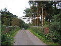
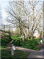
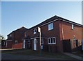
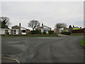
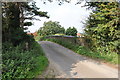
Photos of NR27 9JU


Area Information
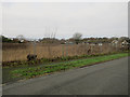
The postcode NR27 9JU occupies a specific residential cluster comprising 29.8 hectares across Norfolk. This area serves a population of 1,387 people, resulting in a low density of 122 people per square kilometre. Such figures indicate a quiet, village-style environment where residents value space and seclusion. You will find this is a place defined by residential tranquility rather than urban bustle. The compact size of the settlement fosters a close-knit atmosphere where neighbours often know one another. Daily life revolves around the immediate grounds and easy access to nearby towns for essential services. You are purchasing into a location that prioritises calm over convenience. The small population ensures that the community retains a traditional character without the pressure of rapid expansion. This restricted scale makes the area suitable for those seeking a distinct break from city living while maintaining a connection to the wider region.
- Area Type
- Postcode
- Area Size
- 29.8 hectares
- Population
- 1387
- Population Density
- 122 people/km²
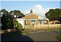
The housing stock in NR27 9JU is characterised by self-ownership and traditional architecture. Houses form the sole accommodation type available in this cluster. This exclusive focus on detached or semi-detached homes dictates the market dynamics. With 74% of residents owning their homes, the area functions primarily as a buy-to-stay or legacy investment zone rather than a rental hub. This high ownership rate implies strong economic stability for the householders present. Potential buyers looking at homes in NR27 9JU will encounter a market driven by owners who have invested deeply in their local plots. The lack of flats means there is no yield from student or urban worker rentals. You are entering a traditional market where property values reflect the secure tenure of current owners. The specific nature of the postcode covers a small residential cluster, limiting large-scale commercial development. Consequently, the housing supply remains static and rooted in the historical footprint of the village.
House Prices in NR27 9JU
Showing 27 properties
| Address | Type | Beds | Baths | Last Sale Price | Last Sale Date | |
|---|---|---|---|---|---|---|
| Maudville, Norwich Road, Cromer, NR27 9JU | Semi-detached | 3 | 2 | £290,000 | Aug 2021 | |
| Pippins, Norwich Road, Cromer, NR27 9JU | Detached | 3 | - | £345,000 | Apr 2021 | |
| Choseley, Norwich Road, Cromer, NR27 9JU | Semi-detached | 2 | 1 | £350,000 | Dec 2019 | |
| Peacehaven, Norwich Road, Cromer, NR27 9JU | Semi-detached | 1 | 1 | £175,000 | Feb 2019 | |
| Belle Vue, Norwich Road, Cromer, NR27 9JU | house | - | - | £191,000 | Dec 2018 | |
| Peaceholme, Norwich Road, Cromer, NR27 9JU | Bungalow | - | - | £215,000 | Jun 2018 | |
| Sandymount, Norwich Road, Cromer, NR27 9JU | Semi-detached | 3 | - | £199,950 | May 2016 | |
| Little Home, Norwich Road, Cromer, NR27 9JU | Semi-detached | 3 | - | £178,000 | Jun 2015 | |
| Rhobert, Norwich Road, Cromer, NR27 9JU | Bungalow | - | - | £180,000 | Oct 2014 | |
| Valbar, Norwich Road, Cromer, NR27 9JU | Semi-detached | - | - | £149,500 | Mar 2008 |
Energy Efficiency in NR27 9JU
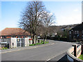
Daily life in NR27 9JU centres on practical reach to essential retail and transport hubs. There are five rail stations available for long-distance travel, including Roughton Road, Cromer, and West Runton railway stations. These stops provide the link to wider Norfolk and national networks. For shopping needs, five retail outlets lie within practical reach. You can visit Lidl Cromer, Iceland Cromer, and Co-op Cromer for groceries, household supplies, and daily essentials. These specific venues ensure you do not need to travel far for food or basic maintenance items. The proximity of these named retailers means your weekly shop requires minimal travel time. Life here balances the quiet of the residential cluster with the convenience of Cromer's larger shops. You have access to a functioning town centre without being embedded in it. This arrangement offers a compromise suitable for families wanting both rural space and urban utility.
Amenities
Schools
Families in NR27 9JU have access to two primary educational institutions within the immediate catchment. Northrepps Primary School operates as a local primary option with an Ofsted rating of good. Overstrand, the Belfry, Church of England Voluntary Aided Primary School also serves the area and holds a good Ofsted rating. Both possibilities provide state-educated options for young children living here. The presence of Church of England designation at one institution offers a specific educational ethos for families seeking religious instruction. You will not find secondary schools listed directly for this postcode in the current data, so pupils typically transition to broader county configurations after age 11. The dual primary setup ensures options for Nursery through Key Stage 2 education. Residents must rely on these local numbers for early learning, ensuring no families face uncertainty in the first phase of schooling. These two schools anchor the educational provision for the 1,387 residents currently living here.
| Rank | School | Type | Entry gender | Ages |
|---|
Explore more schools in this area
Go to Schools tabDemographics
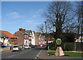
The community within NR27 9JU is defined by established maturity. The median age stands at 47 years, with the most common residents falling into the 30 to 64 age range. This profile suggests the area attracts long-term families and individuals past their immediate childcare years. Owning a home is a dominant feature of daily life here. Home ownership reaches 74%, meaning the vast majority of households have purchased their properties. Accommodation is almost exclusively in the form of houses, confirming the absence of flats or high-density apartments. The predominant ethnic group is White, reflecting a homogenous community structure typical of rural Norfolk. These facts create a stable demographic environment with low turnover. You can expect a neighbourhood where people have downrooted and put lives down locally. The high ownership rate and lack of student or young professional renters point to a legacy market. This stability benefits residents through consistent community engagement and predictable local dynamics.
Household Size
Accommodation Type
Tenure
Ethnic Group
Religion
Household Composition
Age
Household Deprivation
NS-SEC
Explore more demographic insights in this area
Go to Demographics tabPlanning
Planning Constraints
- Flood RiskPremium
- Ramsar Wetland SitesPremium
- Area of Outstanding Natural BeautyPremium
- Protected Nature ReservePremium
- Protected WoodlandPremium