Area Overview for NR27 0NX
Photos of NR27 0NX


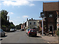
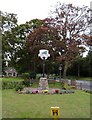

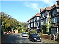

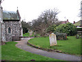
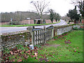
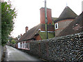
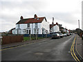
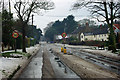
102 photos from this area
Area Information
Key information about the NR27 0NX including its size, population, and administrative classification.
- Area Type
- Postcode
- Area Size
- 5.6 hectares
- Population
- 1195
- Population Density
- 282 people/km²
House Prices in NR27 0NX
23
Properties
£239,433
Average Sold Price
£60,000
Lowest Price
£550,000
Highest Price
Showing 23 properties
| Address | Type | Beds | Baths | Last Sale Price | Last Sale Date | |
|---|---|---|---|---|---|---|
| 34 Cromer Road, Overstrand, NR27 0NX | Detached | 3 | 2 | £550,000 | Nov 2025 | |
| 24 Cromer Road, Overstrand, NR27 0NX | Detached | 3 | 2 | £377,500 | Sep 2025 | |
| 16 Cromer Road, Overstrand, NR27 0NX | Retail | 3 | 1 | £495,000 | Jul 2024 | |
| 12 Cromer Road, Overstrand, NR27 0NX | Mobile Home | 2 | - | £200,000 | Feb 2023 | |
| 28 Cromer Road, Overstrand, NR27 0NX | Bungalow | - | - | £433,333 | May 2021 | |
| Rose Cottage, 14A Cromer Road, Overstrand, NR27 0NX | Detached | 1 | 1 | £120,000 | Jun 2020 | |
| 14 Cromer Road, Overstrand, NR27 0NX | house | - | - | £118,517 | Jan 2020 | |
| 22 Cromer Road, Overstrand, NR27 0NX | Detached | 3 | 3 | £465,000 | Mar 2016 | |
| 46 CROMER ROAD, Overstrand, NR27 0NX | Detached | - | - | £295,000 | Jul 2011 | |
| 44 Cromer Road, Overstrand, NR27 0NX | Semi-detached | - | - | £237,500 | Jul 2008 |
Page 1 of 3
Energy Efficiency in NR27 0NX
Amenities
Schools
| Rank | School | Type | Entry gender | Ages |
|---|
Explore more schools in this area
Go to Schools tabDemographics
Household Size
Two person
most common
Accommodation Type
Houses
most common
Tenure
83
majority
Ethnic Group
White
most common
Religion
N/A
most common
Household Composition
N/A
most common
Age
47
median
Elderly (65+ years)
most common
Household Deprivation
N/A
with no deprivation
NS-SEC
34
in Lower managerial occupations
Explore more demographic insights in this area
Go to Demographics tabPlanning
Planning Constraints
- Flood RiskPremium
- Ramsar Wetland SitesPremium
- Area of Outstanding Natural BeautyPremium
- Protected Nature ReservePremium
- Protected WoodlandPremium