Area Overview for NR26 8UZ
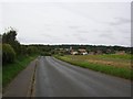
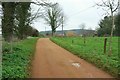
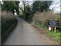
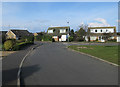
Photos of NR26 8UZ

Area Information
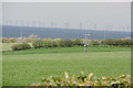
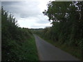
Living in NR26 8UZ offers a quiet existence within a very small residential cluster. This postcode covers approximately 1,755 m² of land, hosting a population of just 1,771 people. The scale of the area suggests a close-knit community where residents likely know their neighbours. The density here is unusually high for a rural cluster, yet the classification as a specific postcode area covering a small residential cluster points to a concentrated settlement rather than spread-out countryside. You are looking at a location defined by its compact footprint. Daily life here moves at a deliberate pace, away from the rush of major urban centres. The area is situated in England, providing a backdrop of typical Norfolk village characteristics. Prospective buyers should understand that this is a modest geography with a distinct identity. It is not a large borough but a focused point on the map. This concentration allows for efficient access to local resources while maintaining a sense of privacy. The environment is tailored for those who prefer a contained neighbourhood over a sprawling cityscape.
- Area Type
- Postcode
- Area Size
- 1755 m²
- Population
- 1771
- Population Density
- 1773 people/km²
The housing market in NR26 8UZ is distinctly characterised by owner-occupancy rather than the rental sector. With 81% home ownership, the market is driven by local families and retirees buying into the community. The predominant accommodation type is houses, meaning you will find semi-detached, detached, or bungalow-style properties rather than apartment buildings. This mix supports a lifestyle where residents value privacy and garden space. The concentration of house ownership suggests that most people have remained in the area for decades. There are very few new build apartments or student housing options within this specific cluster. Buyers looking at this area should expect chalked-up prices typical of established, owner-occupied towns. The market does not cater to the young professional renting crowd found in larger cities. Instead, it serves those seeking longevity in their home. Competition may be keen among local movers because turnover is low when 81% of owners stay put. Understanding this high retention rate helps frame your expectations for purchasing a home here.
House Prices in NR26 8UZ
Showing 4 properties
| Address | Type | Beds | Baths | Last Sale Price | Last Sale Date | |
|---|---|---|---|---|---|---|
| 4 Poppy Drive, Sheringham, NR26 8UZ | house | 5 | 3 | £495,000 | Sep 2024 | |
| 3 Poppy Drive, Sheringham, NR26 8UZ | house | - | - | £395,000 | Mar 2021 | |
| 2 Poppy Drive, Sheringham, NR26 8UZ | house | 3 | 1 | £315,000 | Dec 2020 | |
| 1 Poppy Drive, Sheringham, NR26 8UZ | house | - | - | £320,000 | Nov 2020 |
Energy Efficiency in NR26 8UZ
Residents of NR26 8UZ enjoy convenient access to a range of neighbourhood retail and transport hubs. Within practical reach, you will find five major convenience stores including Budgens Sheringham, Tesco Sheringham, and Sainsburys Sheringham. These retailers provide everything from groceries to household essentials without the need for extensive travel. Transport links are equally accessible, with four nearby railway stations including Sheringham Railway Station, West Runton Railway Station, and Cromer Railway Station. These stations offer direct train services that connect the area to wider regional networks. Additionally, two metro-level transport options exist at Weybourne and Holt, providing further mobility choices. This network of shops and rail links ensures daily necessities are close by. You do not need to drive far for basic errands or weekend trips. The presence of these specific venues defines the convenience of the area. Shopping and commuting are streamlined, allowing you to focus on home life.
Amenities
Schools
Families considering NR26 8UZ have access to a variety of educational institutions within the immediate vicinity. Nearby options include Sheringham Community Primary School, which holds a Good Ofsted rating. This is a state school providing primary education for young children. Another key state institution is Sheringham High School and Sixth Form Centre. Residents should note that this school also carries a Good Ofsted rating and serves secondary education needs. For families requiring special educational support, Sheringham Woodfields School is available as a special education provider. There is also the option of an independent education path through Hilbre School. Private education seekers have a dedicated choice outside the state system. The mix of good-rated state schools alongside a special school and an independent option provides flexibility. You can choose between community-based state education or the curriculum of Hilbre School. This range supports different learning styles and specific needs found within the local population.
| Rank | School | Type | Entry gender | Ages |
|---|
Explore more schools in this area
Go to Schools tabDemographics
The community in NR26 8UZ reflects an established settlement with a mature resident base. The median age is 47 years, indicating a population drawn from middle and older generations. Demographic data shows that the most common age range is the elderly group, specifically those aged 65 years and over. This age profile suggests retirement homes or long-term family residences dominate the street scenes. Home ownership stands at 81%, creating a very stable and settled neighbourhood. Eight out of every ten households own their property outright or with a mortgage, leaving few rental properties available. The predominant ethnic group is White, which aligns with the traditional demographic make-up of the region. Accommodation consists primarily of houses, rather than apartments or flats. There is no evidence of high-rise living or temporary accommodation in this specific area. You will find a population rooted in the locality for the long term. This high ownership rate and age profile imply quiet streets and a lack of transient residents.
Household Size
Accommodation Type
Tenure
Ethnic Group
Religion
Household Composition
Age
Household Deprivation
NS-SEC
Explore more demographic insights in this area
Go to Demographics tabPlanning
Planning Constraints
- Flood RiskPremium
- Ramsar Wetland SitesPremium
- Area of Outstanding Natural BeautyPremium
- Protected Nature ReservePremium
- Protected WoodlandPremium