Area Overview for NR26 8TR
Photos of NR26 8TR
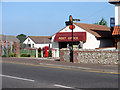

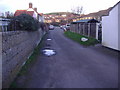

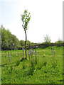
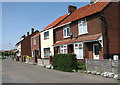


100 photos from this area
Area Information
Key information about the NR26 8TR including its size, population, and administrative classification.
- Area Type
- Postcode
- Area Size
- 7.4 hectares
- Population
- 2257
- Population Density
- 63 people/km²
House Prices in NR26 8TR
15
Properties
£246,500
Average Sold Price
£165,000
Lowest Price
£696,000
Highest Price
Showing 15 properties
| Address | Type | Beds | Baths | Last Sale Price | Last Sale Date | |
|---|---|---|---|---|---|---|
| Mursley, Britons Lane, Beeston Regis, NR26 8TR | Bungalow | 4 | 3 | £696,000 | Aug 2025 | |
| Woodbines, Britons Lane, Beeston Regis, NR26 8TR | Bungalow | - | - | £240,000 | Aug 2017 | |
| Solana, 33 Britons Lane, Beeston Regis, NR26 8TR | Bungalow | 2 | 1 | £185,000 | Jun 2015 | |
| Hazeldene, Britons Lane, Beeston Regis, NR26 8TR | Bungalow | - | - | £178,000 | Aug 2013 | |
| Sunnicot, Britons Lane, Beeston Regis, NR26 8TR | Bungalow | - | - | £166,000 | Sep 2010 | |
| Wood View, Britons Lane, Beeston Regis, NR26 8TR | Bungalow | - | - | £167,000 | Aug 2010 | |
| Lynton Lodge, Britons Lane, Beeston Regis, NR26 8TR | Detached | - | - | £175,000 | May 2009 | |
| Field View, Britons Lane, Beeston Regis, NR26 8TR | Detached | - | - | £165,000 | Nov 2004 | |
| Silverdale, Britons Lane, Beeston Regis, NR26 8TR | Bungalow | 5 | - | - | - | |
| Kyrenia Cottage, Britons Lane, Beeston Regis, NR26 8TR | Detached | - | - | - | - |
Page 1 of 2
Energy Efficiency in NR26 8TR
Amenities
Schools
| Rank | School | Type | Entry gender | Ages |
|---|
Explore more schools in this area
Go to Schools tabDemographics
Household Size
Two person
most common
Accommodation Type
Houses
most common
Tenure
73
majority
Ethnic Group
White
most common
Religion
N/A
most common
Household Composition
N/A
most common
Age
47
median
Adults (30-64 years)
most common
Household Deprivation
N/A
with no deprivation
NS-SEC
33
in Lower managerial occupations
Explore more demographic insights in this area
Go to Demographics tabPlanning
Planning Constraints
- Flood RiskPremium
- Ramsar Wetland SitesPremium
- Area of Outstanding Natural BeautyPremium
- Protected Nature ReservePremium
- Protected WoodlandPremium