Area Overview for NR26 8JW
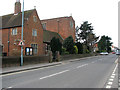
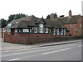
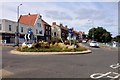
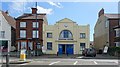
Photos of NR26 8JW


Area Information
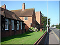
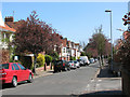
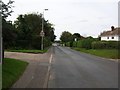
Living in NR26 8JW offers a settled existence within a small residential cluster situated in England. This postcode covers a tiny footprint of just 1995 square metres, yet it supports a population of 2058 people. You will find yourself part of a compact community where space is defined by close proximity rather than sprawling distances. The area is distinctly residential, with houses making up the primary accommodation type. Daily life here focuses on quiet neighbours and a clear understanding of your immediate surroundings. The character of NR26 8JW is shaped by its specific location and modest size. Residents benefit from a tight-knit environment where local interactions are common. There are no large public parks or industrial zones within the immediate cluster, ensuring the space remains dedicated to housing. You can expect a lifestyle that values stability and established routines. The high population density relative to the area size means you will know who lives next door quickly. This setting provides a sense of security and familiarity that larger suburbs often lack. It is a place where infrastructure supports a smaller scale of living, perfectly tailored for those seeking a contained domestic environment.
- Area Type
- Postcode
- Area Size
- 1995 m²
- Population
- 2058
- Population Density
- 2277 people/km²
The property market in NR26 8JW is defined by established ownership and a specific housing typology. Houses constitute the sole accommodation type within this postcode, offering a traditional English suburban feel. You will find that 75% of the homes are owner-occupied. This statistic reveals a market driven by people who have chosen to put down roots rather than those seeking temporary accommodation. Buying a home in NR26 8JW means entering a market with high occupancy rates. The housing stock is likely to be mature properties suitable for the older demographic that predominates the area. Because the population is 2058 people living in a mere 1995 square metres, the land value is intense. There is no rental market data provided for this cluster, suggesting properties are mostly residential dwellings held for owner use. If you are looking for flats, they are not present here; the inventory consists entirely of houses. This structure makes the area particularly attractive to families or retirees seeking single-family dwellings. The market stability comes from the fact that most residents already live there. Potential buyers should focus on the condition of specific houses rather than apartment blocks. The exclusivity of the house market adds to the area's character as a permanent community.
House Prices in NR26 8JW
Showing 12 properties
| Address | Type | Beds | Baths | Last Sale Price | Last Sale Date | |
|---|---|---|---|---|---|---|
| 10, Sandhurst Court, Holway Road, Sheringham, NR26 8JW | Flat | - | - | £260,000 | Mar 2024 | |
| 6, Sandhurst Court, Holway Road, Sheringham, NR26 8JW | Flat | - | - | £255,000 | Mar 2024 | |
| 4, Sandhurst Court, Holway Road, Sheringham, NR26 8JW | Flat | 2 | 1 | £260,000 | Jul 2022 | |
| 3, Sandhurst Court, Holway Road, Sheringham, NR26 8JW | Flat | - | - | £195,000 | Mar 2020 | |
| 8, Sandhurst Court, Holway Road, Sheringham, NR26 8JW | Flat | - | - | £195,000 | Sep 2019 | |
| 5, Sandhurst Court, Holway Road, Sheringham, NR26 8JW | Flat | - | - | £227,000 | Jun 2018 | |
| 7, Sandhurst Court, Holway Road, Sheringham, NR26 8JW | Flat | - | - | £185,000 | Nov 2016 | |
| 9, Sandhurst Court, Holway Road, Sheringham, NR26 8JW | Flat | - | - | £180,000 | Dec 2015 | |
| 11, Sandhurst Court, Holway Road, Sheringham, NR26 8JW | Flat | - | - | £173,500 | Dec 2009 | |
| 12, Sandhurst Court, Holway Road, Sheringham, NR26 8JW | Flat | - | - | £188,000 | Dec 2007 |
Energy Efficiency in NR26 8JW
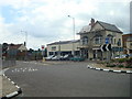
Daily life in NR26 8JW revolves around convenience stores and railway connections rather than large shopping centres or leisure complexes. For your weekly shopping, you have immediate access to Tesco Sheringham, Budgens Sheringham, and Sainsburys Sheringham. These three retail locations provide essential groceries and household necessities without requiring a long drive. You can complete errands quickly using these nearby amenities. Transport links are anchored by four railway stations within reach: Sheringham Railway Station, West Runton Railway Station, Cromer Railway Station, and others. These connections facilitate travel to larger towns for entertainment or specialized services. Beyond the physical commute, two metro-style destinations serve the wider region: Weybourne and Holt. While there are no large parks or cinemas listed as nearest amenities, the clustering of supermarkets and train stations creates a functional lifestyle. Residents must plan visits slightly further out for leisure, but daily needs are met locally. The presence of five retail outlets ensures no major gaps in basic supply. Your routine will centre around these established hubs rather than new developments.
Amenities
Schools
| Rank | School | Type | Entry gender | Ages |
|---|
Explore more schools in this area
Go to Schools tabDemographics
The community in NR26 8JW skews significantly towards older residents. The median age for people living here is 47 years, with the most common age range being the elderly, defined as those over 65 years. This demographic profile suggests a neighbourhood where retirees and older couples form the backbone of the resident base. You will likely encounter neighbours who have called this area home for decades, valuing tradition and stability. Home ownership is extremely prevalent in this zone, with 75% of residents owning their properties outright or with a mortgage. This high rate indicates a preference for long-term settlement rather than short-term renting. The area is predominantly occupied by individuals identifying as White, reflecting the broader national trends of the region. Accommodation types are exclusively houses, meaning you will not find flats or maisonettes within this specific cluster. The absence of younger families or student populations is evident in the age statistics. This steady demographic ensures a predictable social environment. The lack of transient workers contributes to a tranquil atmosphere. Residents here are invested in the local community, fostering an environment of reliability and mutual support.
Household Size
Accommodation Type
Tenure
Ethnic Group
Religion
Household Composition
Age
Household Deprivation
NS-SEC
Explore more demographic insights in this area
Go to Demographics tabPlanning
Planning Constraints
- Flood RiskPremium
- Ramsar Wetland SitesPremium
- Area of Outstanding Natural BeautyPremium
- Protected Nature ReservePremium
- Protected WoodlandPremium