Area Overview for NR26 8BH
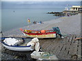
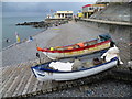
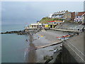
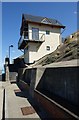
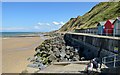
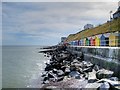
Photos of NR26 8BH


Area Information
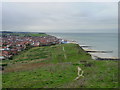
Living in NR26 8BH defines a specific postcode area covering a small residential cluster with defined boundaries. The location spans an area size of 5,886 square metres, hosting a population of 1,752 residents. This density reaches 1,503 people per square kilometre, creating a compact neighbourhood where homes are in close proximity to one another. The setting is practical and grounded, avoiding unnecessary sprawl while providing clear residential zones. You can expect a community where daily routines are influenced by short distances between your door and local services. The area is situated in England, offering a slice of life characterised by stability and established neighbourhood ties. Those considering shelter in this postcode should note its immediate nature; it is not a sprawling expansion but a focused pocket of housing. The small footprint means you will likely know your neighbours well, as the volume of households is limited yet concentrated. This environment suits those seeking a contained living space without the anonymity of larger urban districts. The character of the area remains consistent with its size, offering a straightforward residential experience.
- Area Type
- Postcode
- Area Size
- 5886 m²
- Population
- 1752
- Population Density
- 1503 people/km²
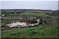
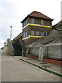
The property market in NR26 8BH is dominated by houses, which serve as the main accommodation type for buyers and sellers. This classification excludes flats and apartments, indicating a stock suited for those who prefer standalone living spaces or bungalows. Ownership patterns reinforce this reality, as 61 per cent of residents own their properties outright or through mortgages. This high proportion suggests the area functions as a retirement destination or a buying option for later-life movers. The remaining 39 per cent of the market consists of rented accommodations or shared equity schemes. Given the small area size of 5,886 square metres and a population of only 1,752, inventory turnover might be slower than in larger towns. You are looking at a limited selection of homes, not a sprawling development. Traditional house designs will predominate, reflecting the historical development patterns of the postcode. The market is likely stable, driven by demographic demands for single-level living in a peaceful setting. Understanding these specifics helps you navigate houses in NR26 8BH with realistic expectations.
House Prices in NR26 8BH
Showing 15 properties
| Address | Type | Beds | Baths | Last Sale Price | Last Sale Date | |
|---|---|---|---|---|---|---|
| 11 Beach Road, Sheringham, NR26 8BH | house | - | - | £306,000 | Jul 2024 | |
| 19 Beach Road, Sheringham, NR26 8BH | house | - | - | £257,000 | Jun 2016 | |
| 21 Beach Road, Sheringham, NR26 8BH | Terraced | - | - | £150,000 | Aug 2012 | |
| 4 Beach Road, Sheringham, NR26 8BH | Terraced | - | - | £250,000 | Jul 2012 | |
| 13 Beach Road, Sheringham, NR26 8BH | Semi-detached | 4 | 2 | £220,000 | Apr 2011 | |
| 6 Beach Road, Sheringham, NR26 8BH | house | - | - | £198,000 | Nov 2009 | |
| 8 Beach Road, Sheringham, NR26 8BH | Semi-detached | - | - | £155,000 | Mar 2003 | |
| 23 Beach Road, Sheringham, NR26 8BH | Terraced | - | - | £34,000 | Dec 1997 | |
| 3 BEACH ROAD, Sheringham, NR26 8BH | Terraced | - | - | - | - | |
| Flat 2, 6 Beach Road, Sheringham, NR26 8BH | Flat | - | - | - | - |
Energy Efficiency in NR26 8BH
Daily life in NR26 8BH involves easy access to essential retail and transport hubs within practical reach. Residents step out to reach five notable retail outlets, including Sainsburys Sheringham, Tesco Sheringham, and Budgens Sheringham. These supermarkets provide food, household essentials, and daily conveniences within a short journey. Four railway stations serve the broader neighbourhood, including Sheringham Railway Station, West Runton Railway Station, and Cromer Railway Station. This rail network grants you rapid links to larger employment centres and leisure destinations. Metro options extend further to Weybourne and Holt, offering alternative routes for commuting or day trips. The combination of supermarkets and rail links means you do not need a car for basic tasks. You can shop for groceries before catching a train to the coast or the city. The lifestyle is shaped by these accessible nodes, blending rural tranquillity with urban connectivity. Even though the local postcode is small, the surrounding amenities offer a comprehensive support network.
Amenities
Schools
| Rank | School | Type | Entry gender | Ages |
|---|
Explore more schools in this area
Go to Schools tabDemographics
The community in NR26 8BH reflects an established population with a median age of 47 years. Most residents fall into the elderly category aged 65 years and older. This age profile indicates a neighbourhood dominated by retirees or older homeowners rather than young professionals or families. A slight majority of the local population identifies as ethnic White, which aligns with typical patterns for this region in England. Over 61 per cent of households own their homes, suggesting a stable owner-occupied sector with long-term residents. The remaining 39 per cent likely include tenants or shared ownership occupants. Houses form the primary accommodation type, reflecting a traditional suburban or rural housing stock. You will not find numerous high-rise blocks or purpose-built apartment complexes in this cluster. The demographic composition points to a quiet, settled environment where life pace may be measured rather than hurried. Many homes have been here for decades, contributing to a strong sense of local continuity. The area lacks significant transient populations, meaning the community fabric remains relatively unchanged over time. For someone researching living in NR26 8BH, these figures paint a picture of maturity and permanence.
Household Size
Accommodation Type
Tenure
Ethnic Group
Religion
Household Composition
Age
Household Deprivation
NS-SEC
Explore more demographic insights in this area
Go to Demographics tabPlanning
Planning Constraints
- Flood RiskPremium
- Ramsar Wetland SitesPremium
- Area of Outstanding Natural BeautyPremium
- Protected Nature ReservePremium
- Protected WoodlandPremium