Area Overview for NR25 7RZ
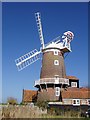
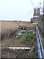
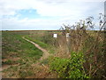
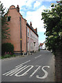
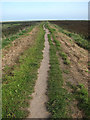
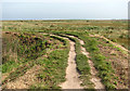
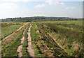
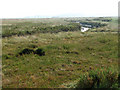
Photos of NR25 7RZ
Area Information
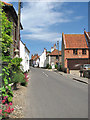
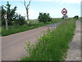
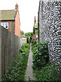
Living in NR25 7RZ offers a specific character defined by its rural nature and modest scale. This postcode covers a precise footprint of only 2.0 hectares, hosting a population of 1,736 residents. The community is small and tightly knit, situated within the broader Norfolk landscape. You will find a residential cluster that prioritises quiet over convenience, typical of settlements in this part of England. The area acts as a sleeping district for many, yet local amenities remain reachable without a lengthy commute. Daily life here revolves around community interaction and appreciation of the surrounding natural environment. The low population density means you are not surrounded by urban sprawl. Instead, the landscape dictates the pace of daily activities. This is a place for those who value stillness and have a car for essential trips to more developed towns. The small size ensures a manageable environment where neighbours and local infrastructure are interchangeable.
- Area Type
- Postcode
- Area Size
- 2.0 hectares
- Population
- 1736
- Population Density
- 57 people/km²
Comparing the United Kingdom's typical housing trends to NR25 7RZ reveals a distinct market structure. This specific postcode area is overwhelmingly owner-occupied, with 76% of households holding title to their property. Just 24% of residents rent their homes. This statistic indicates that properties here are generally purchased assets rather than rental investments. The accommodation type in NR25 7RZ consists entirely of houses. You will not find flats or terraced housing within this residential cluster. This composition aligns with the older demographic profile and the available land. Potential buyers looking for rental回报率 in this postcode will struggle, as the market is dominated by owner-occupiers. The stock consists of traditional family homes suited to the median age of 47. The mix of properties remains consistent with the rural character of the region. Buyers must expect to compete with established households who have lived in these homes for decades.
House Prices in NR25 7RZ
Showing 22 properties
| Address | Type | Beds | Baths | Last Sale Price | Last Sale Date | |
|---|---|---|---|---|---|---|
| The Haven, Coast Road, Cley Next The Sea, NR25 7RZ | house | - | - | £430,000 | Mar 2025 | |
| Thrums, Coast Road, Cley Next The Sea, NR25 7RZ | house | 3 | 2 | £890,000 | Oct 2024 | |
| Hole Cottage, Coast Road, Cley Next The Sea, NR25 7RZ | Semi-detached | 3 | 1 | £550,000 | Feb 2024 | |
| The Watch House, Coast Road, Cley Next The Sea, NR25 7RZ | house | - | - | £888,000 | Dec 2021 | |
| Hillrise Cottage, Coast Road, Cley Next The Sea, NR25 7RZ | house | - | - | £680,100 | Apr 2021 | |
| The Saltings, Coast Road, Cley Next The Sea, NR25 7RZ | house | - | - | £840,000 | Sep 2020 | |
| Marshlands, Coast Road, Cley Next The Sea, NR25 7RZ | Detached | 5 | 3 | £1,445,000 | Dec 2017 | |
| Peggoty's Cottage, Coast Road, Cley Next The Sea, NR25 7RZ | Cottage | 2 | 1 | £315,000 | Oct 2016 | |
| The Nest, Coast Road, Cley Next The Sea, NR25 7RZ | house | 5 | - | £875,000 | Nov 2011 | |
| Hill House, Coast Road, Cley Next The Sea, NR25 7RZ | Detached | 4 | 2 | £440,000 | Jan 2007 |
Energy Efficiency in NR25 7RZ
Your daily routine in NR25 7RZ will rely on three nearby retail outlets. You can purchase groceries and essentials at Spar, Morrisons Daily, and Budgens Holt. These shops provide basic sustenance and household items. For travelled commuting or longer journeys, you depend on two stations located within practical reach. The Holt and Weybourne stations offer rail links to larger urban centres. While not situated directly within the 2.0 hectare postcode, they are considered part of the accessible amenity network. You will find no large leisure centres, cinemas, or evening entertainment districts nearby. Life in this area focuses on quiet days at home and trips to nearby towns. The character of the neighbourhood is defined by these limited but functional services. Residents rely on a car to bridge the gap between the village and the wider region. Convenience is secondary to the quality of the surroundings.
Amenities
Schools
Parents looking at homes near NR25 7RZ have access to two specific primary options. You can find Kelling Primary School which serves as a standard local institution. Nearby is Kelling CE Primary School, which holds a Good Ofsted rating. This rating signifies a school meeting expected standards of education and care. Both institutions are located within the Kelling area, serving the immediate catchment. The presence of two primaries suggests a catchment system that does not yet require a secondary school facility in the immediate vicinity. Families in this postcode must travel to other towns for secondary education, including options in Holt. The rating of Good for the CE primary is a reliable indicator of quality for younger children. You should verify the specific travel distances to these schools based on your home address within the postcode. The limited school choice reflects the rural and lower-density nature of the region.
| Rank | School | Type | Entry gender | Ages |
|---|
Explore more schools in this area
Go to Schools tabDemographics
The community in NR25 7RZ reflects a specific life stage. The median age for residents is 47 years, indicating a mature population base. Older adults make up the most common age group, with a significant proportion being elderly residents aged 65 years and over. This demographic profile suggests a neighbourhood where families may have raised their children elsewhere or sold their properties later in life. Home ownership is high within this community, with 76% of residents owning their homes outright or with a mortgage. Conversely, only a minority of households rent. The predominant ethnic group is White, which aligns with the typical demographic makeup of rural Norfolk. You will find predominantly detached or semi-detached houses rather than flats or urban blocks. This housing stock suits the older demographic who own their properties. There is no indication of significant cultural diversity or high-density living arrangements. The area functions as a quiet retirement haven rather than a young professional hub.
Household Size
Accommodation Type
Tenure
Ethnic Group
Religion
Household Composition
Age
Household Deprivation
NS-SEC
Explore more demographic insights in this area
Go to Demographics tabPlanning
Planning Constraints
- Flood RiskPremium
- Ramsar Wetland SitesPremium
- Area of Outstanding Natural BeautyPremium
- Protected Nature ReservePremium
- Protected WoodlandPremium