Area Overview for NR25 7HE
Photos of NR25 7HE
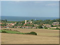
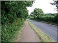
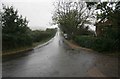
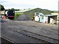
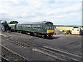
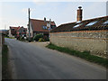
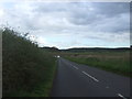
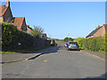
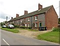
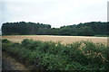
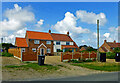
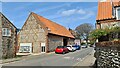
48 photos from this area
Area Information
Key information about the NR25 7HE including its size, population, and administrative classification.
- Area Type
- Postcode
- Area Size
- 1.3 hectares
- Population
- 1736
- Population Density
- 57 people/km²
House Prices in NR25 7HE
19
Properties
£303,954
Average Sold Price
£68,000
Lowest Price
£810,900
Highest Price
Showing 19 properties
| Address | Type | Beds | Baths | Last Sale Price | Last Sale Date | |
|---|---|---|---|---|---|---|
| 5, Rosedale Farm Barns, Station Road, Weybourne, NR25 7HE | house | - | - | £287,500 | Dec 2023 | |
| 1, Rosedale Farm Barns, Station Road, Weybourne, NR25 7HE | house | - | - | £810,900 | Nov 2023 | |
| 2, Rosedale Farm Cottages, Station Road, Weybourne, NR25 7HE | house | - | - | £430,000 | Oct 2022 | |
| 1, Barnfield Cottages, Station Road, Weybourne, NR25 7HE | house | - | - | £95,000 | Jul 2019 | |
| 3, Barnfield Cottages, Station Road, Weybourne, NR25 7HE | Terraced | 3 | 2 | £375,000 | Nov 2017 | |
| 1, Rosedale Farm Cottages, Station Road, Weybourne, NR25 7HE | Terraced | 3 | 1 | £305,000 | Dec 2016 | |
| Jericho House, Station Road, Weybourne, NR25 7HE | Detached | - | - | £580,000 | Jul 2015 | |
| White Webbs, Station Road, Weybourne, NR25 7HE | Bungalow | 3 | 1 | £220,000 | Apr 2015 | |
| 2, Barnfield Cottages, Station Road, Weybourne, NR25 7HE | house | - | - | £247,500 | Oct 2005 | |
| Bridgefoot, Station Road, Weybourne, NR25 7HE | Detached | 4 | 2 | £272,500 | Mar 2004 |
Page 1 of 2
Energy Efficiency in NR25 7HE
Amenities
Schools
| Rank | School | Type | Entry gender | Ages |
|---|
Explore more schools in this area
Go to Schools tabDemographics
Household Size
Two person
most common
Accommodation Type
Houses
most common
Tenure
76
majority
Ethnic Group
White
most common
Religion
N/A
most common
Household Composition
N/A
most common
Age
47
median
Elderly (65+ years)
most common
Household Deprivation
N/A
with no deprivation
NS-SEC
37
in Lower managerial occupations
Explore more demographic insights in this area
Go to Demographics tabPlanning
Planning Constraints
- Flood RiskPremium
- Ramsar Wetland SitesPremium
- Area of Outstanding Natural BeautyPremium
- Protected Nature ReservePremium
- Protected WoodlandPremium