Area Overview for NR25 7BE
Photos of NR25 7BE
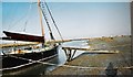
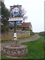
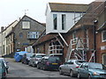
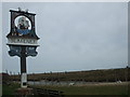
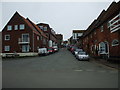
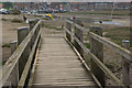

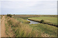
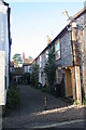
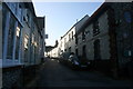
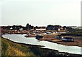
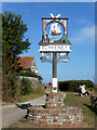
110 photos from this area
Area Information
Key information about the NR25 7BE including its size, population, and administrative classification.
- Area Type
- Postcode
- Area Size
- 22.0 hectares
- Population
- 1913
- Population Density
- 33 people/km²
House Prices in NR25 7BE
34
Properties
£467,726
Average Sold Price
£32,000
Lowest Price
£1,595,000
Highest Price
Showing 34 properties
| Address | Type | Beds | Baths | Last Sale Price | Last Sale Date | |
|---|---|---|---|---|---|---|
| 54 Morston Road, Blakeney, NR25 7BE | house | - | - | £600,000 | Aug 2024 | |
| Butuwa, 58 Morston Road, Blakeney, NR25 7BE | Semi-detached | 5 | 2 | £450,000 | Jan 2020 | |
| 46A Morston Road, Blakeney, NR25 7BE | Terraced | 1 | 1 | £303,000 | Dec 2019 | |
| Crown Cottage, 52 Morston Road, Blakeney, NR25 7BE | Cottage | 3 | 2 | £525,000 | Feb 2019 | |
| 32 Morston Road, Blakeney, NR25 7BE | Terraced | 3 | 1 | £290,000 | Feb 2019 | |
| 42 Morston Road, Blakeney, NR25 7BE | Terraced | 2 | 1 | £340,000 | Jul 2018 | |
| 16 Morston Road, Blakeney, NR25 7BE | Cottage | 2 | 1 | £455,000 | Mar 2018 | |
| Fairacre, 72 Morston Road, Blakeney, NR25 7BE | house | - | - | £1,325,000 | Oct 2017 | |
| 36 Morston Road, Blakeney, NR25 7BE | Terraced | 2 | 1 | £315,500 | Aug 2017 | |
| Vine Cottage, 60 Morston Road, Blakeney, NR25 7BE | Detached | 5 | 4 | £1,595,000 | Jul 2017 |
Page 1 of 4
Energy Efficiency in NR25 7BE
Amenities
Schools
| Rank | School | Type | Entry gender | Ages |
|---|
Explore more schools in this area
Go to Schools tabDemographics
Household Size
Two person
most common
Accommodation Type
Houses
most common
Tenure
69
majority
Ethnic Group
White
most common
Religion
N/A
most common
Household Composition
N/A
most common
Age
47
median
Adults (30-64 years)
most common
Household Deprivation
N/A
with no deprivation
NS-SEC
39
in Lower managerial occupations
Explore more demographic insights in this area
Go to Demographics tabPlanning
Planning Constraints
- Flood RiskPremium
- Ramsar Wetland SitesPremium
- Area of Outstanding Natural BeautyPremium
- Protected Nature ReservePremium
- Protected WoodlandPremium