Area Overview for NR25 6HU
Photos of NR25 6HU
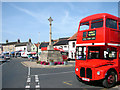
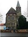
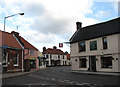
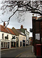
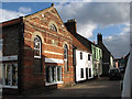
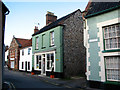
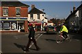
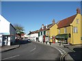
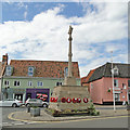
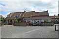
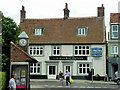
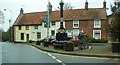
100 photos from this area
Area Information
Key information about the NR25 6HU including its size, population, and administrative classification.
- Area Type
- Postcode
- Area Size
- 1923 m²
- Population
- 2191
- Population Density
- 265 people/km²
House Prices in NR25 6HU
11
Properties
£204,285
Average Sold Price
£25,000
Lowest Price
£345,000
Highest Price
Showing 11 properties
| Address | Type | Beds | Baths | Last Sale Price | Last Sale Date | |
|---|---|---|---|---|---|---|
| 1 Weston Square, Holt, NR25 6HU | Terraced | 2 | 1 | £150,000 | Jan 2025 | |
| 12 Weston Square, Holt, NR25 6HU | Detached | - | - | £271,000 | Aug 2022 | |
| 10 Weston Square, Holt, NR25 6HU | Cottage | 2 | 1 | £265,100 | Feb 2022 | |
| Hive Cottage, 13 Weston Square, Holt, NR25 6HU | house | - | - | £297,250 | Mar 2021 | |
| 4 Weston Square, Holt, NR25 6HU | Cottage | 3 | 1 | £345,000 | May 2018 | |
| Butterfly Cottage, 5B Weston Square, Holt, NR25 6HU | house | 2 | - | £185,000 | Mar 2013 | |
| 5 Weston Square, Holt, NR25 6HU | Terraced | 2 | 1 | £150,000 | Apr 2012 | |
| 8 Weston Square, Holt, NR25 6HU | Terraced | - | - | £156,500 | Sep 2009 | |
| 2 Weston Square, Holt, NR25 6HU | Terraced | 2 | - | £198,000 | Apr 2007 | |
| 11 Weston Square, Holt, NR25 6HU | Terraced | - | - | £25,000 | May 1996 |
Page 1 of 2
Energy Efficiency in NR25 6HU
Amenities
Schools
| Rank | School | Type | Entry gender | Ages |
|---|
Explore more schools in this area
Go to Schools tabDemographics
Household Size
One person
most common
Accommodation Type
Houses
most common
Tenure
55
majority
Ethnic Group
White
most common
Religion
N/A
most common
Household Composition
N/A
most common
Age
47
median
Adults (30-64 years)
most common
Household Deprivation
N/A
with no deprivation
NS-SEC
26
in Lower managerial occupations
Explore more demographic insights in this area
Go to Demographics tabPlanning
Planning Constraints
- Flood RiskPremium
- Ramsar Wetland SitesPremium
- Area of Outstanding Natural BeautyPremium
- Protected Nature ReservePremium
- Protected WoodlandPremium