Area Overview for NR24 2PP
Photos of NR24 2PP
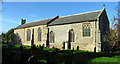
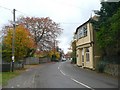
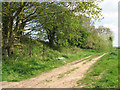
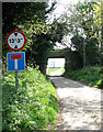
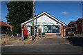
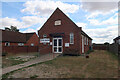
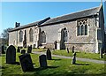
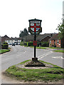
28 photos from this area
Area Information
Key information about the NR24 2PP including its size, population, and administrative classification.
- Area Type
- Postcode
- Area Size
- 2316 m²
- Population
- 2547
- Population Density
- 213 people/km²
House Prices in NR24 2PP
12
Properties
£114,952
Average Sold Price
£29,475
Lowest Price
£175,000
Highest Price
Showing 12 properties
| Address | Type | Beds | Baths | Last Sale Price | Last Sale Date | |
|---|---|---|---|---|---|---|
| 6 Bakery Close, Briston, NR24 2PP | Terraced | 1 | 1 | £172,000 | Feb 2025 | |
| 18 Bakery Close, Briston, NR24 2PP | house | - | - | £175,000 | Jun 2022 | |
| 22 Bakery Close, Briston, NR24 2PP | Terraced | 1 | - | £140,000 | Jan 2021 | |
| 10 Bakery Close, Briston, NR24 2PP | house | - | - | £170,000 | Dec 2020 | |
| 2 Bakery Close, Briston, NR24 2PP | Terraced | 1 | 1 | £116,000 | Nov 2016 | |
| 16 Bakery Close, Briston, NR24 2PP | house | 1 | - | £100,000 | Dec 2010 | |
| 24 Bakery Close, Briston, NR24 2PP | Terraced | - | - | £85,000 | Jan 2005 | |
| 12 Bakery Close, Briston, NR24 2PP | house | 2 | - | £127,500 | Oct 2004 | |
| 4 Bakery Close, Briston, NR24 2PP | Terraced | 1 | 1 | £82,000 | Jan 2004 | |
| 14 Bakery Close, Briston, NR24 2PP | house | - | - | £67,500 | Nov 2001 |
Page 1 of 2
Energy Efficiency in NR24 2PP
Amenities
Schools
| Rank | School | Type | Entry gender | Ages |
|---|
Explore more schools in this area
Go to Schools tabDemographics
Household Size
Two person
most common
Accommodation Type
Houses
most common
Tenure
70
majority
Ethnic Group
White
most common
Religion
N/A
most common
Household Composition
N/A
most common
Age
47
median
Adults (30-64 years)
most common
Household Deprivation
N/A
with no deprivation
NS-SEC
27
in Lower managerial occupations
Explore more demographic insights in this area
Go to Demographics tabPlanning
Planning Constraints
- Flood RiskPremium
- Ramsar Wetland SitesPremium
- Area of Outstanding Natural BeautyPremium
- Protected Nature ReservePremium
- Protected WoodlandPremium