Area Overview for NR23 1JB
Photos of NR23 1JB
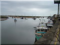
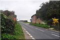
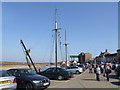
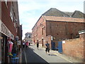
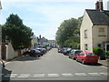
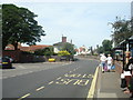
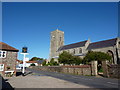
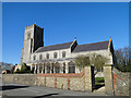

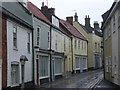
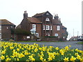
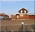
100 photos from this area
Area Information
Key information about the NR23 1JB including its size, population, and administrative classification.
- Area Type
- Postcode
- Area Size
- 1.9 hectares
- Population
- 1268
- Population Density
- 215 people/km²
House Prices in NR23 1JB
15
Properties
£598,563
Average Sold Price
£46,000
Lowest Price
£1,400,000
Highest Price
Showing 15 properties
| Address | Type | Beds | Baths | Last Sale Price | Last Sale Date | |
|---|---|---|---|---|---|---|
| Annexe At, Ebenezer Cottage, Church Street, Wells Next The Sea, NR23 1JB | Semi-detached | - | - | £890,000 | Feb 2023 | |
| Garden House, Church Street, Wells Next The Sea, NR23 1JB | house | - | - | £890,000 | Feb 2023 | |
| Woodlands, Church Street, Wells Next The Sea, NR23 1JB | house | - | - | £740,000 | Mar 2019 | |
| The Old Rectory, Church Street, Wells Next The Sea, NR23 1JB | Detached | 7 | 4 | £1,400,000 | Apr 2013 | |
| The Ark, Church Street, Wells Next The Sea, NR23 1JB | house | - | - | £540,000 | Jun 2010 | |
| 18 Church Street, Wells Next The Sea, NR23 1JB | Detached | - | - | £225,000 | Nov 2008 | |
| Ashanti, Church Street, Wells Next The Sea, NR23 1JB | Detached | 2 | 1 | £46,000 | Nov 1997 | |
| The Wain, 44 Church Street, Wells Next The Sea, NR23 1JB | Semi-detached | - | - | £57,500 | Apr 1995 | |
| Courtyard Flat At, The Old Rectory, Church Street, Wells Next The Sea, NR23 1JB | Flat | - | - | - | - | |
| Coach House At, The Old Rectory, Church Street, Wells Next The Sea, NR23 1JB | Semi-detached | - | - | - | - |
Page 1 of 2
Energy Efficiency in NR23 1JB
Amenities
Schools
| Rank | School | Type | Entry gender | Ages |
|---|
Explore more schools in this area
Go to Schools tabDemographics
Household Size
One person
most common
Accommodation Type
Houses
most common
Tenure
67
majority
Ethnic Group
White
most common
Religion
N/A
most common
Household Composition
N/A
most common
Age
47
median
Elderly (65+ years)
most common
Household Deprivation
N/A
with no deprivation
NS-SEC
34
in Lower managerial occupations
Explore more demographic insights in this area
Go to Demographics tabPlanning
Planning Constraints
- Flood RiskPremium
- Ramsar Wetland SitesPremium
- Area of Outstanding Natural BeautyPremium
- Protected Nature ReservePremium
- Protected WoodlandPremium