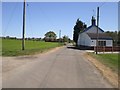
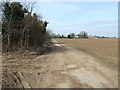
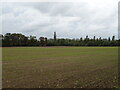
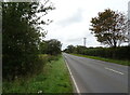
Area Overview for NR21 9NE
Photos of NR21 9NE

Area Information
Living in NR21 9NE offers a quieter residential experience within a defined cluster covering 43.2 hectares. This specific postcode area holds a population of 2,113 residents, resulting in a low density of 32 people per square kilometre. The setting suits those who prefer a settled pace over urban bustle. Residents enjoy a wide-open spatial context while maintaining access to local facilities. The area functions as a compact living space where neighbours often know one another. Daily life revolves around the immediate surroundings rather than distant town centres. You will find the streets are determined by this small population size, which fosters an insular community feel. The environment is characterised by residential clusters rather than high-density developments. Buying a home here means securing a place in a neighbourhood where space is a defining feature. The low population density shapes your daily routine, offering a retreat from crowded city living.
- Area Type
- Postcode
- Area Size
- 43.2 hectares
- Population
- 2113
- Population Density
- 32 people/km²
The housing stock in NR21 9NE is defined by its composition of houses, which accounts for the vast majority of residential properties. With a 55% home ownership rate, the area leans towards owner-occupied living rather than a high-rental market. This statistic indicates that a majority of households have purchased their current homes. The small residential cluster covers 43.2 hectares, limiting the scale of development compared to larger towns. You will find that houses are the standard choice for buyers looking at this postcode. The lower density of 32 people per square kilometre supports this housing form over high-density blocks. Potential buyers should expect a market driven by existing homeowners rather than rapid turnover among landlords. The accommodation type data confirms that you are unlikely to find flats or apartments in this specific cluster.
House Prices in NR21 9NE
Showing 7 properties
| Address | Type | Beds | Baths | Last Sale Price | Last Sale Date | |
|---|---|---|---|---|---|---|
| Ivy Cottage, Fakenham Road, Sculthorpe, NR21 9NE | Semi-detached | 1 | 1 | £405,000 | Apr 2023 | |
| Falgate House, Fakenham Road, Sculthorpe, NR21 9NE | house | 4 | 2 | £491,500 | Apr 2022 | |
| Cobwebs, 2 Fakenham Road, Sculthorpe, NR21 9NE | Semi-detached | 3 | - | - | - | |
| Falgate Farm, Fakenham Road, Sculthorpe, NR21 9NE | Detached | - | - | - | - | |
| 1 Fakenham Road, Sculthorpe, NR21 9NE | Detached | - | - | - | - | |
| Moorlands, Fakenham Road, Sculthorpe, NR21 9NE | Detached | - | - | - | - | |
| Bramble Oaks, Fakenham Road, Sculthorpe, NR21 9NE | Detached | - | - | - | - |
Energy Efficiency in NR21 9NE
Residents in NR21 9NE have practical access to five retail outlets within easy reach. Waitrose Little, Tesco Fakenham, and Morrisons Daily feature as notable shopping destinations that serve the immediate community. A single metro railway stop located at Walsingham provides the main transport link for the area. This station connects residents to broader networks beyond the locality. The combination of supermarket proximity and rail access offers a dual layer of convenience for daily errands. You will find that essential shopping needs are met without requiring lengthy journeys. The amenity layout supports a self-sufficient lifestyle where most weekly trips require local travel. These facilities anchor the area's character as a residential zone with necessary commercial services nearby. The presence of a specific metro stop distinguishes this postcode from purely rural settlements.
Amenities
Schools
Families in NR21 9NE have access to four specific primary schools within their immediate vicinity. Walsingham Community Primary School serves the local area as a primary institution. Sculthorpe Church of England Primary School also caters to younger students in the neighbourhood. Walsingham CE VA Primary School holds a satisfactory Ofsted rating, providing parents with verified educational standards. Sculthorpe Church of England Primary Academy carries a good Ofsted rating, distinguishing it among the local options. The mix includes both community-run and Church of England academies, offering choices based on religious or secular preferences. All listed institutions are primary schools, meaning you will need to plan for secondary education elsewhere once children grow up. The presence of two primary schools with different Ofsted ratings suggests a varied quality of education immediately surrounding this postcode.
| Rank | School | Type | Entry gender | Ages |
|---|
Explore more schools in this area
Go to Schools tabDemographics
The community in NR21 9NE reflects a mature demographic with a median age of 47 years. Most residents fall within the 30 to 64-year age range, indicating a household stability that is typical for families and long-term professionals. House ownership stands at 55%, suggesting a balanced market between owner-occupiers and private tenants. The area is dominated by houses as the primary accommodation type, with no mention of high-rise or apartment living. The predominant ethnic group is White, which creates a homogenous cultural landscape for new incomers. This profile implies a neighbourhood established for stability rather than transient urban churn. You can expect residents to be settled for the long term, valuing consistent community services. The age distribution affects local schools and local shop hours, catering specifically to the needs of established families. Home ownership rates point to a market where many people have financial stakes in their property's long-term value.
Household Size
Accommodation Type
Tenure
Ethnic Group
Religion
Household Composition
Age
Household Deprivation
NS-SEC
Explore more demographic insights in this area
Go to Demographics tabPlanning
Planning Constraints
- Flood RiskPremium
- Ramsar Wetland SitesPremium
- Area of Outstanding Natural BeautyPremium
- Protected Nature ReservePremium
- Protected WoodlandPremium