Area Overview for NR21 8JD
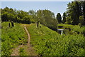
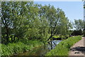
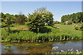
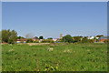
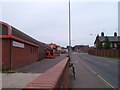
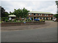
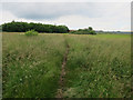
Photos of NR21 8JD


Area Information
Living in NR21 8JD offers a quiet residential experience within a compact cluster covering 1080 square metres. This specific postcode area forms a small community home to 1633 residents, creating an intimate neighbourhood scale. You will find yourself in an environment defined by proximity and stability rather than urban sprawl. The population density reaches 1,512,620 people per square kilometre according to the recorded data, which emphasises the contained nature of this residential zone. Despite the high density figure, the area maintains a distinct identity as a concentrated living space. Daily life here revolves around the immediate surroundings of the postcode boundary, where houses dominate the landscape. This setting prioritises a settled pace of life for those seeking a home in a defined, small-scale residential cluster. The area serves as a local hub for its residents, linking them to nearby towns while maintaining its own character.
- Area Type
- Postcode
- Area Size
- 1080 m²
- Population
- 1633
- Population Density
- 2150 people/km²
Homes in NR21 8JD are characterised overwhelmingly by detached or semi-detached structures, as houses constitute the primary accommodation type. The property market here shows strong owner occupation, with 52% of residents owning their homes outright or with a mortgage. This statistic indicates a traditional housing stock likely suited for families seeking permanence rather than city dwellers renting short-term lets. When looking for properties in this small residential cluster, you will find a limited but focused selection of homes designed for living rather than speculative renting. The low density of 1080 square metres reinforces the idea that this is a neighbourhood for residents who value ownership and space. Buyers here are part of a community where the housing stock supports long-term living arrangements. The market reflects a practical choice for those prioritising house ownership over the rental sector.
House Prices in NR21 8JD
Showing 8 properties
| Address | Type | Beds | Baths | Last Sale Price | Last Sale Date | |
|---|---|---|---|---|---|---|
| 6, Folly Court, Norwich Road, Fakenham, NR21 8JD | Flat | 2 | 1 | £112,250 | Dec 2022 | |
| 1, Folly Court, Norwich Road, Fakenham, NR21 8JD | Flat | - | - | £97,500 | Nov 2018 | |
| 5, Folly Court, Norwich Road, Fakenham, NR21 8JD | Flat | - | - | £119,000 | Jul 2007 | |
| 2, Folly Court, Norwich Road, Fakenham, NR21 8JD | Flat | 2 | 1 | £81,000 | Sep 2004 | |
| 3, Folly Court, Norwich Road, Fakenham, NR21 8JD | Flat | 2 | 1 | - | - | |
| 8, Folly Court, Norwich Road, Fakenham, NR21 8JD | Flat | 2 | - | - | - | |
| 4, Folly Court, Norwich Road, Fakenham, NR21 8JD | Maisonette | 2 | - | - | - | |
| 7, Folly Court, Norwich Road, Fakenham, NR21 8JD | Flat | - | - | - | - |
Energy Efficiency in NR21 8JD
Lifestyle in NR21 8JD centres on practical convenience through nearby retail outlets and transport links. Five key retail locations operate within practical reach, ensuring daily necessities are easily accessible. You can shop at Lidl Fakenham, Aldi Fakenham, and Morrisons Daily for fresh food and household goods. Car parks at these stores provide ample space for loading groceries and shopping bags. Beyond shopping, one metro station serves the area, located at Walsingham. This transport node connects residents to wider regional networks for travel to Norfolk's towns and cities. The combination of supermarkets and a metro station creates a balanced routine where work, shopping, and travel do not require long journeys. Daily life involves a walkable or short drive to these amenities, maintaining a balance between quiet living and access to services.
Amenities
Schools
Families living in NR21 8JD benefit from educational institutions rated highly by inspectors. The nearest provision includes Fakenham Infant and Nursery School, which operates as an academy. This school holds an Ofsted rating of good, ensuring a standard of education consistent with Department for Education benchmarks. They also have access to Fakenham Infant & Nursery School, providing primary education options for younger children. Having two nearby schools offers some flexibility for families depending on specific zoning requirements or catchment areas. The presence of an academy with a good rating is a positive indicator for children's educational outcomes in the NR21 8JD vicinity. You do not need to travel far for primary education, as these schools are located within practical reach of the postcode. The mix of academy and standard primary school types provides a robust set of choices for housebound children.
| Rank | School | Type | Entry gender | Ages |
|---|
Explore more schools in this area
Go to Schools tabDemographics
The community in NR21 8JD reflects a mature household profile centred on adults aged between 30 and 64 years. The median age for residents stands at 47, indicating a established population often associated with families or long-term occupants. Home ownership is significant, with 52% of the population living in owner-occupied properties. This rate suggests a stable settlement pattern rather than a transient rental market. The predominant accommodation type consists of houses, distinguishing the area from zones dominated by flats or apartments. The demographic makeup is predominantly White, aligning with wider regional patterns for this specific postcode. The absence of significant youth populations or elderly clusters points to a working-age demographic likely supporting local services. You are entering an area defined by stability, where the majority of residents have established roots in their homes.
Household Size
Accommodation Type
Tenure
Ethnic Group
Religion
Household Composition
Age
Household Deprivation
NS-SEC
Explore more demographic insights in this area
Go to Demographics tabPlanning
Planning Constraints
- Flood RiskPremium
- Ramsar Wetland SitesPremium
- Area of Outstanding Natural BeautyPremium
- Protected Nature ReservePremium
- Protected WoodlandPremium