Area Overview for NR21 8DF
Photos of NR21 8DF
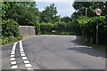
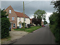
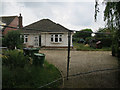
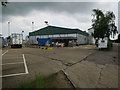
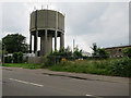
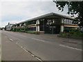


43 photos from this area
Area Information
Key information about the NR21 8DF including its size, population, and administrative classification.
- Area Type
- Postcode
- Area Size
- 1.0 hectares
- Population
- 1852
- Population Density
- 1878 people/km²
House Prices in NR21 8DF
11
Properties
£376,325
Average Sold Price
£120,000
Lowest Price
£650,000
Highest Price
Showing 11 properties
| Address | Type | Beds | Baths | Last Sale Price | Last Sale Date | |
|---|---|---|---|---|---|---|
| 33 Greenway Lane, Fakenham, NR21 8DF | house | - | - | £650,000 | Jan 2025 | |
| Windfall, Greenway Lane, Fakenham, NR21 8DF | house | - | - | £525,000 | Mar 2023 | |
| Rydale, Greenway Lane, Fakenham, NR21 8DF | house | - | - | £490,000 | Nov 2022 | |
| 45 Greenway Lane, Fakenham, NR21 8DF | house | - | - | £200,000 | Jan 2013 | |
| 43 Greenway Lane, Fakenham, NR21 8DF | Semi-detached | 3 | 2 | £272,950 | Jan 2013 | |
| 29 Greenway Lane, Fakenham, NR21 8DF | Semi-detached | - | - | £120,000 | Dec 2002 | |
| 27 Greenway Lane, Fakenham, NR21 8DF | Retail | 4 | 2 | - | - | |
| 31 Greenway Lane, Fakenham, NR21 8DF | Semi-detached | 2 | 1 | - | - | |
| 31A Greenway Lane, Fakenham, NR21 8DF | house | - | - | - | - | |
| Hawthorne, Greenway Lane, Fakenham, NR21 8DF | house | - | - | - | - |
Page 1 of 2
Energy Efficiency in NR21 8DF
Amenities
Schools
| Rank | School | Type | Entry gender | Ages |
|---|
Explore more schools in this area
Go to Schools tabDemographics
Household Size
Two person
most common
Accommodation Type
Houses
most common
Tenure
65
majority
Ethnic Group
White
most common
Religion
N/A
most common
Household Composition
N/A
most common
Age
47
median
Adults (30-64 years)
most common
Household Deprivation
N/A
with no deprivation
NS-SEC
21
in Lower managerial occupations
Explore more demographic insights in this area
Go to Demographics tabPlanning
Planning Constraints
- Flood RiskPremium
- Ramsar Wetland SitesPremium
- Area of Outstanding Natural BeautyPremium
- Protected Nature ReservePremium
- Protected WoodlandPremium