Area Overview for NR21 7JP
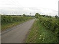
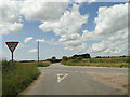
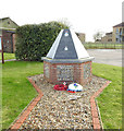
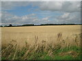
Photos of NR21 7JP
Area Information
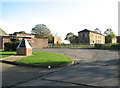
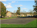
You are entering a quiet residential cluster when you look at NR21 7JP. This postcode covers a specific area of 8506 m² within Norfolk, representing a compact community of 2734 residents. The population density sits at 47 people per kilometre, which creates a distinctly uncluttered neighbourhood feel compared to denser urban environments. Living in NR21 7JP means experiencing a space where individual properties have room to breathe without the pressure of high-density living. The area functions as a tightly knit pocket of settlement rather than a sprawling district, offering residents a specific sense of locality. You find yourself in an environment defined by its small geographical footprint and stable community size. This scale often translates to quieter streets and a more manageable commute for those working within the local region. The area represents a specific slice of the Norwich postcode spread where residents know their immediate surroundings well.
- Area Type
- Postcode
- Area Size
- 8506 m²
- Population
- 2734
- Population Density
- 47 people/km²
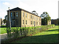
The property market in NR21 7JP is defined by stability rather than high turnover. With 67 per cent of residents owning their homes fully or through a mortgage, this is firmly an owner-occupied area. The dominant accommodation type is houses, which fits the profile of a post-code serving a residential cluster rather than a high-rise urban centre. This high ownership rate means you will see established gardens and mature trees as standard features in NR21 7JP. Most dwellings are not landlord properties, so tenant restrictions or council maintenance schedules are largely irrelevant concerns for you. The housing stock consists of houses only, according to the available data, which simplifies your search for a garden and driveway. You can expect a consistent quality of single-family residences without the mix of flats or conversions found in larger towns. This consistency makes it easy to anticipate what a typical street or cul-de-sac looks like before you move in.
House Prices in NR21 7JP
Showing 20 properties
| Address | Type | Beds | Baths | Last Sale Price | Last Sale Date | |
|---|---|---|---|---|---|---|
| 47 Oxburgh Square, West Raynham, NR21 7JP | Terraced | 2 | 1 | £171,000 | Jan 2023 | |
| 44 Oxburgh Square, West Raynham, NR21 7JP | Terraced | 2 | 1 | - | - | |
| 45 Oxburgh Square, West Raynham, NR21 7JP | Terraced | 2 | 1 | - | - | |
| 41 Oxburgh Square, West Raynham, NR21 7JP | Terraced | 2 | 1 | - | - | |
| 51 Oxburgh Square, West Raynham, NR21 7JP | Terraced | 2 | 1 | - | - | |
| 48 Oxburgh Square, West Raynham, NR21 7JP | Terraced | 2 | 1 | - | - | |
| 39 Oxburgh Square, West Raynham, NR21 7JP | Terraced | 2 | - | - | - | |
| 46 Oxburgh Square, West Raynham, NR21 7JP | Terraced | 2 | 1 | - | - | |
| 55 Oxburgh Square, West Raynham, NR21 7JP | house | - | - | - | - | |
| 42 Oxburgh Square, West Raynham, NR21 7JP | Terraced | 2 | 1 | - | - |
Energy Efficiency in NR21 7JP
Your daily routine in NR21 7JP revolves around a compact selection of retail amenities within practical reach. You have five main retail destinations nearby, including Tesco Fakenham, Waitrose Little, and Morrisons Daily. These venues provide the essentials for supermarket shopping as well as more specialised grocery needs. The presence of both a supermarket and a convenience store means you do not need to travel far for your weekly shop. Shopping trips in NR21 7JP are short and accessible, fitting well with a lifestyle that values convenience over sprawling commercial zones. While the data lists only these specific retail names, they confirm that essential services are aggregated just outside the immediate residential core. This setup supports a low-stress lifestyle where time spent travelling to shops is minimal. The local amenities are sufficient for everyday requirements without demanding frequent long-distance journeys.
Amenities
Schools
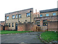
Families in NR21 7JP have multiple primary education options within their vicinity. Blenheim Park Primary School serves as a local foundation for younger children. You also have West Raynham Church of England Voluntary Aided Primary School and West Raynham Church of England Primary Academy available as alternatives. For secondary education or those seeking larger academy structures, Blenheim Park Academy sits nearby and holds a Good Ofsted rating. This rating confirms that educational standards meet the required benchmark for government inspection. The mix of Church of England schools and an academy offers a choice regarding curriculum and religious education for parents. Blenheim Park Primary School and its academy counterpart provide continuity for children moving from nursery age through to adolescence within the same catchment context. These institutions form the backbone of the local infrastructure, ensuring that families living in NR21 7JP have access to regulated and recognised educational facilities without needing to travel far afield.
| Rank | School | Type | Entry gender | Ages |
|---|
Explore more schools in this area
Go to Schools tabDemographics
The community makeup of NR21 7JP reflects a predominantly mature population structure. The median age is 47 years old, with adults aged between 30 and 64 years forming the most common age range. This demographic profile indicates a stable area where families with older children or empty nesters are key occupants. Home ownership stands at a high 67 per cent, suggesting that most people have purchased their dwellings rather than renting. The primary accommodation type consists of houses, reinforcing the suburban character of the postcode. The predominant ethnic group is White, which aligns with the broader rural and townscape demographics of the Norfolk region. At 47 years old, the typical resident is well established, likely having put down roots in this specific location for a significant period. The combination of a high ownership rate and a house-dominant stock points to an area valued for long-term stability rather than transient living.
Household Size
Accommodation Type
Tenure
Ethnic Group
Religion
Household Composition
Age
Household Deprivation
NS-SEC
Explore more demographic insights in this area
Go to Demographics tabPlanning
Planning Constraints
- Flood RiskPremium
- Ramsar Wetland SitesPremium
- Area of Outstanding Natural BeautyPremium
- Protected Nature ReservePremium
- Protected WoodlandPremium