Area Overview for NR21 0EJ
Photos of NR21 0EJ


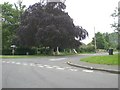

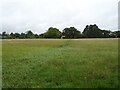
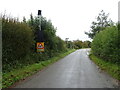

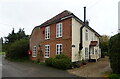
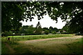
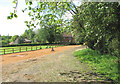
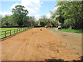
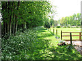
34 photos from this area
Area Information
Key information about the NR21 0EJ including its size, population, and administrative classification.
- Area Type
- Postcode
- Area Size
- 25.7 hectares
- Population
- 1073
- Population Density
- 64 people/km²
House Prices in NR21 0EJ
31
Properties
£362,675
Average Sold Price
£145,000
Lowest Price
£580,000
Highest Price
Showing 31 properties
| Address | Type | Beds | Baths | Last Sale Price | Last Sale Date | |
|---|---|---|---|---|---|---|
| Little Gables, Moor End Lane, Stibbard, NR21 0EJ | Bungalow | 2 | 1 | £363,000 | Oct 2025 | |
| The Maples, Moor End Lane, Stibbard, NR21 0EJ | Detached | 6 | 2 | £580,000 | Aug 2025 | |
| Conifers, Moor End Lane, Stibbard, NR21 0EJ | Detached | 4 | 1 | £380,000 | Jul 2025 | |
| Bluebells, Moor End Lane, Stibbard, NR21 0EJ | Chalet | 4 | 2 | £570,000 | Sep 2024 | |
| Springbank, Moor End Lane, Stibbard, NR21 0EJ | Detached | 4 | 3 | £570,000 | Jan 2023 | |
| Lagrimone, Moor End Lane, Stibbard, NR21 0EJ | Bungalow | 3 | 1 | £437,500 | Dec 2020 | |
| Oaklea, Moor End Lane, Stibbard, NR21 0EJ | house | - | - | £375,000 | Dec 2020 | |
| Flintstone Cottage, Moor End Lane, Stibbard, NR21 0EJ | Detached | 4 | - | £480,000 | Sep 2020 | |
| The Croft, Moor End Lane, Stibbard, NR21 0EJ | Detached | 4 | - | £492,500 | Mar 2020 | |
| Greenways, Moor End Lane, Stibbard, NR21 0EJ | Detached | 5 | 2 | £480,000 | May 2019 |
Page 1 of 4
Energy Efficiency in NR21 0EJ
Amenities
Schools
| Rank | School | Type | Entry gender | Ages |
|---|
Explore more schools in this area
Go to Schools tabDemographics
Household Size
Two person
most common
Accommodation Type
Houses
most common
Tenure
68
majority
Ethnic Group
White
most common
Religion
N/A
most common
Household Composition
N/A
most common
Age
47
median
Adults (30-64 years)
most common
Household Deprivation
N/A
with no deprivation
NS-SEC
32
in Lower managerial occupations
Explore more demographic insights in this area
Go to Demographics tabPlanning
Planning Constraints
- Flood RiskPremium
- Ramsar Wetland SitesPremium
- Area of Outstanding Natural BeautyPremium
- Protected Nature ReservePremium
- Protected WoodlandPremium