Area Overview for NR20 5RD
Photos of NR20 5RD

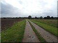
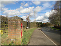
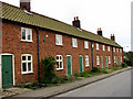
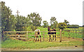

13 photos from this area
Area Information
Key information about the NR20 5RD including its size, population, and administrative classification.
- Area Type
- Postcode
- Area Size
- 4.9 hectares
- Population
- 1448
- Population Density
- 44 people/km²
House Prices in NR20 5RD
56
Properties
£244,687
Average Sold Price
£37,000
Lowest Price
£410,000
Highest Price
Showing 56 properties
| Address | Type | Beds | Baths | Last Sale Price | Last Sale Date | |
|---|---|---|---|---|---|---|
| Harbour Cottage, 48 Station Road, Foulsham, NR20 5RD | Semi-detached | 2 | 1 | £195,000 | Aug 2024 | |
| Peverell, 54 Station Road, Foulsham, NR20 5RD | house | 4 | - | £309,428 | Sep 2023 | |
| Foundry House, 45 Station Road, Foulsham, NR20 5RD | house | - | - | £395,000 | Oct 2022 | |
| 63 Station Road, Foulsham, NR20 5RD | Terraced | 4 | 2 | £290,000 | May 2022 | |
| 60 Station Road, Foulsham, NR20 5RD | Terraced | 3 | - | £190,000 | Oct 2021 | |
| The Castings, 47 Station Road, Foulsham, NR20 5RD | Detached | 3 | 1 | £222,500 | Aug 2021 | |
| 67 Station Road, Foulsham, NR20 5RD | Terraced | - | - | £273,000 | Feb 2021 | |
| Grey House, 25 Station Road, Foulsham, NR20 5RD | Terraced | 3 | 2 | £260,000 | Jan 2021 | |
| 65 Station Road, Foulsham, NR20 5RD | Terraced | 4 | 2 | £280,000 | Nov 2020 | |
| Jasmine Cottage, 59 Station Road, Foulsham, NR20 5RD | Semi-detached | 3 | 2 | £317,750 | Nov 2019 |
Page 1 of 6
Energy Efficiency in NR20 5RD
Amenities
Schools
| Rank | School | Type | Entry gender | Ages |
|---|
Explore more schools in this area
Go to Schools tabDemographics
Household Size
Two person
most common
Accommodation Type
Houses
most common
Tenure
69
majority
Ethnic Group
White
most common
Religion
N/A
most common
Household Composition
N/A
most common
Age
47
median
Adults (30-64 years)
most common
Household Deprivation
N/A
with no deprivation
NS-SEC
31
in Lower managerial occupations
Explore more demographic insights in this area
Go to Demographics tabPlanning
Planning Constraints
- Flood RiskPremium
- Ramsar Wetland SitesPremium
- Area of Outstanding Natural BeautyPremium
- Protected Nature ReservePremium
- Protected WoodlandPremium