Area Overview for NR20 5NE
Photos of NR20 5NE
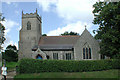
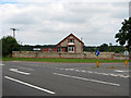
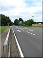
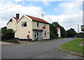

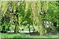
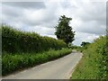
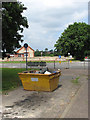
63 photos from this area
Area Information
Key information about the NR20 5NE including its size, population, and administrative classification.
- Area Type
- Postcode
- Area Size
- 5.9 hectares
- Population
- 2291
- Population Density
- 85 people/km²
House Prices in NR20 5NE
23
Properties
£206,134
Average Sold Price
£68,000
Lowest Price
£495,000
Highest Price
Showing 23 properties
| Address | Type | Beds | Baths | Last Sale Price | Last Sale Date | |
|---|---|---|---|---|---|---|
| Dandelion Cottage, 45 The Street, Bintree, NR20 5NE | Cottage | 3 | 2 | £425,000 | Dec 2024 | |
| 22 The Street, Bintree, NR20 5NE | Terraced | 3 | 1 | £253,000 | Dec 2024 | |
| 31 The Street, Bintree, NR20 5NE | house | 2 | 1 | £250,000 | Dec 2024 | |
| 29 The Street, Bintree, NR20 5NE | Terraced | 2 | 1 | £175,000 | Apr 2022 | |
| Sandstone, 33 The Street, Bintree, NR20 5NE | house | - | - | £137,500 | Oct 2019 | |
| 18 The Street, Bintree, NR20 5NE | Terraced | 2 | 1 | £151,000 | Aug 2019 | |
| 16 The Street, Bintree, NR20 5NE | Semi-detached | 3 | - | £263,000 | Aug 2016 | |
| 24 The Street, Bintree, NR20 5NE | Cottage | 2 | 1 | £150,000 | Aug 2014 | |
| 37 The Street, Bintree, NR20 5NE | Semi-detached | 3 | - | £137,650 | Nov 2013 | |
| Poplar Lodge, 47 The Street, Bintree, NR20 5NE | Detached | 5 | - | £495,000 | Jul 2010 |
Page 1 of 3
Energy Efficiency in NR20 5NE
Amenities
Schools
| Rank | School | Type | Entry gender | Ages |
|---|
Explore more schools in this area
Go to Schools tabDemographics
Household Size
Two person
most common
Accommodation Type
Houses
most common
Tenure
69
majority
Ethnic Group
White
most common
Religion
N/A
most common
Household Composition
N/A
most common
Age
47
median
Adults (30-64 years)
most common
Household Deprivation
N/A
with no deprivation
NS-SEC
35
in Lower managerial occupations
Explore more demographic insights in this area
Go to Demographics tabPlanning
Planning Constraints
- Flood RiskPremium
- Ramsar Wetland SitesPremium
- Area of Outstanding Natural BeautyPremium
- Protected Nature ReservePremium
- Protected WoodlandPremium