Area Overview for NR20 5LY
Photos of NR20 5LY
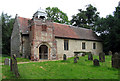
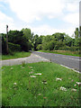
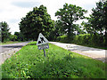
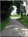
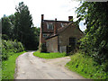
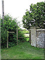
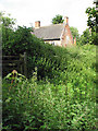
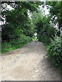
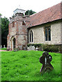
43 photos from this area
Area Information
Key information about the NR20 5LY including its size, population, and administrative classification.
- Area Type
- Postcode
- Area Size
- 1.2 km²
- Population
- 1116
- Population Density
- 35 people/km²
House Prices in NR20 5LY
12
Properties
£384,458
Average Sold Price
£94,250
Lowest Price
£1,500,000
Highest Price
Showing 12 properties
| Address | Type | Beds | Baths | Last Sale Price | Last Sale Date | |
|---|---|---|---|---|---|---|
| Waterside Cottage, Norwich Road Service Road, Twyford, NR20 5LY | house | - | - | £140,000 | Oct 2024 | |
| Twyford Hall, Norwich Road, Twyford, NR20 5LY | Detached | 8 | 6 | £1,500,000 | Feb 2020 | |
| Meadow View, Norwich Road, Twyford, NR20 5LY | Bungalow | - | - | £200,500 | Jun 2017 | |
| 3, Hall Cottages, Norwich Road Service Road, Twyford, NR20 5LY | house | 3 | 1 | £187,000 | Apr 2015 | |
| Chop Lodge Farm, Wood Norton Road, Twyford, NR20 5LY | house | 4 | 2 | £185,000 | Jul 2008 | |
| 1, Hall Cottages, Norwich Road Service Road, Twyford, NR20 5LY | house | 3 | - | £94,250 | Jun 2003 | |
| 2, Mulsanne Cottage, Hall Cottages, Norwich Road Service Road, Twyford, NR20 5LY | Terraced | 3 | 2 | - | - | |
| Caravan At Barn Conversion, Wood Norton Road, Twyford, NR20 5LY | Mobile Home | - | - | - | - | |
| Twyford Farmhouse, Norwich Road, Twyford, NR20 5LY | Detached | - | - | - | - | |
| Gate House, Norwich Road Service Road, Twyford, NR20 5LY | house | - | - | - | - |
Page 1 of 2
Energy Efficiency in NR20 5LY
Amenities
Schools
| Rank | School | Type | Entry gender | Ages |
|---|
Explore more schools in this area
Go to Schools tabDemographics
Household Size
Two person
most common
Accommodation Type
Houses
most common
Tenure
57
majority
Ethnic Group
White
most common
Religion
N/A
most common
Household Composition
N/A
most common
Age
47
median
Adults (30-64 years)
most common
Household Deprivation
N/A
with no deprivation
NS-SEC
27
in Lower managerial occupations
Explore more demographic insights in this area
Go to Demographics tabPlanning
Planning Constraints
- Flood RiskPremium
- Ramsar Wetland SitesPremium
- Area of Outstanding Natural BeautyPremium
- Protected Nature ReservePremium
- Protected WoodlandPremium