Area Overview for NR20 4RU
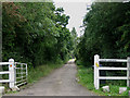
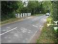
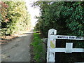
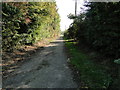
Photos of NR20 4RU
Area Information
The postcode NR20 4RU defines a compact residential cluster within a small 1.1 km² footprint. This limited geographic area supports a population of 2,468 people, creating a close-knit community where neighbours are likely to know one another by name. Living in NR20 4RU means navigating a space with high intimacy, as the population density reaches 74 people per square kilometre. The area functions primarily as a self-contained neighbourhood rather than a bustling commercial hub. Daily life here revolves around the immediate surroundings of this specific postcode sector, which serves as a distinct residential zone in the wider Norfolk region. Residents experience a quiet existence defined by the small scale of the estate. The physical boundaries of this 1.1 km² plot constrain expansion, keeping the local character consistent and manageable for those who prefer a settled environment. You will find yourself in a location where the distinction between private gardens and communal space is minimal due to the tight clustering of homes. This density ensures that essentials are never far away, yet the small size maintains a sense of seclusion. The area represents a low-impact settlement where housing and residents share a significant amount of land space. Prospective buyers entering the NR20 4RU market acquire a home in a tightly defined pocket of the village landscape. The specific nature of this postcode ensures that there is no sprawl, only a cohesive cluster of dwellings designed for local living.
- Area Type
- Postcode
- Area Size
- 1.1 km²
- Population
- 2468
- Population Density
- 74 people/km²
Homes in NR20 4RU are defined by a strong culture of private ownership. With 78% of the population living in owner-occupied dwellings, the area sells through the buying process rather than the private rental market. This high level of home ownership indicates that residents have significant equity in their properties and are less likely to move frequently. The predominant accommodation type is houses, which shapes the housing stock away from apartments or terraced flats. This focus on detached or semi-detached properties creates a market where buyers seek privacy and garden space within the 1.1 km² boundary. For those looking at the NR20 4RU property market, expect a selection of residential clusters rather than conversion projects or new-build developments. The concentration of houses suggests a historic development pattern, where the architecture likely reflects the era in which the area was established. You will compete with other long-term owners who value the stability of their current homes. This market dynamic means that price reductions on the open market may be less common than in high-turnover rental areas. The specific nature of the postcode ensures that the housing inventory is curated for families and retirees rather than transient tenants. Buying a home here secures a stake in a community that prioritises tenure over tenancy. The local real estate environment reflects this stability, with fewer short-term rental listings disrupting the neighbourhood character. Your search for homes in NR20 4RU will focus on specific property types that suit the established residential pattern.
House Prices in NR20 4RU
Showing 45 properties
| Address | Type | Beds | Baths | Last Sale Price | Last Sale Date | |
|---|---|---|---|---|---|---|
| 8 Reepham Road, Bawdeswell, NR20 4RU | Semi-detached | 3 | 2 | £295,000 | May 2025 | |
| 25 Reepham Road, Bawdeswell, NR20 4RU | Semi-detached | 3 | 2 | £300,000 | Jan 2025 | |
| 33 Reepham Road, Bawdeswell, NR20 4RU | Cottage | 4 | 1 | £375,000 | May 2024 | |
| 19 Reepham Road, Bawdeswell, NR20 4RU | Semi-detached | 2 | 1 | £226,500 | Sep 2022 | |
| Breeze Barns 18, Reepham Road, Bawdeswell, NR20 4RU | Semi-detached | - | - | £880,000 | Sep 2022 | |
| 11 Reepham Road, Bawdeswell, NR20 4RU | Terraced | 2 | 1 | £210,000 | May 2022 | |
| 6 Reepham Road, Bawdeswell, NR20 4RU | Semi-detached | 3 | - | £285,000 | Mar 2022 | |
| Le Ruthom House, 36 Reepham Road, Bawdeswell, NR20 4RU | Detached | 3 | 2 | £305,000 | Jul 2021 | |
| Mulberry Lodge, 5 Reepham Road, Bawdeswell, NR20 4RU | house | 5 | - | £482,500 | Jun 2021 | |
| Colgresco, 2 Reepham Road, Bawdeswell, NR20 4RU | Detached | 3 | 1 | £331,000 | Jan 2021 |
Energy Efficiency in NR20 4RU
Daily life for residents of NR20 4RU involves a short walk to essential retail services located within the immediate postcode area. You can visit Morrisons Daily, Spar, or Co-op Reepham for groceries and everyday necessities without travelling far. These four nearby retail venues ensure that your weekly shopping is convenient and does not require a longer commute. The proximity of these shops means you can run errands quickly while the area remains quiet. This concentration of amenities supports a self-sufficient lifestyle where most daily needs are met locally. You will find that the NR20 4RU cluster offers practical simplicity, with no long journeys required for basic goods. The presence of multiple cooperative and chain stores reflects a standard village high street model adapted to this small footprint. Your evening routine might involve returning to your home after a quick stop at one of these local retailers. The layout of the area facilitates easy access to these shops, maintaining the residential character while ensuring convenience. There are no large entertainment venues listed, so your leisure activities will likely revolve around the local shops and home. This modest but functional amenity profile aligns with the area's demographic and geographic constraints. Living in NR20 4RU means you trade broad entertainment options for uncomplicated access to essential goods. The retail selection is sufficient for daily living but does not cater to major leisure events.
Amenities
Schools
Parents living in NR20 4RU are supported by a selective group of nearby educational institutions. Bawdeswell Community Primary School operates within the catchment, holding a good Ofsted rating. Lyng Church of England Primary School serves as another option for younger children in the immediate vicinity. Lyng Church of England Primary Academy is also located nearby, offering an alternative educational path. The Tutorial Centre is present in the area, though its specific educational function may vary compared to state-funded primary institutions. This mix of primary schools and a tutorial centre means that most school-age children receive their early education locally. The presence of Bawdeswell Community Primary School with a good rating provides reassurance for families prioritising academic standards. You do not need to look far beyond NR20 4RU to find schooling options, as these institutions are situated within practical reach of the postcode. The density of schools suggests a developing cluster of educational provision in this sector of Norfolk. Families with children will find the selection adequate for early years education without needing to commute further afield. The variety of school types ensures that neighbouring NR20 4RU can cater to different educational preferences available in the local cluster. This arrangement supports a family-friendly environment where schooling is integrated into the daily rhythm of the area.
| Rank | School | Type | Entry gender | Ages |
|---|
Explore more schools in this area
Go to Schools tabDemographics
The community within NR20 4RU presents a mature population profile, with a median age of 47 years. Adults between the ages of 30 and 64 form the most common age range, suggesting the area attracts families and those approaching retirement. You will find that 78% of residents own their homes, indicating a stable, long-term community with deep roots in the locality. The predominant accommodation type consists of houses, meaning you are unlikely to find high-rise flats or terraced rows in this specific postcode. This focus on house ownership aligns with the demographic shift towards older, more established households. The ethnic composition is predominantly white, reflecting the broader regional trends of this part of Norfolk. You can expect a traditional local community where the people have likely lived in their homes for many years. The high home ownership rate of 78% reduces the number of rental properties available, making purchase opportunities key to securing a home here. Children in the area typically attend local institutions, supporting a family-oriented atmosphere. The absence of young households under 30 suggests this is not a student or young professional area. Instead, the population structure supports a quiet, established lifestyle where neighbours rely on one another for local support. The 74 people per square kilometre density provides a residential experience that feels spacious despite the small total area. This demographic stability means the community atmosphere remains consistent throughout the year.
Household Size
Accommodation Type
Tenure
Ethnic Group
Religion
Household Composition
Age
Household Deprivation
NS-SEC
Explore more demographic insights in this area
Go to Demographics tabPlanning
Planning Constraints
- Flood RiskPremium
- Ramsar Wetland SitesPremium
- Area of Outstanding Natural BeautyPremium
- Protected Nature ReservePremium
- Protected WoodlandPremium