Area Overview for NR20 4NJ
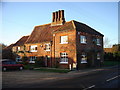
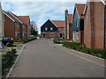
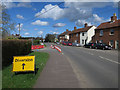
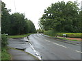
Photos of NR20 4NJ


Area Information
NR20 4NJ stands as a compact residential cluster spanning just 2.8 hectares within England. This specific postcode serves a defined population of 1,608 residents, creating a tight-knit community rather than a sprawling suburb. Living in this area means navigating a village-like environment where your neighbours are likely to become friends quickly. The density averages 103 people per square kilometre, indicating a low intensity of development that preserves a sense of space for each household. You move here for the quiet solitude and the scale of the settlement itself. It is not a bustling town centre but a functional living space designed for families and homeowners seeking stability away from larger urban centres. The geography supports a lifestyle focused on proximity to home, with daily needs met through careful planning rather than immediate local abundance. When you consider buying a home here, you are entering an established community where living in NR20 4NJ offers a predictable rhythm to daily life.
- Area Type
- Postcode
- Area Size
- 2.8 hectares
- Population
- 1608
- Population Density
- 103 people/km²
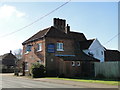
The housing market in NR20 4NJ is characterised by a heavy concentration of owner-occupied stock. With 82 per cent of households owning their homes, the area represents a retiree and family stronghold rather than a rental hotspot. This statistic distinguishes the postcode from many urban locations where private renting drives turnover. The accommodation type is uniformly houses, eliminating the variety found in estates with mixed flats and terraced homes. You will not find purpose-built multi-unit developments here; instead, the stock likely comprises detached or semi-detached properties suited to the 30 to 64-year-old demographic. The small area size of 2.8 hectares limits the total number of listings available at any one time. For buyers seeking homes in NR20 4NJ, availability may be intermittent compared to larger towns. The market reflects long-term residency, where properties tend to stay with the same families for generations. This stability means fewer short-term sales but potentially less inventory for those looking to move quickly.
House Prices in NR20 4NJ
Showing 11 properties
| Address | Type | Beds | Baths | Last Sale Price | Last Sale Date | |
|---|---|---|---|---|---|---|
| 3 Harris Road, Swanton Morley, NR20 4NJ | Detached | 3 | 1 | £290,000 | Dec 2023 | |
| 4 Harris Road, Swanton Morley, NR20 4NJ | Bungalow | 2 | 1 | £390,000 | Feb 2022 | |
| 9 Harris Road, Swanton Morley, NR20 4NJ | Semi-detached | 3 | 1 | £189,000 | Feb 2020 | |
| 7 Harris Road, Swanton Morley, NR20 4NJ | house | - | - | £245,000 | Nov 2019 | |
| 5 Harris Road, Swanton Morley, NR20 4NJ | Detached | 3 | - | £172,000 | Jun 2014 | |
| 13 Harris Road, Swanton Morley, NR20 4NJ | Detached | 3 | - | £165,000 | May 2013 | |
| 6 Harris Road, Swanton Morley, NR20 4NJ | Detached | - | - | £91,500 | Feb 1998 | |
| 17 Harris Road, Swanton Morley, NR20 4NJ | Detached | - | - | - | - | |
| 15 Harris Road, Swanton Morley, NR20 4NJ | Detached | - | - | - | - | |
| 2 Harris Road, Swanton Morley, NR20 4NJ | Detached | - | - | - | - |
Energy Efficiency in NR20 4NJ
Daily life in NR20 4NJ revolves around practical amenities located within a short drive. The nearest major metro point is Dereham, which serves as the primary hub for wider services and travel. For groceries, you have access to five retail outlets noted in the surrounding area. Specific venues include Iceland East, Co-op East, and Morrisons Scarning. These supermarkets provide full-fat grocery shopping without requiring a lengthy journey. Living in NR20 4NJ means your weekly shop is accessible quickly via the nearby retail parks. You do not need a shop on your doorstep, but the distance is not prohibitive given the area's low density. There are no listed leisure facilities, parks, or restaurants within this specific data set. Your lifestyle needs beyond basics rely on the reach of Dereham and the cluster of supermarkets. This setup suits residents who prioritise cost-effective shopping and quiet domestic life over immediate access to cafes or cinemas. Convenience centres are nearby, but they define the boundary of local lifestyle.
Amenities
Schools
Families living in NR20 4NJ have access to specific educational facilities within practical reach. The nearest primary education option is Swanton Morley VC Primary School, which holds a good Ofsted rating. This single named institution serves the local community for younger children. There are no secondary schools listed in the immediate vicinity of this postcode. This configuration implies that families with older children may commute to secondary schools outside the immediate area. The concentration on one primary school suggests a streamlined local offering rather than a diverse educational landscape. Living in NR20 4NJ with school-age children means planning for transport to Swanton Morley VC Primary School for early years. You must look beyond this postcode for secondary or specialised provision. The good rating provides assurance on the quality of early education available. However, the lack of multi-variant options limits choice for those seeking specialised curricula or alternative school types without traveling further afield.
| Rank | School | Type | Entry gender | Ages |
|---|
Explore more schools in this area
Go to Schools tabDemographics
The community within NR20 4NJ reflects a mature demographic profile dominated by adults between the ages of 30 and 64 years. The median age sits at 47 years, confirming that this is an area populated by settled households rather than transient young professionals. Home ownership remains the prevailing mode of tenure, with 82 per cent of residents owning their homes outright or with a mortgage. This high figure defines the social fabric, suggesting a population invested in building equity and stability within the postcode. Accommodation types consist almost exclusively of houses, aligning with the age profile and ownership statistics. The predominant ethnic group is White, mirroring the broader national trends for this region of England. Living in NR20 4NJ places you among a peer group likely to share similar life stages and financial commitments. You are less likely to encounter high levels of student renting or transient populations. The diversity is currently low, meaning the social dynamics are understated and familiar.
Household Size
Accommodation Type
Tenure
Ethnic Group
Religion
Household Composition
Age
Household Deprivation
NS-SEC
Explore more demographic insights in this area
Go to Demographics tabPlanning
Planning Constraints
- Flood RiskPremium
- Ramsar Wetland SitesPremium
- Area of Outstanding Natural BeautyPremium
- Protected Nature ReservePremium
- Protected WoodlandPremium