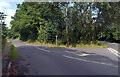
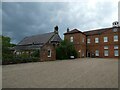
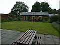
Area Overview for NR20 4HB
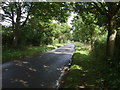
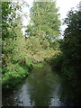
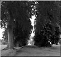
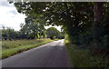
Photos of NR20 4HB

Area Information
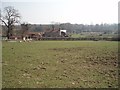
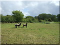
Living in NR20 4HB offers a quiet residential experience within a compact cluster just under three hectares in size. The area holds a population of 2,291 residents, creating a close-knit environment where the closely packed homes reflect a traditional neighbourhood feel. You will find yourself in a setting defined by low population density, with only 85 people per square kilometre. This spacious distribution suggests a lifestyle away from the noise and congestion of larger towns, prioritising peace and green space over urban density. The postcode serves as a specific entry point into this small, self-contained community in Norfolk. Daily life here revolves around a slower pace, driven by the limited number of neighbours and the surrounding countryside. While the area is small, it offers the stability of established housing rather than the uncertainty of new developments. Residents enjoy a sense of privacy and community that larger developments often struggle to sustain. The physical boundaries of the postcode ensure that interactions within the immediate street network remain intimate. This layout supports a lifestyle where local streets become social hubs rather than mere thoroughfares. Buyers considering this specific cluster should appreciate how the limited footprint fosters a distinct quietude compared to broader urban or semi-urban zones. The demographic profile further supports a settled atmosphere, as most inhabitants fall into a stable adult working age bracket. This balance between space, population, and age underpins the character of NR20 4HB.
- Area Type
- Postcode
- Area Size
- 2.8 hectares
- Population
- 2291
- Population Density
- 85 people/km²
The property market in NR20 4HB is defined by its strong owner-occupier base, with 69% of homes owned outright or with a mortgage. This statistic indicates that the area is not a hotspot for short-term letting or student housing. Instead, the housing stock consists predominantly of houses, aligning with the needs of families and older couples. The postcode represents a small residential cluster, meaning supply is limited compared to larger towns. Buyers looking at this area should expect a competitive market driven by local demand rather than investment speculation. The high ownership rate suggests sellers are likely long-term residents who may hold onto their properties for extended periods. This can result in fewer property changes and a more established local character. If you are looking to move into NR20 4HB, you are entering a market where stability outweighs rapid turnover. The absence of multi-unit buildings or large apartment blocks means traditional family homes dominate the landscape. ThisMarket appeal lies in the security of tenure and the retention of property values within a stable community structure. Buyers often value this predictability in a climate where wider housing markets can fluctuate wildly. The nature of the housing stock also simplifies maintenance expectations compared to flats or converted properties.
House Prices in NR20 4HB
Showing 2 properties
| Address | Type | Beds | Baths | Last Sale Price | Last Sale Date | |
|---|---|---|---|---|---|---|
| Gorgate Cottage, Gorgate Drive, Hoe, NR20 4HB | Semi-detached | - | - | £175,000 | Jan 2004 | |
| Greencroft, Gorgate Drive, Hoe, NR20 4HB | Semi-detached | - | - | £75,000 | Nov 2000 |
Energy Efficiency in NR20 4HB
Your daily life in NR20 4HB relies heavily on a select number of nearby amenities due to the small scale of the area. Within practical reach, you have access to five retail outlets including the East of England Co-operative Co and the Co-op East. These supermarkets form the backbone of your local shopping needs, offering essentials without the need to travel far. You can also stop at Iceland East for groceries, ensuring fresh food access is no more than a short drive away. Transport links are similarly limited but functional, with one metro station available at Dereham. This single station provides the primary rail connection for those needing to commute or travel beyond the immediate locality. While the choice of venues is modest, the proximity reduces reliance on long-distance travel for daily necessities. The character here is one of convenience within a small radius rather than abundance. You will find yourself catering to your needs with what is immediately to hand in East of England. This setup suits those who prefer a car-dependent lifestyle or those content with a short walk to the nearest shop. The specific presence of these co-operative stores and ice cream shops adds a traditional local flavour to the scene.
Amenities
Schools
| Rank | School | Type | Entry gender | Ages |
|---|
Explore more schools in this area
Go to Schools tabDemographics
The community in NR20 4HB is characterised by an older demographic, with a median age of 47 years. Most residents fall into the adult age range between 30 and 64 years, indicating a population actively engaged in their careers and family lives. Home ownership stands at a high level of 69%, suggesting a stable, long-term community rather than a transient rental market. The predominant accommodation type consists of houses, which reinforces the family-oriented nature of the neighbourhood. Diversity in the area is primarily White, reflecting the common demographic patterns found across many English rural locales. This homogeneity often contributes to a cohesive social fabric where neighbours know each other well. The high rate of ownership correlates with the mature age profile, as families often buy into such areas as their primary homes. Social isolation is less of a concern for younger residents, as the area draws people seeking stability. The lack of significant youth or elderly skew beyond the median age point suggests a balanced social dynamic. You can expect a neighbourhood where families have put down roots for the long term. This stability is attractive to those seeking a predictable environment free from the volatility of student housing or high-turnover districts.
Household Size
Accommodation Type
Tenure
Ethnic Group
Religion
Household Composition
Age
Household Deprivation
NS-SEC
Explore more demographic insights in this area
Go to Demographics tabPlanning
Planning Constraints
- Flood RiskPremium
- Ramsar Wetland SitesPremium
- Area of Outstanding Natural BeautyPremium
- Protected Nature ReservePremium
- Protected WoodlandPremium