Area Overview for NR20 4FU
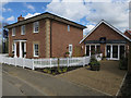
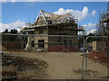
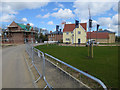
Photos of NR20 4FU

Area Information
Living in NR20 4FU means inhabiting a specific postcode area that covers a small residential cluster of just under half a hectare. The site spans 3649 square metres, providing a compact footprint for a population of 1608. This density places the area at 103 people per square kilometre, creating a settled environment rather than an expansionist one. You will find homes concentrated in a defined zone where neighbours are likely to know one another personally due to the limited geographical spread. The area functions as a distinct residential island within the wider NR20 postal region, offering a sense of containment that many buyers value. Daily life here revolves around this tight-knit setting, where the boundaries between streets are clearly marked by the postcode itself. Prospective buyers should understand that living in this specific cluster means accessing local services from a centralised point. The small physical size dictates proximity to nearby towns, meaning your daily commute relies heavily on connections to the surrounding infrastructure. You do not live in a sprawling suburb; you live in a focused residential pocket where every road leads directly into the cluster. This definition of a small residential cluster shapes the entire character of the neighbourhood.
- Area Type
- Postcode
- Area Size
- 3649 m²
- Population
- 1608
- Population Density
- 103 people/km²
The property market in NR20 4FU is characterised by a strong leaning towards ownership. With 82% of residents being homeowners, the area functions primarily as an owner-occupied market rather than a rental zone. This high level of home ownership suggests that when properties become available, they are often the result of life-cycle moves rather than landlord turnovers. Accommodation types are exclusively Houses, meaning buyers can expect traditional standalone or semi-detached properties rather than flats or converted units. This homogeneity in building type often results in consistent pricing trends and a market where property values are influenced more by house condition and local positioning than by architectural variety. If you are looking at this small area and its immediate surroundings, you will find a stock designed for family living or retirement. The lack of rental pressure means less frequent turnover, which can lead to a slower-paced market. Buyers seeking investment through tenant turnover may find limited opportunities here. Instead, the market rewards those looking for a stable environment where they can secure a permanent home. The dominance of Houses as the primary accommodation type ensures that lenders and insurers will view these properties with familiar criteria.
House Prices in NR20 4FU
Showing 3 properties
| Address | Type | Beds | Baths | Last Sale Price | Last Sale Date | |
|---|---|---|---|---|---|---|
| 4 Dennis Close, Swanton Morley, NR20 4FU | Detached | 4 | 4 | £535,000 | Jan 2025 | |
| 6 Dennis Close, Swanton Morley, NR20 4FU | house | - | - | £249,995 | Dec 2015 | |
| 2 Dennis Close, Swanton Morley, NR20 4FU | house | - | - | £314,995 | Dec 2015 |
Energy Efficiency in NR20 4FU
Your lifestyle in NR20 4FU is shaped by specific amenities located within practical reach. For shoppers, there are five nearby retail options, including Morrisons Daily, Iceland East, and Co-op East. These three named venues provide essential goods, groceries, and daily necessities without requiring a long journey. If you value freshness or convenience, having Morrisons Daily and Iceland East nearby supports a routine of regular local shopping. Beyond retail, transport for longer trips is supported by one metro link to Dereham. This station serves as the gateway for critical travel, connecting residents to the wider network of buses and trains. While there are no parks or leisure facilities listed in the immediate data, the proximity of Dereham suggests access to broader regional entertainment and leisure. The character of daily life is utilitarian and efficient, anchored by the practical reach of these five retail units. You do not need to drive far for basics like food and soft groceries. The presence of Co-op East alongside the other two stores creates a mini-shopping district. This configuration supports a self-sufficient routine where you can handle most errands within a short drive. The amenities listed are functional rather than luxury, aligning with the practical needs of the local community.
Amenities
Schools
Families in NR20 4FU have access to educational facilities that meet national standards. The nearest school option is Swanton Morley VC Primary School, which serves as the main educational provision for young children in the vicinity. This institution holds an Ofsted rating of good, validating its educational quality. Currently, the data lists only a primary school, indicating that the immediate vicinity of NR20 4FU may rely on this single provider for early education. For households with older children, you would need to look beyond the immediate cluster for secondary options, though this specific dataset does not name them. The presence of a primary school with a good rating offers reassurance for parents moving into this postcode. Swanton Morley VC Primary School is a named, verified entity that residents can engage with directly. While the area lacks a secondary school within the immediate listed data, the primary provision is solid. When considering where to live, you must factor in the travel time to any missing secondary options if your children are already in later years. The school data provided confirms a single point of reference for primary education near this area.
| Rank | School | Type | Entry gender | Ages |
|---|
Explore more schools in this area
Go to Schools tabDemographics
The community in NR20 4FU is defined by a mature demographic profile with a median age of 47. Adults between 30 and 64 years old represent the most common age range, indicating a family-oriented or early-retirement population. This age group dominates the housing stock, suggesting stability and long-term residence rather than transient mobility. Home ownership is exceptionally high at 82%, meaning the vast majority of residents own their properties outright or with a mortgage, rather than renting. This metric points to an area where people stay put, invest in improvements, and build deep local roots. The predominant ethnic group is White, reflecting the traditional character of the region. Accommodation types consist primarily of Houses, reinforcing the suburban or semi-rural feel rather than urban terrace living. You are unlikely to find purpose-built high-density apartments in this location. The combination of high ownership rates and a predominantly owner-occupied stock creates a neighbourhood where residents have a tangible stake in the area's maintenance and values. Eighty-two percent ownership is a significant figure that signals financial stability and community engagement among the population you will encounter.
Household Size
Accommodation Type
Tenure
Ethnic Group
Religion
Household Composition
Age
Household Deprivation
NS-SEC
Explore more demographic insights in this area
Go to Demographics tabPlanning
Planning Constraints
- Flood RiskPremium
- Ramsar Wetland SitesPremium
- Area of Outstanding Natural BeautyPremium
- Protected Nature ReservePremium
- Protected WoodlandPremium