Area Overview for NR20 4EG
Photos of NR20 4EG
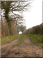
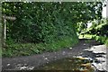
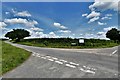
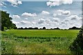
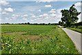
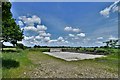
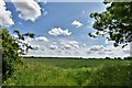
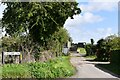
8 photos from this area
Area Information
Key information about the NR20 4EG including its size, population, and administrative classification.
- Area Type
- Postcode
- Area Size
- 1.2 km²
- Population
- 1711
- Population Density
- 148 people/km²
House Prices in NR20 4EG
20
Properties
£315,417
Average Sold Price
£110,000
Lowest Price
£585,000
Highest Price
Showing 20 properties
| Address | Type | Beds | Baths | Last Sale Price | Last Sale Date | |
|---|---|---|---|---|---|---|
| 24 Bilney Road, Gressenhall, NR20 4EG | Bungalow | 4 | 2 | £550,000 | Oct 2025 | |
| 16 Bilney Road, Gressenhall, NR20 4EG | Bungalow | 2 | 2 | £300,000 | Jun 2025 | |
| 8 Bilney Road, Gressenhall, NR20 4EG | house | - | - | £585,000 | Aug 2021 | |
| 28 Bilney Road, Gressenhall, NR20 4EG | Detached | 4 | 2 | £470,000 | Aug 2019 | |
| 6 Bilney Road, Gressenhall, NR20 4EG | house | - | - | £290,000 | Jul 2017 | |
| Primrose Cottage, 2A Bilney Road, Gressenhall, NR20 4EG | Detached | 3 | 2 | £220,000 | Sep 2015 | |
| 18 Bilney Road, Gressenhall, NR20 4EG | Bungalow | 3 | - | £237,500 | Jun 2014 | |
| Sherwood, 26 Bilney Road, Gressenhall, NR20 4EG | Bungalow | - | - | £250,000 | Apr 2014 | |
| 22 Bilney Road, Gressenhall, NR20 4EG | Bungalow | - | - | £360,000 | Jan 2008 | |
| Country Life, 26A Bilney Road, Gressenhall, NR20 4EG | Detached | - | - | £249,500 | Nov 2005 |
Page 1 of 2
Energy Efficiency in NR20 4EG
Amenities
Schools
| Rank | School | Type | Entry gender | Ages |
|---|
Explore more schools in this area
Go to Schools tabDemographics
Household Size
Two person
most common
Accommodation Type
Houses
most common
Tenure
74
majority
Ethnic Group
White
most common
Religion
N/A
most common
Household Composition
N/A
most common
Age
47
median
Adults (30-64 years)
most common
Household Deprivation
N/A
with no deprivation
NS-SEC
33
in Lower managerial occupations
Explore more demographic insights in this area
Go to Demographics tabPlanning
Planning Constraints
- Flood RiskPremium
- Ramsar Wetland SitesPremium
- Area of Outstanding Natural BeautyPremium
- Protected Nature ReservePremium
- Protected WoodlandPremium