Area Overview for NR20 4DT
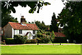
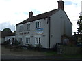
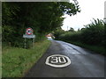
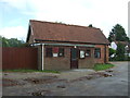
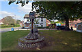
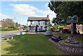
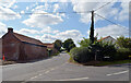
Photos of NR20 4DT

Area Information
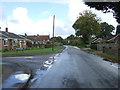
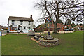
Living in NR20 4DT offers a quiet residential experience within a compact cluster covering 19.2 hectares. This specific postcode area houses 1,711 people, creating a close-knit environment where neighbours are likely to know each other. The low population density of 148 people per square kilometre ensures ample space around your home without the noise of high-rise blocks or heavy traffic. You will find this area characterised primarily by detached and semi-detached houses rather than flats or high-density housing. The community feels established and stable, with no indication of rapid change or transient populations. Daily life here involves a mix of green spaces and local infrastructure designed for a smaller population. While the area may not offer the amenities of a large town centre, its scale means services are accessible without long commutes. Residents enjoy a sense of community that larger cities struggle to replicate. The layout supports a slower pace of life, ideal for those prioritising space and tranquillity over urban bustle. This postcode serves as a self-contained community where the balance between housing and open land supports a relaxed domestic routine.
- Area Type
- Postcode
- Area Size
- 19.2 hectares
- Population
- 1711
- Population Density
- 148 people/km²
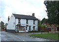
The property market in NR20 4DT is defined by a strong tradition of owner occupation. With 74 percent of residents owning their homes, the local housing stock is likely dominated by owner-occupied properties rather than student rentals or social housing. This dynamic usually results in a community where owners look out for their street's upkeep and property values tend to reflect long-term holding periods rather than rapid turnover. The accommodation type is exclusively houses, meaning you will not encounter flats or maisonettes within this specific postcode cluster. If you are looking to move to NR20 4DT, you should expect to choose from a range of detached, semi-detached, or terraced houses typical of the region. This homogeneity in housing style simplifies the buying process for those seeking a specific home type. The area does not cater to renters, as the low rental stock correlates with the high home ownership figure. Buyers looking for a family home in a quiet setting will find the inventory here matches that requirement.
House Prices in NR20 4DT
Showing 43 properties
| Address | Type | Beds | Baths | Last Sale Price | Last Sale Date | |
|---|---|---|---|---|---|---|
| York Cottage, The Green, Gressenhall, NR20 4DT | house | 3 | 1 | £395,000 | Jun 2023 | |
| Trevia, The Green, Gressenhall, NR20 4DT | house | - | - | £425,000 | Aug 2022 | |
| Chilterns End, The Green, Gressenhall, NR20 4DT | Bungalow | 4 | 2 | £455,000 | Feb 2022 | |
| Peartree Cottage, The Green, Gressenhall, NR20 4DT | Retail | 2 | 2 | £452,500 | Feb 2022 | |
| Woodstock Care Home Limited, The Green, Gressenhall, NR20 4DT | hospital_care_home | - | - | £2,230,000 | Oct 2021 | |
| Gartree Cottage, The Green, Gressenhall, NR20 4DT | Cottage | 4 | - | £430,000 | Mar 2019 | |
| Kisakura, Bridge Street, Gressenhall, NR20 4DT | Bungalow | - | - | £315,000 | Nov 2016 | |
| Anwima, The Green, Gressenhall, NR20 4DT | Bungalow | 3 | - | £260,000 | Jul 2016 | |
| Hobbits House, The Green, Gressenhall, NR20 4DT | house | - | - | £297,500 | Sep 2012 | |
| The Whare, The Green, Gressenhall, NR20 4DT | Detached | - | - | £240,000 | Jul 2011 |
Energy Efficiency in NR20 4DT
Residents of NR20 4DT enjoy convenient access to essential retail and transport hubs within a practical driving distance. Five major retail options operate nearby, including the East of England Co-operative Co, Co-op East, and Iceland East. These supermarkets and shops provide everything you need for weekly grocery shopping and household essentials without requiring a trip to a distant town centre. Transport links are supported by one metro station situated in Dereham. This station offers a connection beyond the local area, allowing residents to travel to Norwich or other connected cities for work or leisure. The combination of local high-street convenience and regional rail access makes NR20 4DT a viable location for those who do not wish to live entirely off the grid. You can run errands locally and use the Dereham station to expand your day trips or commute reach. This blend of local retail and regional transport ensures daily life remains simple and efficient.
Amenities
Schools
Families living in NR20 4DT have access to excellent primary education options nearby. Scarning Voluntary Controlled Primary School sits close to the postcode and holds a Good Ofsted rating. This designation confirms the school meets the standards set by the Department for Education. The presence of a single named primary school in the immediate vicinity suggests that most children in NR20 4DT attend this specific institution for their early education. While secondary school data is not listed in the immediate proximity records, the current setup indicates a strong foundation for young children before they transfer to broader local schools. The voluntary controlled status of Scarning implies governance that balances community input with state education standards. For parents in this area, having a Good-rated primary school on their doorstep simplifies the early school run and provides reassurance about their child's initial schooling. The school count and ratings available confirm a solid educational provision for the early years in this quiet neighbourhood.
| Rank | School | Type | Entry gender | Ages |
|---|
Explore more schools in this area
Go to Schools tabDemographics
The community in NR20 4DT displays a mature demographic profile with a median age of 47 years. The majority of residents fall into the adult age range between 30 and 64 years, meaning you will find families with school-age children alongside retired couples and people approaching retirement age. This age distribution suggests a stable neighbourhood where long-term residents often raise children and then settle into retirement within the same locality. Home ownership stands at 74 percent, indicating that most people have bought their own homes rather than renting. This high rate of ownership typically correlates with greater community investment and stability. The accommodation type is predominantly houses, aligning with the homeowner rate and the area's design. You are unlikely to find purpose-built estates or student housing in this cluster. The predominant ethnic group is White, reflecting the traditional settlement patterns of the Norfolk countryside. These figures paint a picture of an established, owner-occupied community where families form the core of the social fabric.
Household Size
Accommodation Type
Tenure
Ethnic Group
Religion
Household Composition
Age
Household Deprivation
NS-SEC
Explore more demographic insights in this area
Go to Demographics tabPlanning
Planning Constraints
- Flood RiskPremium
- Ramsar Wetland SitesPremium
- Area of Outstanding Natural BeautyPremium
- Protected Nature ReservePremium
- Protected WoodlandPremium