Area Overview for NR20 3UF
Photos of NR20 3UF
Area Information
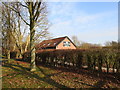
Living in NR20 3UF offers a specific residential experience focused on a tightly clustered neighbourhood rather than a sprawling district. This postcode covers just 5,861 square metres, indicating a dense and contained living environment. The population stands at 2,320 people, which creates a sizeable community within a very small geographic footprint. Residents experience a high degree of proximity to one another, as the area supports 2139 people per square kilometre. This density shapes daily life by placing neighbours in close physical reach. The setting is defined by its urban nature within the East of England, specifically serving the Dereham region. Unlike open rural expanses, this cluster prioritises efficiency and compact living. You should consider the scale of the area when imagining your routine; local services operate within this concentrated zone. The small area size means everything from shops to transport links is likely within short walking distances. This postcode serves as a distinct residential hub where the community interacts frequently due to limited space. Understanding the scale of NR20 3UF is the first step in evaluating if this specific cluster fits your lifestyle requirements. The compact nature defines the entire character of living here.
- Area Type
- Postcode
- Area Size
- 5861 m²
- Population
- 2320
- Population Density
- 2139 people/km²
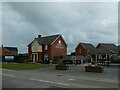
Homes in NR20 3UF are primarily defined by their structure and ownership status, creating a distinct market environment. The local housing stock consists mainly of houses, meaning you will not find rows of flats or modern apartment complexes typical of larger urban centres. This accommodation type suits those seeking traditional living spaces with gardens or private outdoor areas. Ownership rates stand at 43%, indicating that slightly fewer than half of the residents own their homes outright or with a mortgage. This figure suggests a substantial rental sector, likely attracting professionals or those seeking flexibility in this postcode area. The small area size of 5,861 square metres constrains the total number of properties available for purchase or rent. Consequently, the market for homes in this specific cluster is tight and competitive. Buyers looking into NR20 3UF should anticipate a premium on location due to the limited supply. The dominance of houses over other dwelling types defines the architectural character of the zone. If you prefer a house with space, this area delivers that specific product. However, the low volume of properties means choices will be limited compared to broader districts. The 43% ownership statistic highlights the mixed nature of the tenure landscape here.
House Prices in NR20 3UF
Showing 4 properties
| Address | Type | Beds | Baths | Last Sale Price | Last Sale Date | |
|---|---|---|---|---|---|---|
| 4 Clifftonville Drive, Dereham, NR20 3UF | house | - | - | £250,000 | May 2024 | |
| 8 Clifftonville Drive, Dereham, NR20 3UF | house | - | - | £291,000 | Apr 2024 | |
| 6 Clifftonville Drive, Dereham, NR20 3UF | house | - | - | £243,000 | Mar 2024 | |
| 2 Clifftonville Drive, Dereham, NR20 3UF | house | - | - | - | - |
Energy Efficiency in NR20 3UF
Daily life in NR20 3UF centres on convenient access to essential retail and transport hubs nearby. Residents can visit the nearby town of Dereham for major retail and commuter links. Specific shopping options include Tesco Dereham, Lidl Toftwood, and Aldi Toftwood, all located within practical reach of the cluster. These supermarkets provide a wide range of groceries and household essentials without requiring long journeys. The postcode offers five notable retail locations nearby, ensuring variety in your weekly shop. Transport connectivity is supported by one primary railway station in Dereham, facilitating commutes to broader East of England destinations. You do not need to travel far to access food, fresh produce, or daily necessities. The presence of multiple major supermarkets means you can choose between Lidl, Aldi, or Tesco depending on your preferences. This proximity to Toftwood and Dereham amenities removes the need for a car for routine errands. Shopping trips can be managed with ease from your home in NR20 3UF. The network of local stores supports a self-sufficient lifestyle where most needs are met quickly. Your neighbours will familiarise themselves with using these local facilities regularly.
Amenities
Schools
| Rank | School | Type | Entry gender | Ages |
|---|
Explore more schools in this area
Go to Schools tabDemographics
The community profile of NR20 3UF reflects a mature demographic with clear patterns in housing and age. The most common age group is adults between 30 and 64 years, suggesting a workforce-oriented population settled in the locality. The median age reaches 47, reinforcing the presence of long-term residents and established families. Home ownership accounts for 43% of households, leaving a significant portion of the population as renters. Houses dominate the local accommodation stock, categorising the area as residential rather than apartment-driven. The predominant ethnic group is White, mirroring broader regional norms for this postcode area. These figures indicate a stable community where many residents have settled for extended periods. The moderate home ownership rate suggests a mix of lifestyle choices, with some residents preferring the flexibility of renting. This demographic balance creates an environment where adult responsibilities and career focus remain central. You can expect a neighbourhood where working professionals and families with children form the backbone of society. The data paints a picture of a practical, settled community without extreme age skewing. Understanding these numbers helps you gauge the social dynamics of NR20 3UF accurately.
Household Size
Accommodation Type
Tenure
Ethnic Group
Religion
Household Composition
Age
Household Deprivation
NS-SEC
Explore more demographic insights in this area
Go to Demographics tabPlanning
Planning Constraints
- Flood RiskPremium
- Ramsar Wetland SitesPremium
- Area of Outstanding Natural BeautyPremium
- Protected Nature ReservePremium
- Protected WoodlandPremium