Area Overview for NR20 3PD
Photos of NR20 3PD
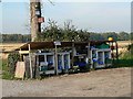
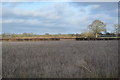
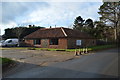
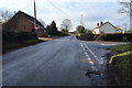
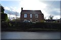
53 photos from this area
Area Information
Key information about the NR20 3PD including its size, population, and administrative classification.
- Area Type
- Postcode
- Area Size
- 25.0 hectares
- Population
- 1501
- Population Density
- 79 people/km²
House Prices in NR20 3PD
20
Properties
£570,000
Average Sold Price
£180,000
Lowest Price
£1,000,000
Highest Price
Showing 20 properties
| Address | Type | Beds | Baths | Last Sale Price | Last Sale Date | |
|---|---|---|---|---|---|---|
| Kensington House, 110 Dereham Road, Mattishall, NR20 3PD | house | 4 | 3 | £1,000,000 | Jul 2023 | |
| May House, 147 Dereham Road, Mattishall, NR20 3PD | Semi-detached | - | - | £530,000 | Aug 2020 | |
| Lyndhurst, 157 Dereham Road, Mattishall, NR20 3PD | Detached | - | - | £180,000 | Aug 2000 | |
| The Croft, 159 Dereham Road, Mattishall, NR20 3PD | Detached | 4 | 2 | - | - | |
| Holly Dale Barn, Holly Dale, 145 Dereham Road, Mattishall, NR20 3PD | Semi-detached | 4 | 2 | - | - | |
| Holly Dale, 145 Dereham Road, Mattishall, NR20 3PD | Semi-detached | 3 | - | - | - | |
| Gate House, 145A Dereham Road, Mattishall, NR20 3PD | Detached | - | - | - | - | |
| Cart Shed, 145B Dereham Road, Mattishall, NR20 3PD | Detached | - | - | - | - | |
| Kensington Lodge Farm, 112 Dereham Road, Mattishall, NR20 3PD | barnConversion | 4 | 2 | - | - | |
| Glenthorne, 149 Dereham Road, Mattishall, NR20 3PD | Detached | 7 | 4 | - | - |
Page 1 of 2
Energy Efficiency in NR20 3PD
Amenities
Schools
| Rank | School | Type | Entry gender | Ages |
|---|
Explore more schools in this area
Go to Schools tabDemographics
Household Size
Two person
most common
Accommodation Type
Houses
most common
Tenure
75
majority
Ethnic Group
White
most common
Religion
N/A
most common
Household Composition
N/A
most common
Age
47
median
Adults (30-64 years)
most common
Household Deprivation
N/A
with no deprivation
NS-SEC
30
in Lower managerial occupations
Explore more demographic insights in this area
Go to Demographics tabPlanning
Planning Constraints
- Flood RiskPremium
- Ramsar Wetland SitesPremium
- Area of Outstanding Natural BeautyPremium
- Protected Nature ReservePremium
- Protected WoodlandPremium