Area Overview for NR20 3JN
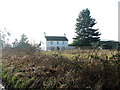
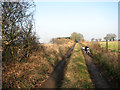
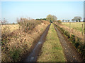
Photos of NR20 3JN
Area Information
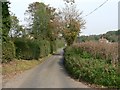
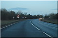
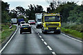
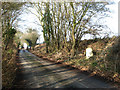
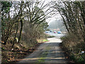
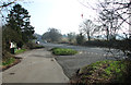
Living in NR20 3JN offers a settled existence within a compact residential cluster of just 4.0 hectares. This postcode area accommodates 1,344 residents, creating a low-density environment that prioritises space and quiet over urban intensity. The area sits at a population density of 81 people per square kilometre, meaning you will find homes spread out rather than clustered in high-rise blocks or terraced rows. This small geographic footprint fosters a neighbourhood feel where routes are short and the local environment is the primary focus of daily life. Prospective buyers seeking a slice of rural calm without total isolation will find this postcode matches those expectations. The community is stabilised by a high rate of long-term residence, with 76% of households owning their homes rather than renting. The demographic profile centres on adults between 30 and 64 years of age, with a median age of 47. This indicates a generation of professionals and families who have put roots down, creating a stable social fabric. You can expect a pace of life that reflects this demographic, moving away from the frenetic energy of city centres towards a measured routine. The area encompasses 13 buildings within its boundaries, suggesting a mix of detached and semi-detached properties typical of this region. There are no planning constraints related to protected nature reserves, woodlands, or Ramsar sites, ensuring that redevelopment or garden maintenance faces few regulatory hurdles. This sense of security and stability makes NR20 3JN a practical choice for those prioritising a tranquil setting over extravagant urban conveniences.
- Area Type
- Postcode
- Area Size
- 4.0 hectares
- Population
- 1344
- Population Density
- 81 people/km²
The property market in NR20 3JN operates as a stable, owner-driven sphere rather than a high-turnover rental sector. With a home ownership level of 76%, this postcode is fundamentally an established residential area where sellers are homeowners who have likely lived in their properties for many years. This high rate of ownership means that housing prices may reflect long-term value rather than speculative investment potential. You will find that the accommodation stock consists entirely of houses, reflecting the rural character of the 4.0-hectare site. There are no flats or apartments listed for this specific postcode, which narrows your search to dettached and semi-detached family homes. This exclusive market composition appeals to those seeking traditional garden settings and space. For buyers looking at homes in NR20 3JN, the challenge lies in competition from local owners rather than corporate landlords. The small size of the area, covering only 4 hectares and housing 1,344 people, suggests a boutique market with limited inventory. This scarcity can drive up prices if multiple buyers target the same few properties. The fact that 76% of residents own their homes indicates a reluctance to move, which can reduce the frequency of properties hitting the market. When they do, you can expect motivated sellers rather than renters looking for an easy exit. This environment suits buyers who value property longevity and stability over rapid transaction speeds.
House Prices in NR20 3JN
Showing 11 properties
| Address | Type | Beds | Baths | Last Sale Price | Last Sale Date | |
|---|---|---|---|---|---|---|
| 12 Albatross Road, Hockering, NR20 3JN | house | - | - | £625,000 | Sep 2024 | |
| Hill House Lodge, Albatross Road, Hockering, NR20 3JN | house | - | - | £258,272 | May 2023 | |
| 5 Albatross Road, Hockering, NR20 3JN | house | - | - | £825,000 | Sep 2022 | |
| 8 Albatross Road, Hockering, NR20 3JN | Detached | 6 | 2 | £800,000 | Dec 2021 | |
| 4 Albatross Road, Hockering, NR20 3JN | Detached | 4 | 2 | £640,000 | Oct 2021 | |
| 9 Albatross Road, Hockering, NR20 3JN | Detached | 4 | 2 | £640,000 | May 2021 | |
| 6 Albatross Road, Hockering, NR20 3JN | Detached | 4 | 2 | £600,000 | Apr 2021 | |
| 10 Albatross Road, Hockering, NR20 3JN | Detached | 4 | 2 | £775,000 | Mar 2021 | |
| 11 Albatross Road, Hockering, NR20 3JN | Detached | 4 | 2 | £550,000 | Oct 2019 | |
| Country Fresh, Road From Honingham To North Tuddenham, Hockering, NR20 3JN | warehouse | - | - | - | - |
Energy Efficiency in NR20 3JN
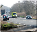
Living in NR20 3JN involves a lifestyle oriented around local retail availability rather than urban shopping centres. You will find five retail premises within practical reach of your home. Specific venues include Budgens Lenwade, which offers grocery shopping and daily essentials. For other necessities, the Co-op Queens serves as a trusted local option. Additionally, Marks and Spencer Longwater is available nearby, providing a broader range of goods for those seeking department store items. These specific names give you a concrete list of where to queue for your shopping trips. These retail venues, combined with the small area size, mean you do not need to travel far for basic supplies. The proximity of three specific named retailers ensures that your weekly shop is just a short drive away. Beyond retail, the area offers access to Dereham Metro as the nearest transport node, though this requires a journey outside the immediate local cluster. The lifestyle here is defined by these named amenities: Budgens, Co-op, and M&S form the backbone of your local convenience network. This setup supports a self-sufficient routine where you rely on established local brands rather than new developments. The character of this lifestyle is practical and local. You are not surrounded by a bustling night scene or extensive leisure parks, but you are surrounded by reliable, named service points. This creates a predictable environment where you know exactly where to find your goods. The convenience of having Budgens and Co-op in your vicinity supports a quiet but functional daily routine for the 1,344 residents who live in this close-knit cluster.
Amenities
Schools
Families considering NR20 3JN have access to three listed primary schools within their immediate vicinity. Hockering Church of England Voluntary Aided Primary School serves the local education needs, offering voluntary aided status which often implies strong community governance. Another option is Honingham Primary School, which accommodates children in the broader catchment area. For families seeking a school with a stronger track record, Hockering Church of England Primary Academy holds a Good Ofsted rating, providing confidence in educational standards. The mix of school types is limited to those designated as primary institutions. This detail is significant for children approaching secondary age, who may need to travel further for older education. All listed options are public sector schools rather than private institutions. The presence of a voluntary aided academy alongside a standard primary school suggests a diverse range of educational philosophies available locally. If you have younger children, you will find that the nearest educational facilities are within reasonable travelling distance. The fact that one school carries a Good rating provides a reassuring benchmark for parents prioritising educational quality. However, the absence of secondary listings means you should research transport links to the nearest secondary school, which is not specified in the local cluster.
| Rank | School | Type | Entry gender | Ages |
|---|
Explore more schools in this area
Go to Schools tabDemographics
The community in NR20 3JN is defined by a mature and established population. Households in this postcode generally consist of adults aged 30 to 64, reflecting a life stage focused on stability and family life. The median age for residents is 47, confirming that this is not an area dominated by students or young singles. This age profile suggests a neighbourhood where most residents have established careers and families, leading to a quieter social atmosphere compared to younger cities. Home ownership stands at a striking 76%, the highest level seen in the data. This figure indicates that the vast majority of people look to buy a property here rather than rent. Consequently, the housing stock is likely populated by long-term residents who have invested in their local infrastructure and community groups. The predominant ethnic group is White, mirroring the broader demographic trends of Norfolk. Accommodation is exclusively comprised of houses, with no high-rise apartments or flats within this specific 4-hectare zone. This aligns perfectly with the low-density living style you might expect. The area is 100% owner-occupied in terms of the housing type available, which reinforces the sense of permanence. You will find that neighbours here are likely to be familiar faces rather than transient tenants. This demographic consistency supports a predictable neighbourhood dynamic where local customs and rules are well understood by everyone.
Household Size
Accommodation Type
Tenure
Ethnic Group
Religion
Household Composition
Age
Household Deprivation
NS-SEC
Explore more demographic insights in this area
Go to Demographics tabPlanning
Planning Constraints
- Flood RiskPremium
- Ramsar Wetland SitesPremium
- Area of Outstanding Natural BeautyPremium
- Protected Nature ReservePremium
- Protected WoodlandPremium