Area Overview for NR20 3GX
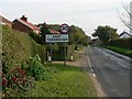
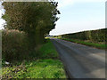
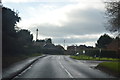
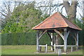
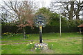
Photos of NR20 3GX
Area Information
Living in NR20 3GX offers a distinct experience within a small residential cluster defined by your specific postcode. This area covers just 7.1 hectares, creating an intimate neighbourhood where residents share close proximity to one another. You are part of a community with 1,344 people, resulting in a population density of 81 people per square kilometre. This low density means the area feels spacious despite its modest physical footprint, yet you remain connected to essential services. The location sits in England, providing a stable backdrop for domestic life without the high-pressure pace of major urban centres. The setting is characterised by a mix of quiet streets and accessible green space. You will find that daily life here revolves around local routines rather than the commotion of large towns. The area functions as a peaceful sanctuary for families and individuals who prefer a slower pace. Because the land area is so compact, you can walk to many local destinations, reducing reliance on a car for short trips. The environment supports a lifestyle focused on simplicity and community interaction. Residents appreciate the lack of congestion, allowing for tranquil mornings and evenings outdoors. For those considering buying, the limited size of the zone means you are entering a well-defined community with established norms. The housing stock reflects the population's needs, prioritising practical dwellings over grand estates. You benefit from being in a location that balances isolation with accessibility. The postcode area serves as a gateway to wider networks while maintaining its own identity. Life here is straightforward, defined by the rhythm of the immediate surroundings and the stability of the local infrastructure. The community in NR20 3GX is defined by a mature and stable population. The median age stands at 47, indicating that the neighbourhood attracts adults seeking long-term stability rather than rapid urban turnover. Most residents fall into the 30 to 64 years age range, suggesting a workforce that heads towards retirement or settled family life. This demographic profile explains the nature of the local economy and social interactions you would experience. Home ownership is exceptionally high, with 76% of properties owned outright or with a substantial portion paid off. This figure indicates a deeply rooted community where residents have a significant investment in their local area. Consequently, the local estate market remains dynamic even if individual transactions are infrequent. The high ownership rate contributes to a sense of permanence and neighbourhood watchfulness among the residents. You are likely to encounter neighbours who have lived in the area for decades, creating strong local bonds. Accommodation in this zone consists almost entirely of houses, reflecting the preferences of the adult demographic living here. Unlike urban flats or high-density apartments, the housing stock offers private gardens and detached or semi-detached living arrangements. The predominant ethnic group is White, which mirrors the broader rural character of the region. This homogeneous mixture fosters a cohesive social environment where cultural traditions intersect smoothly. The area appeals to those who value space, privacy, and a predictable social calendar over the diversity found in larger cities. The property market in NR20 3GX reflects the solidified nature of the local housing stock. With 76% home ownership, the area is overwhelmingly owner-occupied rather than a rental market driven by landlords or short-term tenants. This statistic means that when you look for homes in this postcode, you are evaluating properties with established histories and motivated owner-sellers. The market does not fluctuate wildly based on tourist trends or student demand, providing relative stability for investors or first-time buyers. Accommodation types are exclusively houses, distinguishing this zone from urban postcodes where flats and maisonettes might dominate. You will find that every property offers the privacy and outdoor space associated with detached or semi-detached living. This uniformity suggests that the construction boom has not yet changed the character of the neighbourhood. Developers have limited scope for altering the housing mix within these 7.1 hectares, preserving the existing aesthetic and functional layout. For buyers considering this small area, the lack of rental properties implies strong local demand from homeowners. Property values are likely supported by the high percentage of residents with long-term ties to the community. You should expect a market where price negotiation relies more on property condition and local factors rather than speculative investment potential. The absence of rental units also means fewer doors need to be ticked to find tenancies, streamlining the sales process. Each house represents a tangible asset within a tight-knit network of neighbours who value their property rights. Families in NR20 3GX benefit from a selection of primary education options just outside the immediate cluster. The nearest schools include Honingham Primary School and Hockering Church of England Primary Academy, both offering primary education for young children. Notably, Hockering Church of England Primary Academy holds a Ofsted rating of good, indicating a standard of education that meets regulatory expectations for the sector. You can trust that your child will receive a curriculum aligned with national standards at this institution. Another option nearby is Hockering Church of England Voluntary Aided Primary School, which complements the choice of voluntary aided status in the local area. No secondary schools are listed in the immediate vicinity, so older children are likely to travel further for high school education. This mix of school types means you have access to both voluntary aided and academy models, each with its own governance and funding structure. The presence of multiple primary schools suggests the parish council actively supports early education. For parents, having these three primary institutions close by reduces commute times and allows for flexible school run arrangements. The walking distance from NR20 3GX to Hockering Church of England Voluntary Aided Primary School and Honingham Primary School is practical for daily use. You do not need to consider long-distance boarding or transfer to distant towns unless you seek specific specialisms not available locally. The local education provision is adequate for primary-aged children and well-distributed across the bordering parishes. Digital connectivity is a crucial factor for modern living, and NR20 3GX presents specific considerations for internet and mobile access. Mobile coverage scores 74 out of 100, indicating good signal strength for most areas within the postcode. This rating suggests you will experience reliable calls and messaging, sufficient for daily communication and emergencies. A strong mobile signal supports the use of location-based services and social media without significant interruption during your day. Fixed broadband, however, presents a different picture. The broadband score is 36 out of 100, which categorises as a fair to poor connection speed compared to national standards. This lower score limits your ability to stream high-definition content, host video calls, or download large files quickly. If you work from home requiring heavy bandwidth usage, you might face frustrations with slow page loads or buffering. Residents may need to supplement standard provision with dedicated lines or upgraders to meet professional needs. For daily life outside the home, reliance on cars remains necessary. There are no direct trains from the postcode itself, but the nearby Metro station in Dereham offers one transport link for regional travel. You will find that planning your week around driving or using bus services is essential. The gap in broadband quality contrasts with the decent mobile signal, so keeping in touch is easy while working remotely requires careful planning. Connectivity here is adequate for light users but demands patience from those with heavy digital demands. Living in NR20 3GX places you within practical reach of several retail outlets and transport hubs. You can visit Budgens Lenwade for grocery shopping, which is a staple for local households seeking convenience. M&S Longwater offers broader retail options including clothing and household goods, serving as a primary social and commercial destination. Iceland Norwich provides fresh food and frozen parcels, ensuring you have access to a variety of culinary products without needing to travel far. These three stores form the core of your shopping routine, offering everything from daily essentials to weekly stockpiles. Dining and leisure options are less extensive but sufficient for regular visits. The immediate area supports a lifestyle centred on local beauty and quiet spots rather than nightclubs or cinemas. Parks and green spaces are readily accessible given the low population density of 81 people per square kilometre. You can enjoy the countryside surrounding the postcode on foot or by bike, taking advantage of the lack of large urban planning constraints. The area remains open and airy, encouraging outdoor activities regardless of season. For commuting, the nearby station in Dereham serves as your main transport gateway. This link connects you to the wider network, though access requires a short drive or bus trip from your doorstep. Retail and dining within a reasonable distance means you rarely need to venture into larger towns for basic needs. Life here is balanced between isolation and accessibility, with enough amenities to feel self-sufficient. You build a routine that centres on these local touchpoints while enjoying the freedom of a spacious environment. Safety and environmental factors in NR20 3GX are fundamentally positive for residents. The crime risk assessment passes with a safety score of 79 out of 100. This score reflects below-average crime rates, positioning the area as one of the safer neighbourhoods for homebuyers. You can expect low levels of burglary, assault, and vehicle crime compared to national averages. The majority of residents feel secure walking alone after dark, supported by the low household crime rates. This environment encourages a relaxed pace of life without constant vigilance. Environmental constraints also present minimal risk. There is no coverage of Ramsar wetland sites, protecting the area from strict planning restrictions tied to nature conservation. The absence of AONB coverage and protected nature reserves means development planning is more flexible. Similarly, there is no protected woodland or other special nature reserves limiting construction or renovation in this 7.1-hectare zone. These clearances ensure that building projects face fewer objections from environmental bodies. Flood risk is negligible, with a score of 0, indicating very low probability of water submersion. This factor is critical for property longevity and insurance premiums. Combined with the solid safety score, the area offers a secure foundation for raising a family or retiring. You do not face significant threats from natural disasters or high crime statistics. The overall assessment paints a picture of stability, reassuring both homeowners and prospective buyers that their investment is protected by robust environmental and social conditions. What is the community feel like in NR20 3GX?The neighbourhood attracts adults aged 30 to 64, with a median age of 47. High home ownership at 76% indicates a stable, resident-focused community rather than a transient rental market. The low population density of 81 people per km² fosters a quiet, neighbourly atmosphere. How good are the local schools?Hockering Church of England Primary Academy holds a Ofsted rating of good. Residents also have access to Honingham Primary School and Hockering Church of England Voluntary Aided Primary School, providing multiple options for primary education just outside the immediate postcode. What is the transport and internet situation?Mobile coverage is good with a score of 74/100, but fixed broadband averages only 36/100, which may affect heavy digital users. The nearest train station is Dereham, requiring a short drive or bus ride from the 7.1-hectare cluster. Is the area safe and environmentally secure?Crime risk is low with a safety score of 79/100, reflecting below-average criminal activity. The area has no flood risk, Ramsar sites, AONB coverage, or protected woodlands, ensuring flexible planning and minimal environmental constraints for homeowners. What amenities are nearby for daily life?Residents can shop at Budgens Lenwade, M&S Longwater, and Iceland Norwich. These three retail outlets provide comprehensive grocery and shopping needs within practical walking or driving distance of the residential cluster.
- Area Type
- Postcode
- Area Size
- 7.1 hectares
- Population
- 1344
- Population Density
- 81 people/km²
The property market in NR20 3GX reflects the solidified nature of the local housing stock. With 76% home ownership, the area is overwhelmingly owner-occupied rather than a rental market driven by landlords or short-term tenants. This statistic means that when you look for homes in this postcode, you are evaluating properties with established histories and motivated owner-sellers. The market does not fluctuate wildly based on tourist trends or student demand, providing relative stability for investors or first-time buyers. Accommodation types are exclusively houses, distinguishing this zone from urban postcodes where flats and maisonettes might dominate. You will find that every property offers the privacy and outdoor space associated with detached or semi-detached living. This uniformity suggests that the construction boom has not yet changed the character of the neighbourhood. Developers have limited scope for altering the housing mix within these 7.1 hectares, preserving the existing aesthetic and functional layout. For buyers considering this small area, the lack of rental properties implies strong local demand from homeowners. Property values are likely supported by the high percentage of residents with long-term ties to the community. You should expect a market where price negotiation relies more on property condition and local factors rather than speculative investment potential. The absence of rental units also means fewer doors need to be ticked to find tenancies, streamlining the sales process. Each house represents a tangible asset within a tight-knit network of neighbours who value their property rights. Families in NR20 3GX benefit from a selection of primary education options just outside the immediate cluster. The nearest schools include Honingham Primary School and Hockering Church of England Primary Academy, both offering primary education for young children. Notably, Hockering Church of England Primary Academy holds a Ofsted rating of good, indicating a standard of education that meets regulatory expectations for the sector. You can trust that your child will receive a curriculum aligned with national standards at this institution. Another option nearby is Hockering Church of England Voluntary Aided Primary School, which complements the choice of voluntary aided status in the local area. No secondary schools are listed in the immediate vicinity, so older children are likely to travel further for high school education. This mix of school types means you have access to both voluntary aided and academy models, each with its own governance and funding structure. The presence of multiple primary schools suggests the parish council actively supports early education. For parents, having these three primary institutions close by reduces commute times and allows for flexible school run arrangements. The walking distance from NR20 3GX to Hockering Church of England Voluntary Aided Primary School and Honingham Primary School is practical for daily use. You do not need to consider long-distance boarding or transfer to distant towns unless you seek specific specialisms not available locally. The local education provision is adequate for primary-aged children and well-distributed across the bordering parishes. Digital connectivity is a crucial factor for modern living, and NR20 3GX presents specific considerations for internet and mobile access. Mobile coverage scores 74 out of 100, indicating good signal strength for most areas within the postcode. This rating suggests you will experience reliable calls and messaging, sufficient for daily communication and emergencies. A strong mobile signal supports the use of location-based services and social media without significant interruption during your day. Fixed broadband, however, presents a different picture. The broadband score is 36 out of 100, which categorises as a fair to poor connection speed compared to national standards. This lower score limits your ability to stream high-definition content, host video calls, or download large files quickly. If you work from home requiring heavy bandwidth usage, you might face frustrations with slow page loads or buffering. Residents may need to supplement standard provision with dedicated lines or upgraders to meet professional needs. For daily life outside the home, reliance on cars remains necessary. There are no direct trains from the postcode itself, but the nearby Metro station in Dereham offers one transport link for regional travel. You will find that planning your week around driving or using bus services is essential. The gap in broadband quality contrasts with the decent mobile signal, so keeping in touch is easy while working remotely requires careful planning. Connectivity here is adequate for light users but demands patience from those with heavy digital demands. Living in NR20 3GX places you within practical reach of several retail outlets and transport hubs. You can visit Budgens Lenwade for grocery shopping, which is a staple for local households seeking convenience. M&S Longwater offers broader retail options including clothing and household goods, serving as a primary social and commercial destination. Iceland Norwich provides fresh food and frozen parcels, ensuring you have access to a variety of culinary products without needing to travel far. These three stores form the core of your shopping routine, offering everything from daily essentials to weekly stockpiles. Dining and leisure options are less extensive but sufficient for regular visits. The immediate area supports a lifestyle centred on local beauty and quiet spots rather than nightclubs or cinemas. Parks and green spaces are readily accessible given the low population density of 81 people per square kilometre. You can enjoy the countryside surrounding the postcode on foot or by bike, taking advantage of the lack of large urban planning constraints. The area remains open and airy, encouraging outdoor activities regardless of season. For commuting, the nearby station in Dereham serves as your main transport gateway. This link connects you to the wider network, though access requires a short drive or bus trip from your doorstep. Retail and dining within a reasonable distance means you rarely need to venture into larger towns for basic needs. Life here is balanced between isolation and accessibility, with enough amenities to feel self-sufficient. You build a routine that centres on these local touchpoints while enjoying the freedom of a spacious environment. Safety and environmental factors in NR20 3GX are fundamentally positive for residents. The crime risk assessment passes with a safety score of 79 out of 100. This score reflects below-average crime rates, positioning the area as one of the safer neighbourhoods for homebuyers. You can expect low levels of burglary, assault, and vehicle crime compared to national averages. The majority of residents feel secure walking alone after dark, supported by the low household crime rates. This environment encourages a relaxed pace of life without constant vigilance. Environmental constraints also present minimal risk. There is no coverage of Ramsar wetland sites, protecting the area from strict planning restrictions tied to nature conservation. The absence of AONB coverage and protected nature reserves means development planning is more flexible. Similarly, there is no protected woodland or other special nature reserves limiting construction or renovation in this 7.1-hectare zone. These clearances ensure that building projects face fewer objections from environmental bodies. Flood risk is negligible, with a score of 0, indicating very low probability of water submersion. This factor is critical for property longevity and insurance premiums. Combined with the solid safety score, the area offers a secure foundation for raising a family or retiring. You do not face significant threats from natural disasters or high crime statistics. The overall assessment paints a picture of stability, reassuring both homeowners and prospective buyers that their investment is protected by robust environmental and social conditions. What is the community feel like in NR20 3GX?The neighbourhood attracts adults aged 30 to 64, with a median age of 47. High home ownership at 76% indicates a stable, resident-focused community rather than a transient rental market. The low population density of 81 people per km² fosters a quiet, neighbourly atmosphere. How good are the local schools?Hockering Church of England Primary Academy holds a Ofsted rating of good. Residents also have access to Honingham Primary School and Hockering Church of England Voluntary Aided Primary School, providing multiple options for primary education just outside the immediate postcode. What is the transport and internet situation?Mobile coverage is good with a score of 74/100, but fixed broadband averages only 36/100, which may affect heavy digital users. The nearest train station is Dereham, requiring a short drive or bus ride from the 7.1-hectare cluster. Is the area safe and environmentally secure?Crime risk is low with a safety score of 79/100, reflecting below-average criminal activity. The area has no flood risk, Ramsar sites, AONB coverage, or protected woodlands, ensuring flexible planning and minimal environmental constraints for homeowners. What amenities are nearby for daily life?Residents can shop at Budgens Lenwade, M&S Longwater, and Iceland Norwich. These three retail outlets provide comprehensive grocery and shopping needs within practical walking or driving distance of the residential cluster.
House Prices in NR20 3GX
Showing 4 properties
| Address | Type | Beds | Baths | Last Sale Price | Last Sale Date | |
|---|---|---|---|---|---|---|
| Hawkswood, 6 Windfields, East Tuddenham, NR20 3GX | house | - | - | £1,100,000 | Aug 2022 | |
| Meadowcroft, 4 Windfields, East Tuddenham, NR20 3GX | house | - | - | £875,000 | May 2022 | |
| Thornburys, 2 Windfields, East Tuddenham, NR20 3GX | Bungalow | - | - | £815,000 | Feb 2022 | |
| Woodburgh House, 8 Windfields, East Tuddenham, NR20 3GX | house | - | - | £495,000 | Oct 2019 |
Energy Efficiency in NR20 3GX
Living in NR20 3GX places you within practical reach of several retail outlets and transport hubs. You can visit Budgens Lenwade for grocery shopping, which is a staple for local households seeking convenience. M&S Longwater offers broader retail options including clothing and household goods, serving as a primary social and commercial destination. Iceland Norwich provides fresh food and frozen parcels, ensuring you have access to a variety of culinary products without needing to travel far. These three stores form the core of your shopping routine, offering everything from daily essentials to weekly stockpiles. Dining and leisure options are less extensive but sufficient for regular visits. The immediate area supports a lifestyle centred on local beauty and quiet spots rather than nightclubs or cinemas. Parks and green spaces are readily accessible given the low population density of 81 people per square kilometre. You can enjoy the countryside surrounding the postcode on foot or by bike, taking advantage of the lack of large urban planning constraints. The area remains open and airy, encouraging outdoor activities regardless of season. For commuting, the nearby station in Dereham serves as your main transport gateway. This link connects you to the wider network, though access requires a short drive or bus trip from your doorstep. Retail and dining within a reasonable distance means you rarely need to venture into larger towns for basic needs. Life here is balanced between isolation and accessibility, with enough amenities to feel self-sufficient. You build a routine that centres on these local touchpoints while enjoying the freedom of a spacious environment. Safety and environmental factors in NR20 3GX are fundamentally positive for residents. The crime risk assessment passes with a safety score of 79 out of 100. This score reflects below-average crime rates, positioning the area as one of the safer neighbourhoods for homebuyers. You can expect low levels of burglary, assault, and vehicle crime compared to national averages. The majority of residents feel secure walking alone after dark, supported by the low household crime rates. This environment encourages a relaxed pace of life without constant vigilance. Environmental constraints also present minimal risk. There is no coverage of Ramsar wetland sites, protecting the area from strict planning restrictions tied to nature conservation. The absence of AONB coverage and protected nature reserves means development planning is more flexible. Similarly, there is no protected woodland or other special nature reserves limiting construction or renovation in this 7.1-hectare zone. These clearances ensure that building projects face fewer objections from environmental bodies. Flood risk is negligible, with a score of 0, indicating very low probability of water submersion. This factor is critical for property longevity and insurance premiums. Combined with the solid safety score, the area offers a secure foundation for raising a family or retiring. You do not face significant threats from natural disasters or high crime statistics. The overall assessment paints a picture of stability, reassuring both homeowners and prospective buyers that their investment is protected by robust environmental and social conditions. What is the community feel like in NR20 3GX?The neighbourhood attracts adults aged 30 to 64, with a median age of 47. High home ownership at 76% indicates a stable, resident-focused community rather than a transient rental market. The low population density of 81 people per km² fosters a quiet, neighbourly atmosphere. How good are the local schools?Hockering Church of England Primary Academy holds a Ofsted rating of good. Residents also have access to Honingham Primary School and Hockering Church of England Voluntary Aided Primary School, providing multiple options for primary education just outside the immediate postcode. What is the transport and internet situation?Mobile coverage is good with a score of 74/100, but fixed broadband averages only 36/100, which may affect heavy digital users. The nearest train station is Dereham, requiring a short drive or bus ride from the 7.1-hectare cluster. Is the area safe and environmentally secure?Crime risk is low with a safety score of 79/100, reflecting below-average criminal activity. The area has no flood risk, Ramsar sites, AONB coverage, or protected woodlands, ensuring flexible planning and minimal environmental constraints for homeowners. What amenities are nearby for daily life?Residents can shop at Budgens Lenwade, M&S Longwater, and Iceland Norwich. These three retail outlets provide comprehensive grocery and shopping needs within practical walking or driving distance of the residential cluster.
Amenities
Schools
Families in NR20 3GX benefit from a selection of primary education options just outside the immediate cluster. The nearest schools include Honingham Primary School and Hockering Church of England Primary Academy, both offering primary education for young children. Notably, Hockering Church of England Primary Academy holds a Ofsted rating of good, indicating a standard of education that meets regulatory expectations for the sector. You can trust that your child will receive a curriculum aligned with national standards at this institution. Another option nearby is Hockering Church of England Voluntary Aided Primary School, which complements the choice of voluntary aided status in the local area. No secondary schools are listed in the immediate vicinity, so older children are likely to travel further for high school education. This mix of school types means you have access to both voluntary aided and academy models, each with its own governance and funding structure. The presence of multiple primary schools suggests the parish council actively supports early education. For parents, having these three primary institutions close by reduces commute times and allows for flexible school run arrangements. The walking distance from NR20 3GX to Hockering Church of England Voluntary Aided Primary School and Honingham Primary School is practical for daily use. You do not need to consider long-distance boarding or transfer to distant towns unless you seek specific specialisms not available locally. The local education provision is adequate for primary-aged children and well-distributed across the bordering parishes. Digital connectivity is a crucial factor for modern living, and NR20 3GX presents specific considerations for internet and mobile access. Mobile coverage scores 74 out of 100, indicating good signal strength for most areas within the postcode. This rating suggests you will experience reliable calls and messaging, sufficient for daily communication and emergencies. A strong mobile signal supports the use of location-based services and social media without significant interruption during your day. Fixed broadband, however, presents a different picture. The broadband score is 36 out of 100, which categorises as a fair to poor connection speed compared to national standards. This lower score limits your ability to stream high-definition content, host video calls, or download large files quickly. If you work from home requiring heavy bandwidth usage, you might face frustrations with slow page loads or buffering. Residents may need to supplement standard provision with dedicated lines or upgraders to meet professional needs. For daily life outside the home, reliance on cars remains necessary. There are no direct trains from the postcode itself, but the nearby Metro station in Dereham offers one transport link for regional travel. You will find that planning your week around driving or using bus services is essential. The gap in broadband quality contrasts with the decent mobile signal, so keeping in touch is easy while working remotely requires careful planning. Connectivity here is adequate for light users but demands patience from those with heavy digital demands. Living in NR20 3GX places you within practical reach of several retail outlets and transport hubs. You can visit Budgens Lenwade for grocery shopping, which is a staple for local households seeking convenience. M&S Longwater offers broader retail options including clothing and household goods, serving as a primary social and commercial destination. Iceland Norwich provides fresh food and frozen parcels, ensuring you have access to a variety of culinary products without needing to travel far. These three stores form the core of your shopping routine, offering everything from daily essentials to weekly stockpiles. Dining and leisure options are less extensive but sufficient for regular visits. The immediate area supports a lifestyle centred on local beauty and quiet spots rather than nightclubs or cinemas. Parks and green spaces are readily accessible given the low population density of 81 people per square kilometre. You can enjoy the countryside surrounding the postcode on foot or by bike, taking advantage of the lack of large urban planning constraints. The area remains open and airy, encouraging outdoor activities regardless of season. For commuting, the nearby station in Dereham serves as your main transport gateway. This link connects you to the wider network, though access requires a short drive or bus trip from your doorstep. Retail and dining within a reasonable distance means you rarely need to venture into larger towns for basic needs. Life here is balanced between isolation and accessibility, with enough amenities to feel self-sufficient. You build a routine that centres on these local touchpoints while enjoying the freedom of a spacious environment. Safety and environmental factors in NR20 3GX are fundamentally positive for residents. The crime risk assessment passes with a safety score of 79 out of 100. This score reflects below-average crime rates, positioning the area as one of the safer neighbourhoods for homebuyers. You can expect low levels of burglary, assault, and vehicle crime compared to national averages. The majority of residents feel secure walking alone after dark, supported by the low household crime rates. This environment encourages a relaxed pace of life without constant vigilance. Environmental constraints also present minimal risk. There is no coverage of Ramsar wetland sites, protecting the area from strict planning restrictions tied to nature conservation. The absence of AONB coverage and protected nature reserves means development planning is more flexible. Similarly, there is no protected woodland or other special nature reserves limiting construction or renovation in this 7.1-hectare zone. These clearances ensure that building projects face fewer objections from environmental bodies. Flood risk is negligible, with a score of 0, indicating very low probability of water submersion. This factor is critical for property longevity and insurance premiums. Combined with the solid safety score, the area offers a secure foundation for raising a family or retiring. You do not face significant threats from natural disasters or high crime statistics. The overall assessment paints a picture of stability, reassuring both homeowners and prospective buyers that their investment is protected by robust environmental and social conditions. What is the community feel like in NR20 3GX?The neighbourhood attracts adults aged 30 to 64, with a median age of 47. High home ownership at 76% indicates a stable, resident-focused community rather than a transient rental market. The low population density of 81 people per km² fosters a quiet, neighbourly atmosphere. How good are the local schools?Hockering Church of England Primary Academy holds a Ofsted rating of good. Residents also have access to Honingham Primary School and Hockering Church of England Voluntary Aided Primary School, providing multiple options for primary education just outside the immediate postcode. What is the transport and internet situation?Mobile coverage is good with a score of 74/100, but fixed broadband averages only 36/100, which may affect heavy digital users. The nearest train station is Dereham, requiring a short drive or bus ride from the 7.1-hectare cluster. Is the area safe and environmentally secure?Crime risk is low with a safety score of 79/100, reflecting below-average criminal activity. The area has no flood risk, Ramsar sites, AONB coverage, or protected woodlands, ensuring flexible planning and minimal environmental constraints for homeowners. What amenities are nearby for daily life?Residents can shop at Budgens Lenwade, M&S Longwater, and Iceland Norwich. These three retail outlets provide comprehensive grocery and shopping needs within practical walking or driving distance of the residential cluster.
| Rank | School | Type | Entry gender | Ages |
|---|
Explore more schools in this area
Go to Schools tabDemographics
The community in NR20 3GX is defined by a mature and stable population. The median age stands at 47, indicating that the neighbourhood attracts adults seeking long-term stability rather than rapid urban turnover. Most residents fall into the 30 to 64 years age range, suggesting a workforce that heads towards retirement or settled family life. This demographic profile explains the nature of the local economy and social interactions you would experience. Home ownership is exceptionally high, with 76% of properties owned outright or with a substantial portion paid off. This figure indicates a deeply rooted community where residents have a significant investment in their local area. Consequently, the local estate market remains dynamic even if individual transactions are infrequent. The high ownership rate contributes to a sense of permanence and neighbourhood watchfulness among the residents. You are likely to encounter neighbours who have lived in the area for decades, creating strong local bonds. Accommodation in this zone consists almost entirely of houses, reflecting the preferences of the adult demographic living here. Unlike urban flats or high-density apartments, the housing stock offers private gardens and detached or semi-detached living arrangements. The predominant ethnic group is White, which mirrors the broader rural character of the region. This homogeneous mixture fosters a cohesive social environment where cultural traditions intersect smoothly. The area appeals to those who value space, privacy, and a predictable social calendar over the diversity found in larger cities. The property market in NR20 3GX reflects the solidified nature of the local housing stock. With 76% home ownership, the area is overwhelmingly owner-occupied rather than a rental market driven by landlords or short-term tenants. This statistic means that when you look for homes in this postcode, you are evaluating properties with established histories and motivated owner-sellers. The market does not fluctuate wildly based on tourist trends or student demand, providing relative stability for investors or first-time buyers. Accommodation types are exclusively houses, distinguishing this zone from urban postcodes where flats and maisonettes might dominate. You will find that every property offers the privacy and outdoor space associated with detached or semi-detached living. This uniformity suggests that the construction boom has not yet changed the character of the neighbourhood. Developers have limited scope for altering the housing mix within these 7.1 hectares, preserving the existing aesthetic and functional layout. For buyers considering this small area, the lack of rental properties implies strong local demand from homeowners. Property values are likely supported by the high percentage of residents with long-term ties to the community. You should expect a market where price negotiation relies more on property condition and local factors rather than speculative investment potential. The absence of rental units also means fewer doors need to be ticked to find tenancies, streamlining the sales process. Each house represents a tangible asset within a tight-knit network of neighbours who value their property rights. Families in NR20 3GX benefit from a selection of primary education options just outside the immediate cluster. The nearest schools include Honingham Primary School and Hockering Church of England Primary Academy, both offering primary education for young children. Notably, Hockering Church of England Primary Academy holds a Ofsted rating of good, indicating a standard of education that meets regulatory expectations for the sector. You can trust that your child will receive a curriculum aligned with national standards at this institution. Another option nearby is Hockering Church of England Voluntary Aided Primary School, which complements the choice of voluntary aided status in the local area. No secondary schools are listed in the immediate vicinity, so older children are likely to travel further for high school education. This mix of school types means you have access to both voluntary aided and academy models, each with its own governance and funding structure. The presence of multiple primary schools suggests the parish council actively supports early education. For parents, having these three primary institutions close by reduces commute times and allows for flexible school run arrangements. The walking distance from NR20 3GX to Hockering Church of England Voluntary Aided Primary School and Honingham Primary School is practical for daily use. You do not need to consider long-distance boarding or transfer to distant towns unless you seek specific specialisms not available locally. The local education provision is adequate for primary-aged children and well-distributed across the bordering parishes. Digital connectivity is a crucial factor for modern living, and NR20 3GX presents specific considerations for internet and mobile access. Mobile coverage scores 74 out of 100, indicating good signal strength for most areas within the postcode. This rating suggests you will experience reliable calls and messaging, sufficient for daily communication and emergencies. A strong mobile signal supports the use of location-based services and social media without significant interruption during your day. Fixed broadband, however, presents a different picture. The broadband score is 36 out of 100, which categorises as a fair to poor connection speed compared to national standards. This lower score limits your ability to stream high-definition content, host video calls, or download large files quickly. If you work from home requiring heavy bandwidth usage, you might face frustrations with slow page loads or buffering. Residents may need to supplement standard provision with dedicated lines or upgraders to meet professional needs. For daily life outside the home, reliance on cars remains necessary. There are no direct trains from the postcode itself, but the nearby Metro station in Dereham offers one transport link for regional travel. You will find that planning your week around driving or using bus services is essential. The gap in broadband quality contrasts with the decent mobile signal, so keeping in touch is easy while working remotely requires careful planning. Connectivity here is adequate for light users but demands patience from those with heavy digital demands. Living in NR20 3GX places you within practical reach of several retail outlets and transport hubs. You can visit Budgens Lenwade for grocery shopping, which is a staple for local households seeking convenience. M&S Longwater offers broader retail options including clothing and household goods, serving as a primary social and commercial destination. Iceland Norwich provides fresh food and frozen parcels, ensuring you have access to a variety of culinary products without needing to travel far. These three stores form the core of your shopping routine, offering everything from daily essentials to weekly stockpiles. Dining and leisure options are less extensive but sufficient for regular visits. The immediate area supports a lifestyle centred on local beauty and quiet spots rather than nightclubs or cinemas. Parks and green spaces are readily accessible given the low population density of 81 people per square kilometre. You can enjoy the countryside surrounding the postcode on foot or by bike, taking advantage of the lack of large urban planning constraints. The area remains open and airy, encouraging outdoor activities regardless of season. For commuting, the nearby station in Dereham serves as your main transport gateway. This link connects you to the wider network, though access requires a short drive or bus trip from your doorstep. Retail and dining within a reasonable distance means you rarely need to venture into larger towns for basic needs. Life here is balanced between isolation and accessibility, with enough amenities to feel self-sufficient. You build a routine that centres on these local touchpoints while enjoying the freedom of a spacious environment. Safety and environmental factors in NR20 3GX are fundamentally positive for residents. The crime risk assessment passes with a safety score of 79 out of 100. This score reflects below-average crime rates, positioning the area as one of the safer neighbourhoods for homebuyers. You can expect low levels of burglary, assault, and vehicle crime compared to national averages. The majority of residents feel secure walking alone after dark, supported by the low household crime rates. This environment encourages a relaxed pace of life without constant vigilance. Environmental constraints also present minimal risk. There is no coverage of Ramsar wetland sites, protecting the area from strict planning restrictions tied to nature conservation. The absence of AONB coverage and protected nature reserves means development planning is more flexible. Similarly, there is no protected woodland or other special nature reserves limiting construction or renovation in this 7.1-hectare zone. These clearances ensure that building projects face fewer objections from environmental bodies. Flood risk is negligible, with a score of 0, indicating very low probability of water submersion. This factor is critical for property longevity and insurance premiums. Combined with the solid safety score, the area offers a secure foundation for raising a family or retiring. You do not face significant threats from natural disasters or high crime statistics. The overall assessment paints a picture of stability, reassuring both homeowners and prospective buyers that their investment is protected by robust environmental and social conditions. What is the community feel like in NR20 3GX?The neighbourhood attracts adults aged 30 to 64, with a median age of 47. High home ownership at 76% indicates a stable, resident-focused community rather than a transient rental market. The low population density of 81 people per km² fosters a quiet, neighbourly atmosphere. How good are the local schools?Hockering Church of England Primary Academy holds a Ofsted rating of good. Residents also have access to Honingham Primary School and Hockering Church of England Voluntary Aided Primary School, providing multiple options for primary education just outside the immediate postcode. What is the transport and internet situation?Mobile coverage is good with a score of 74/100, but fixed broadband averages only 36/100, which may affect heavy digital users. The nearest train station is Dereham, requiring a short drive or bus ride from the 7.1-hectare cluster. Is the area safe and environmentally secure?Crime risk is low with a safety score of 79/100, reflecting below-average criminal activity. The area has no flood risk, Ramsar sites, AONB coverage, or protected woodlands, ensuring flexible planning and minimal environmental constraints for homeowners. What amenities are nearby for daily life?Residents can shop at Budgens Lenwade, M&S Longwater, and Iceland Norwich. These three retail outlets provide comprehensive grocery and shopping needs within practical walking or driving distance of the residential cluster.
Household Size
Accommodation Type
Tenure
Ethnic Group
Religion
Household Composition
Age
Household Deprivation
NS-SEC
Explore more demographic insights in this area
Go to Demographics tabPlanning
Planning Constraints
- Flood RiskPremium
- Ramsar Wetland SitesPremium
- Area of Outstanding Natural BeautyPremium
- Protected Nature ReservePremium
- Protected WoodlandPremium