Area Overview for NR20 3FA
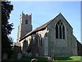
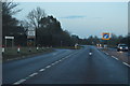
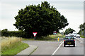
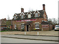
Photos of NR20 3FA

Area Information
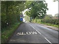
Living in NR20 3FA offers a quiet residential experience within a compact cluster spanning just 1.2 hectares. This small postcode area supports a population of 1,344 residents, resulting in a density of 81 people per square kilometre. The setting is intimate and low-key, avoiding the congestion of larger urban centres. As with many similar clusters in the region, your daily life centres on your immediate neighbourhood, with travel to broader amenities taking a short drive. The area attracts those seeking a settled, non-crowded environment. You are part of a community defined by stability rather than rapid change. The small size of the postcode means that streets are likely well-known to neighbours, fostering a close-knit social circle. While the area lacks the sprawl of bigger towns, its modest footprint ensures that essentials remain within a manageable distance. This layout suits buyers who prioritise peace and privacy over proximity to immediate urban infrastructure. The character of NR20 3FA is therefore one of simplicity and localised focus. Any prospective buyer considering homes in NR20 3FA should appreciate the scale of the location. You know your comings and goings simply because the district is so small. The community has grown to its current size of 1,344 souls over time, creating a self-contained bubble that operates largely independently.
- Area Type
- Postcode
- Area Size
- 1.2 hectares
- Population
- 1344
- Population Density
- 81 people/km²
The property market in NR20 3FA is distinctly characterised by owner-occupied housing. With home ownership standing at 76%, the area functions primarily as a place for people to put down roots rather than a hub for short-term rentals. This high saturation suggests that existing listings will likely be fewer in number but motivated by life changes rather than investment strategies. Accommodation consists entirely of houses, reflecting the layout of the 1.2-hectare site. You will not encounter flats or purpose-built rental units within this specific postcode. Every potential purchase is a standalone house, which commands a different premium compared to block living. For buyers seeking NR20 3FA, this means you are looking for traditional family homes or retirement properties suited to the adult demographic. The low population density of 81 people per square kilometre reinforces the character of the stock. Properties are spread out, offering space and gardens that appeal to those wary of urban density. The fact that nearly four out of five residents own their homes implies a market where property values tend to reflect sentimental attachment and long-term stability. When comparing homes in NR20 3FA to larger towns, you find a quieter market driven by local needs.
House Prices in NR20 3FA
Showing 10 properties
| Address | Type | Beds | Baths | Last Sale Price | Last Sale Date | |
|---|---|---|---|---|---|---|
| 8 Canary Close, Hockering, NR20 3FA | Semi-detached | 3 | 2 | £260,000 | Dec 2024 | |
| 9 Canary Close, Hockering, NR20 3FA | house | 3 | 2 | £375,000 | Oct 2024 | |
| 1 Canary Close, Hockering, NR20 3FA | Detached | 2 | 1 | £387,000 | Aug 2024 | |
| 5 Canary Close, Hockering, NR20 3FA | Detached | 3 | 2 | £340,000 | Jul 2023 | |
| 6 Canary Close, Hockering, NR20 3FA | house | - | - | £240,000 | Feb 2022 | |
| 2 Canary Close, Hockering, NR20 3FA | house | - | - | £280,000 | May 2021 | |
| 7 Canary Close, Hockering, NR20 3FA | house | - | - | £349,995 | Jul 2018 | |
| 3 Canary Close, Hockering, NR20 3FA | Detached | 4 | 2 | £349,995 | Apr 2018 | |
| 4 Canary Close, Hockering, NR20 3FA | house | - | - | £199,995 | Apr 2018 | |
| 10 Canary Close, Hockering, NR20 3FA | house | - | - | £239,995 | Apr 2018 |
Energy Efficiency in NR20 3FA
Residents of NR20 3FA enjoy direct access to three key retail locations within practical reach for daily shopping needs. Budgens Lenwade and Co-op Queen's are local points of convenience, while the larger Tesco Dereham offers extensive supermarket provisions and range. These three venues collectively provide for groceries, household essentials, and basic daily needs without requiring a long journey into a city centre. Your options for mobility include one metro station nearby in Dereham. This single station point links the residential cluster to the wider regional transport network. While NR20 3FA itself is a rural residential zone, Dereham station provides the essential rail link for those wishing to travel outside the immediate locality. The proximity of these three retail outlets and one transport hub defines the convenience factor for you. The lifestyle here is defined by these anchors of daily life. You will handle your weekly shop at the nearest supermarket and use the nearby railway for any occasional trips away. The layout supports a self-sufficient routine where most necessities are accessible via a short car journey. This balance of rural quietness and practical access makes the area viable for families who need regular supplies but dislike urban density. Homes in NR20 3FA suit those who plan their trips to Budgens, the Co-op, or Tesco with a view towards efficiency and local control over their shopping budget.
Amenities
Schools
Parents looking for schools near NR20 3FA have access to several local provision just outside the immediate cluster. Hockering Church of England Voluntary Aided Primary School stands as a primary option for younger children, offering faith-based education and a local community focus. Families with slightly older children will consider Honingham Primary School, which serves the nearby town and provides primary education for the wider catchment area. The most highly rated option is Hockering Church of England Primary Academy. This primary institution holds a 'good' Ofsted rating, a specific designation that signals consistent standards in teaching and organisation. Isobel families prioritising academic performance within the immediate vicinity will view this rating favourably when researching schools near NR20 3FA. The presence of multiple primary schools indicates that the area serves a strong family demographic despite its small size. There are no secondary schools listed directly within the immediate data for this postcode. Families will likely need to rely on out-of-area provision for older children, meaning travel times increase as children progress. The availability of these three named primary institutions ensures that early education remains local and convenient. When evaluating the education landscape for homes in NR20 3FA, the cluster of local primaries is the key feature, offering familiar avenues for school runs without the need for long-distance travel to distant academies.
| Rank | School | Type | Entry gender | Ages |
|---|
Explore more schools in this area
Go to Schools tabDemographics
The community in NR20 3FA is dominated by adults, with the most common age range falling between 30 and 64 years. Your neighbours are likely empty nesters or mid-career professionals rather than young children or retirees. The median age sits at 47, confirming that this is a mature household area. This demographic profile suggests a population that values stability and has already established their careers or families. Home ownership is the prevailing norm, with 76% of residents owning their properties outright or with a mortgage. This high percentage indicates financial security and a long-term commitment to the local area. Fewer than one-quarter of households are renting, which limits the transient nature often found in flashier, student-heavy zones. The accommodation type is exclusively houses, meaning you will not find flats within this specific postcode. Every residence is a detached or semi-detached home, providing more privacy than apartment living. Ethnic diversity is low, with White residents forming the predominant group. This homogeneity often correlates with a slower pace of life and traditional social values. The 81 people per square kilometre density further emphasises a spread-out living arrangement rather than high-density blocks. When evaluating homes in NR20 3FA, you are buying into an older, stable community where the demographic structure has remained consistent for many years.
Household Size
Accommodation Type
Tenure
Ethnic Group
Religion
Household Composition
Age
Household Deprivation
NS-SEC
Explore more demographic insights in this area
Go to Demographics tabPlanning
Planning Constraints
- Flood RiskPremium
- Ramsar Wetland SitesPremium
- Area of Outstanding Natural BeautyPremium
- Protected Nature ReservePremium
- Protected WoodlandPremium