Area Overview for NR20 3ET
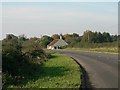
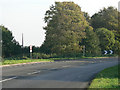
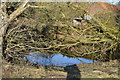
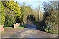
Photos of NR20 3ET
Area Information
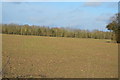
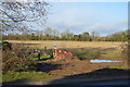
Living in NR20 3ET within the Dereham postcode cluster offers a tranquil residential experience situated across 21.6 hectares. This small residential cluster accommodates a population of 2,348 people, resulting in a calm environment with a density of 223 people per square kilometre. The area is defined by its quiet nature and strong sense of community rather than high-density urban activity. Residents here enjoy a slower pace of life, which appeals to those seeking stability away from the bustling centres of larger Norfolk towns. The housing stock is largely dominated by houses, reflecting a traditional suburban layout rather than high-rise developments. For families or professionals seeking a quieter home, this postcode provides a balanced setting where the immediate surroundings remain unposed by large-scale planning constraints. There are no protected wetlands, AONBs, or woodlands within the immediate boundary, allowing for straightforward local development while maintaining a green, open feel. The area's identity is rooted in its manageable size, making local amenities and neighbours easily accessible without the noise of major thoroughfares. When considering homes in NR20 3ET, you are choosing a location defined by its modest footprint and established residential character.
- Area Type
- Postcode
- Area Size
- 21.6 hectares
- Population
- 2348
- Population Density
- 223 people/km²
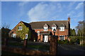
The property market in NR20 3ET is firmly established as an owner-occupied zone, with 75% of households owning their homes. This figure indicates that buying a property here is a standard lifetime goal for residents rather than a temporary holding for short-term lets. The dominant accommodation type consists of houses, meaning you will encounter detached, semi-detached, or terraced family homes rather than flats or apartments. This residential composition supports a landlord market focused on long-term tenants or maintenance of existing stock rather than speculative development. Given the total area size of 21.6 hectares, the housing supply is limited, which often sustains property values within the immediate cluster. Families looking at homes in NR20 3ET prioritize space and gardens, consistent with the prevalence of house-style living. The low population density of 223 people per square kilometre suggests spacious plots and a lack of high-rise pressure that characterises city centres. Buyers consider this small residential cluster for its mature character and the absence of major planning constraints like protected woodlands or wetlands. The market here reflects a practical need for family-oriented housing in a setting that avoids the density of larger urban areas.
House Prices in NR20 3ET
Showing 15 properties
| Address | Type | Beds | Baths | Last Sale Price | Last Sale Date | |
|---|---|---|---|---|---|---|
| Grange Farm, Etling Green, Dereham, NR20 3ET | Land | - | - | £1,250,000 | Apr 2025 | |
| Holly Barn, Etling Green, Dereham, NR20 3ET | Bungalow | 5 | 5 | £770,000 | Mar 2025 | |
| Former, 1 Etling Green, Dereham, NR20 3ET | Detached | - | - | £87,500 | Nov 2023 | |
| Owlslee, 10 Etling Green, Dereham, NR20 3ET | Detached | 4 | 1 | £580,000 | Aug 2023 | |
| Meadoway, Etling Green, Dereham, NR20 3ET | Bungalow | 3 | 2 | £300,000 | May 2020 | |
| Field Fare, Etling Green, Dereham, NR20 3ET | Bungalow | - | - | £415,000 | Sep 2017 | |
| Pedallers, 8 Etling Green, Dereham, NR20 3ET | Bungalow | 3 | 1 | £216,000 | Nov 2016 | |
| Woodstock Barn, Bush Lane North, Etling Green, Dereham, NR20 3ET | house | 5 | - | £330,000 | Dec 2012 | |
| 6 Etling Green, Dereham, NR20 3ET | Detached | - | - | £89,950 | Mar 2006 | |
| The Barn, Etling Green, Dereham, NR20 3ET | Detached | 5 | 5 | - | - |
Energy Efficiency in NR20 3ET
Residents of NR20 3ET benefit from convenient access to major retail and transport hubs within practical reach of their homes. Five key retail outlets are located nearby, including Tesco Dereham, Lidl Toftwood, and Morrisons Scarning. These supermarkets provide daily essentials and a wide range of household goods without requiring a long journey into the city centre. A metro station in Dereham also serves the area, offering a single point of public transport connection for commuters moving elsewhere in the region. This mix of large supermarkets and a metro hub ensures that daily shopping and occasional travel are simple tasks. The proximity of these amenities supports a lifestyle where most regular needs are met within a short drive or walk. Living in NR20 3ET does not mean isolation from essential services, as the area is well-supported by established local chains. The availability of Tesco, Lidl, and Morrisons places high-quality retail options directly in the surroundings of the residential cluster. This accessibility complements the quiet residential nature of the postcode, allowing residents to enjoy both peace and convenience.
Amenities
Schools
Families in NR20 3ET have access to established educational institutions nearby, ensuring local support for children's learning. The nearest educational providers include Dereham Neatherd High School, which operates under two distinct educational frameworks as a primary school and an academy. The presence of both primary and academy structures within the same naming convention suggests a coordinated educational approach for local children. These schools serve the residential cluster directly, eliminating the need for long-distance commuting for daily education. The academy status of one of the sites indicates a modern educational curriculum driven by broader government standards rather than local authority constraints alone. For parents considering living in NR20 3ET, the availability of these specific schools provides a clear and reliable option for their children's primary education. The schools listed in the data confirm that formal education is integrated into the immediate neighbourhood fabric. Families benefit from having secondary-level and primary-level options available in close proximity, which simplifies school run logistics significantly. This setup supports families who wish to keep their children's education local while maintaining a connection to the wider Dereham educational network.
| Rank | School | Type | Entry gender | Ages |
|---|
Explore more schools in this area
Go to Schools tabDemographics
The community in NR20 3ET is predominantly composed of adults between 30 and 64 years old, with a median age of 47 years. This demographic profile suggests a neighbourhood characterised by settled families and long-term residents rather than transient populations. Home ownership stands at a solid 75% level, indicating that the majority of households own their residences outright or through a mortgage. This high rate of ownership typically contributes to greater community stability and local investment in property maintenance. Accommodation types are overwhelmingly houses, aligning with the needs of the adult population and families in this age bracket. The predominant ethnic group is White, which mirrors the broader patterns often found in established English suburban clusters of this size. With such a clear demographic structure, the area likely fosters established social networks and familiar neighbourhood dynamics. There is no significant proportion of young renters or students within the core age range, reinforcing the static nature of the population. Living in NR20 3ET means joining a community where generations oversee the same streets, creating an environment where local customs and lifestyles remain consistent over time.
Household Size
Accommodation Type
Tenure
Ethnic Group
Religion
Household Composition
Age
Household Deprivation
NS-SEC
Explore more demographic insights in this area
Go to Demographics tabPlanning
Planning Constraints
- Flood RiskPremium
- Ramsar Wetland SitesPremium
- Area of Outstanding Natural BeautyPremium
- Protected Nature ReservePremium
- Protected WoodlandPremium