Area Overview for NR20 3BX
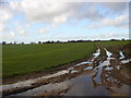
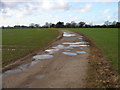
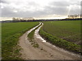
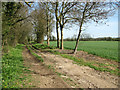
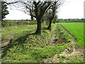
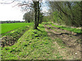
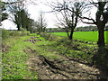
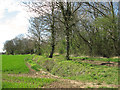
Photos of NR20 3BX
Area Information
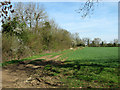
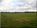
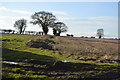
Living in NR20 3BX offers a quiet residence within a compact residential cluster. This specific postcode area spans 21.3 hectares and accommodates 2,348 people. The population density stands at 223 people per square kilometre, creating a settled and intimate living environment. You will find that daily life here is defined by proximity and stability rather than rapid urban expansion. The area functions as a self-contained community where neighbours know each other well. This post code serves as a home for those seeking a slower pace without complete isolation. Expect a neighbourhood where the focus remains on family life and local convenience. The setting provides a solid foundation for building a home life.
- Area Type
- Postcode
- Area Size
- 21.3 hectares
- Population
- 2348
- Population Density
- 223 people/km²
Homes in NR20 3BX reflect a traditional market dominated by private ownership. The accommodation type for the area consists primarily of houses, with detached and semi-detached properties forming the bulk of the stock. Owner occupancy reaches 75% across the postcode area. This high level of tenure means you are more likely to find established homes than new builds or short-term rentals. The housing market here is not driven by investors looking for quick flips. Instead, it serves families and professionals who wish to settle down. You may find a range of properties suitable for different household sizes, though the dominance of houses suggests fewer flats are available. The market operates with the expectation of permanent residence rather than transient living.
House Prices in NR20 3BX
Showing 6 properties
| Address | Type | Beds | Baths | Last Sale Price | Last Sale Date | |
|---|---|---|---|---|---|---|
| Meadow View, Badley Moor, Dereham, NR20 3BX | Bungalow | 4 | 2 | £542,500 | Aug 2025 | |
| Cherry Tree Cottage, Badley Moor, Dereham, NR20 3BX | house | - | - | £505,000 | Jul 2022 | |
| Caravan At Mill Vue Farm, Badley Moor, Dereham, NR20 3BX | Land | 4 | 2 | - | - | |
| Mill Vue, Badley Moor, Dereham, NR20 3BX | Detached | - | - | - | - | |
| Thornham, Badley Moor, Dereham, NR20 3BX | Detached | - | - | - | - | |
| Mill Vue Farm, Badley Moor, Dereham, NR20 3BX | house | - | - | - | - |
Energy Efficiency in NR20 3BX
Amenities
Schools
Families living near NR20 3BX have access to dedicated educational facilities in the immediate vicinity. Dereham Neatherd High School operates as a primary school option for younger children. The same institution, Dereham Neatherd High School, also functions as an academy, providing secondary education for older students. This dual classification within a single name indicates a cohesive local school chain. The presence of both primary and academy options means you can keep children at the same institution as they grow up. These schools serve the local catchment area and are central to the community infrastructure. You will find that these facilities are branded with the Neatherd name, ensuring consistency in ethos and location for residents of the postcode.
| Rank | School | Type | Entry gender | Ages |
|---|
Explore more schools in this area
Go to Schools tabDemographics
The community in NR20 3BX displays clear characteristics shaped by established residency. Adults aged between 30 and 64 years represent the most common age range within the population. The median age recorded for the area is 47 years, confirming an older demographic profile. Three quarters of households, or exactly 75%, consist of owners who live in their homes. This high rate of ownership indicates long-term stability and resident investment in the locality. Most residents occupy houses rather than any other dwelling type. The predominant ethnic group within the area is White. These figures paint a picture of a mature, owner-occupied community focused on practical living arrangements.
Household Size
Accommodation Type
Tenure
Ethnic Group
Religion
Household Composition
Age
Household Deprivation
NS-SEC
Explore more demographic insights in this area
Go to Demographics tabPlanning
Planning Constraints
- Flood RiskPremium
- Ramsar Wetland SitesPremium
- Area of Outstanding Natural BeautyPremium
- Protected Nature ReservePremium
- Protected WoodlandPremium