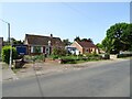
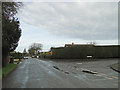
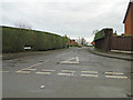
Area Overview for NR20 3BF
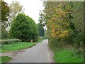
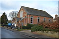
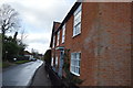
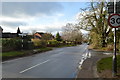
Photos of NR20 3BF
Area Information
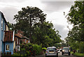
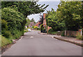
Living in NR20 3BF offers a quiet residential experience within the Norfolk countryside. This specific postcode covers a small cluster containing 1,605 residents across an area of 2,653 square metres. The population density reaches 671 people per square kilometre, indicating a tightly knit neighbourhood rather than a sprawling suburb. Most people living here are in the age range of thirty to sixty-four years old, suggesting a community of settled adults rather than students or families with very young children driving the local scene. The area is dominated by houses, creating an environment where individual character often defines the streetscape. You will find that daily life revolves around stability, with a high level of familiar faces comparing gardening maintenance with neighbours or walking dogs together. The location avoids significant planning constraints, with no protected woodlands, nature reserves, or areas of outstanding natural beauty lying directly within these boundaries. This means development decisions focus on standard housing regulations rather than strict conservation rules. Safety scores indicate a peaceful environment, while the absence of flood risks or wetland sites ensures that environmental hazards do not disrupt routine living. Residents benefit from a setting that prioritises low-risk conditions for everyday life.
- Area Type
- Postcode
- Area Size
- 2653 m²
- Population
- 1605
- Population Density
- 671 people/km²
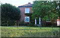
Understanding the property market in NR20 3BF requires noting that the area is overwhelmingly owner-occupied. With home ownership reaching eighty-five per cent, you will find very few private rental properties available within this specific cluster. The accommodation type is strictly houses, so there are no flats or apartments to consider if you have a preference for a specific housing style. This market structure implies that any foreign buyer or investor looking to rent from this postcode will find limited options locally. Properties here are likely maintained by their owners, who have lived there for decades, rather than by professional landlords seeking quick turnover. The small population of just 1,605 people means the stock of available homes remains constant unless re-sale occurs. If you are house hunting in the immediate surroundings of Toftwood or Dereham, you will encounter a similar dominance of detached and semi-detached properties. The lack of social housing or council estates in the data suggests a privately funded building history. For families looking to secure a home, this area represents a buying opportunity rather than a rental search. The high density of owner-occupiers often correlates with higher property prices compared to rental-dominated markets nearby.
House Prices in NR20 3BF
Showing 5 properties
| Address | Type | Beds | Baths | Last Sale Price | Last Sale Date | |
|---|---|---|---|---|---|---|
| 3 Ringers Close, Mattishall, NR20 3BF | Bungalow | 3 | 2 | £345,000 | Dec 2023 | |
| 2 Ringers Close, Mattishall, NR20 3BF | Bungalow | 3 | 2 | £360,000 | Sep 2023 | |
| 1 Ringers Close, Mattishall, NR20 3BF | Bungalow | 3 | 1 | £272,000 | Jul 2019 | |
| 4 Ringers Close, Mattishall, NR20 3BF | Detached | - | - | £247,000 | Feb 2007 | |
| Iona, 60 Dereham Road, Mattishall, NR20 3BF | Detached | - | - | - | - |
Energy Efficiency in NR20 3BF
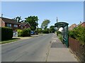
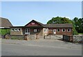
Your lifestyle in NR20 3BF revolves around a handful of accessible amenities within practical reach. For everyday shopping needs, you have five retail outlets available nearby. These include substantial supermarkets such as Tesco Dereham, Lidl Toftwood, and Aldi Toftwood, catering to weekly grocery and household requirements. Beyond general retail, the area offers transport links through Dereham, which serves as the nearest major rail or bus hub. This connection point allows residents to travel to wider Norfolk towns or further afield with relative ease. The concentration of major retailers in Toftwood and Dereham means you do not need to travel far for essential bulk shopping. Daily errands are manageable without entering the city centre. While the data does not list specific parks, cafes, or leisure centres, the presence of these large supermarkets implies a functional network of services supporting family life. Residents can combine a stop at Lidl or Aldi with errands in Dereham to maximise their weekly trip. The lifestyle is practical and understated, focussed on efficiency rather than luxury shopping districts or entertainment venues. The proximity of these specific supermarkets defines the commercial character of the immediate neighbourhood.
Amenities
Schools
Families living in NR20 3BF benefit from immediate access to several educational institutions. Mattishall Primary School, Mattishall Middle School, and another Mattishall Primary School serve the local community. One of these primary schools holds a distinct Ofsted rating of Good, which provides a verified standard of quality for its pupils. The presence of three schools with the name Mattishall indicates a decentralised approach to providing education, potentially reducing travel time for children living in this cluster. While the specific location details for each building are not in the data, their proximity is confirmed by the list of nearby schools. If you are considering homes near NR20 3BF, you are positioned well for primary education regardless of which of the three Mattishall institutions your child attends. The mix includes primary schools, but no secondary schools are listed in the immediate vicinity of this specific postcode. This means that older children will likely need to commute to larger towns for secondary education once they outgrow the primary or middle years. Parents should verify the catchment areas for the specific primary schools to ensure alignment with their child's needs before purchasing a home.
| Rank | School | Type | Entry gender | Ages |
|---|
Explore more schools in this area
Go to Schools tabDemographics
The community profile of NR20 3BF reflects a mature and established population. The median age sits at forty-seven years, confirming that the most common age group comprises adults between thirty and sixty-four. This demographic structure points towards families with older children, retirees, or those who have chosen to stay long-term in the locality. Home ownership stands at eighty-five per cent, which is a decisive factor for anyone seeking to understand the area's social fabric. Such a high rate indicates that most residents are settled owners rather than tenants, often giving the pavement a distinct sense of permanence and care. The accommodation type is exclusively houses, meaning no terraced flats or apartment blocks exist within this postcode boundary. While the predominant ethnic group is White, the high ownership rate suggests a community where residents have invested deeply in their local home over many years. There are no large institutional estates or private rental blocks driving the energy of the street. The homogeneity in housing type correlates with the high ownership rate, creating a uniform character throughout the cluster. This stability means that community governance often relies on traditional methods rather than newer tenant-based forums.
Household Size
Accommodation Type
Tenure
Ethnic Group
Religion
Household Composition
Age
Household Deprivation
NS-SEC
Explore more demographic insights in this area
Go to Demographics tabPlanning
Planning Constraints
- Flood RiskPremium
- Ramsar Wetland SitesPremium
- Area of Outstanding Natural BeautyPremium
- Protected Nature ReservePremium
- Protected WoodlandPremium