Area Overview for NR2 4DQ
Photos of NR2 4DQ


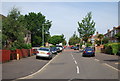
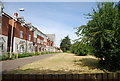
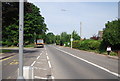
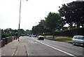
73 photos from this area
Area Information
Key information about the NR2 4DQ including its size, population, and administrative classification.
- Area Type
- Postcode
- Area Size
- 10.1 hectares
- Population
- Not available
- Population Density
- Not available
House Prices in NR2 4DQ
49
Properties
£148,121
Average Sold Price
£52,000
Lowest Price
£240,000
Highest Price
Showing 49 properties
| Address | Type | Beds | Baths | Last Sale Price | Last Sale Date | |
|---|---|---|---|---|---|---|
| 39 Sycamore Crescent, Norwich, NR2 4DQ | Flat | 2 | 1 | £175,000 | Aug 2025 | |
| 7 Sycamore Crescent, Norwich, NR2 4DQ | Terraced | 3 | 1 | £240,000 | Nov 2022 | |
| 12 Sycamore Crescent, Norwich, NR2 4DQ | Terraced | 3 | - | £208,000 | May 2019 | |
| 8 Sycamore Crescent, Norwich, NR2 4DQ | Semi-detached | 3 | 1 | £190,000 | Sep 2017 | |
| 73 Sycamore Crescent, Norwich, NR2 4DQ | Semi-detached | 3 | - | £193,500 | Nov 2015 | |
| 37 Sycamore Crescent, Norwich, NR2 4DQ | Flat | 2 | 1 | £119,000 | Aug 2014 | |
| 4 Sycamore Crescent, Norwich, NR2 4DQ | Terraced | 3 | - | £131,500 | Oct 2009 | |
| 49 Sycamore Crescent, Norwich, NR2 4DQ | Flat | - | - | £124,500 | Dec 2007 | |
| 47 Sycamore Crescent, Norwich, NR2 4DQ | Flat | 3 | - | £149,950 | Aug 2005 | |
| 17 Sycamore Crescent, Norwich, NR2 4DQ | Flat | 3 | - | £86,000 | Jul 2005 |
Page 1 of 5
Energy Efficiency in NR2 4DQ
Amenities
Schools
| Rank | School | Type | Entry gender | Ages |
|---|
Explore more schools in this area
Go to Schools tabDemographics
Household Size
One person
most common
Accommodation Type
Houses
most common
Tenure
47
majority
Ethnic Group
White
most common
Religion
N/A
most common
Household Composition
N/A
most common
Age
47
median
Adults (30-64 years)
most common
Household Deprivation
N/A
with no deprivation
NS-SEC
34
in Lower managerial occupations
Explore more demographic insights in this area
Go to Demographics tabPlanning
Planning Constraints
- Flood RiskPremium
- Ramsar Wetland SitesPremium
- Area of Outstanding Natural BeautyPremium
- Protected Nature ReservePremium
- Protected WoodlandPremium