Area Overview for NR2 3UH
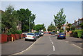
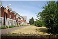
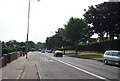
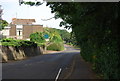
Photos of NR2 3UH


Area Information
Living in NR2 3UH offers a quiet residential experience within a cluster defined by this specific postcode. With a population of 1,981, the locality maintains a close-knit feel while remaining connected to Norwich. The area sits in England and combines the convenience of city access with the relative tranquillity of a smaller settlement. Residents benefit from direct links to major infrastructure without living in the urban sprawl. Daily life revolves around a compact community where local interactions are frequent. The neighbourhood structure supports those seeking a grounded lifestyle rather than high-density urban living. You will find that the small population ensures low traffic volumes compared to larger districts. Housing here forms a cohesive stock that defines the visual character of the street. This postcode covers a specific residential cluster that acts as a gateway to wider services. Families and commuters often choose NR2 3UH for its balanced approach to location. The setting allows for easy travel to employment hubs while retaining a distinct community identity. Living in this area means navigating a place where local needs drive development and service provision.
- Area Type
- Postcode
- Area Size
- Not available
- Population
- 1981
- Population Density
- 2521 people/km²
The property market in NR2 3UH is defined by a strong presence of house ownership within a residential cluster. With 49% of homes in the area being owner-occupied, the local stock leans significantly towards independent homeowners rather than investors or landlords. This high ownership rate typically indicates stability for people looking to settle down. Houses remain the primary form of accommodation in NR2 3UH, catering to families requiring space and independent living areas. You will find that flats are rare in this specific postcode, which focuses on detached or semi-detached structures. This housing preference aligns with the older demographic profile where adults aged 30 to 64 years often dominate the market. Potential buyers looking for rentals will encounter a smaller segment of the market compared to owner-occupied properties. The nature of this small residential cluster means property values can be influenced heavily by local conditions and the immediate quality of each home. Those seeking to buy here face a market where ownership is a common goal rather than the exception. Understanding this mix helps you gauge competition and pricing trends accurately. The lack of high-density blocks suggests a slower market pace compared to urban regeneration zones.
House Prices in NR2 3UH
No properties found in this postcode.
Energy Efficiency in NR2 3UH
Living in NR2 3UH grants easy access to a wide variety of practical amenities within practical reach. Five notable retail outlets serve the local shopping needs, including Co-op Norwich, Tesco Norwich, and East of England Co-operative Co. These venues provide everything from daily groceries to household essentials without requiring a long journey. Two railway stations offer train links nearby, specifically Norwich Railway Station and Salhouse Railway Station. These transport hubs connect residents to wider national networks efficiently. Norwich International Airport lies close by, providing air travel options for those needing to fly. The proximity of these airports and stations simplifies commuting and visiting extended family. You will find that daily errands can be completed locally or via nearby train lines. The combination of retail and transport options creates a convenient lifestyle for busy households. Dining and leisure often extend to the immediate outskirts of Norwich given the location. This blend of local variety and external access defines the character of life in this postcode.
Amenities
Schools
Families in NR2 3UH have access to two main educational institutions located nearby. Henderson Green Primary School serves as a preparatory institution for local children. Close to the residential cluster is Henderson Green Primary Academy, which holds a satisfactory Ofsted rating. This rating confirms that the academy meets the required standards for educational provision. The presence of a primary academy suggests that the curriculum is suitable for younger age groups rather than older students. You will not find secondary schools listed in the immediate vicinity of this specific postcode based on available records. The educational mix places primary education as the central focus for households living in NR2 3UH. Parents with school-age children rely heavily on these two facilities for their daily educational needs. The satisfactory status of the academy provides assurance regarding the quality of instruction delivered within its halls. Access to these schools remains a practical consideration for anyone viewing homes in the area. Prospective buyers must factor in travel time to these specific locations when evaluating property suitability. The concentration of primary institutions indicates a strong demand for early years education in the neighbourhood.
| Rank | School | Type | Entry gender | Ages |
|---|
Explore more schools in this area
Go to Schools tabDemographics
The community within NR2 3UH reflects a mature population with a median age of 47 years. Adults between the ages of 30 and 64 years constitute the most common age range in the area. This demographic profile suggests a neighbourhood populated by established households rather than young professionals or students. Home ownership stands at 49% of all residences, meaning nearly half of the properties are owned outright. The remaining dwellings likely represent rental accommodation within the local housing stock. Houses form the predominant type of accommodation in NR2 3UH, indicating a preference for traditional family living spaces over flats. The predominant ethnic group in the neighbourhood is White, which aligns with broader patterns for this demographic cluster. These statistics paint a picture of a stable, family-oriented community where long-term residents form the backbone of the society. The age distribution implies that schools catering to younger children may be more in demand than those for teenagers. This steady demographic also influences local business decisions regarding retail and service offerings. You can expect a populace familiar with their immediate surroundings and invested in the local area's wellbeing.
Household Size
Accommodation Type
Tenure
Ethnic Group
Religion
Household Composition
Age
Household Deprivation
NS-SEC
Explore more demographic insights in this area
Go to Demographics tabPlanning
Planning Constraints
- Flood RiskPremium
- Ramsar Wetland SitesPremium
- Area of Outstanding Natural BeautyPremium
- Protected Nature ReservePremium
- Protected WoodlandPremium